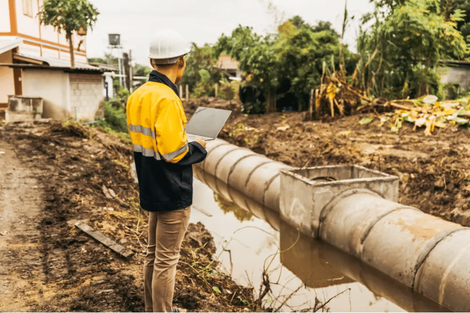
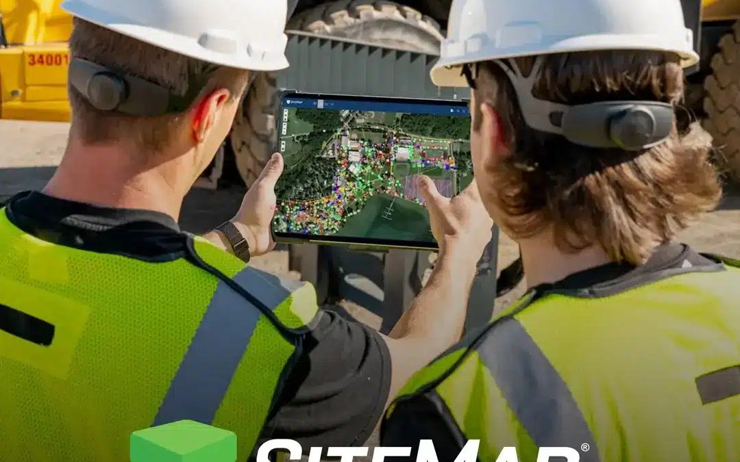
In 2023, the new facilities director at Dexter Southfield School, located in Brookline, Massachusetts, initiated a comprehensive evaluation of the school’s 36-acre campus, which dates back 58 years. The school also sought a virtual tour of the property to enhance its...
Articles
The Evolution of the Facilities Audit Process
Facility management is essential for preserving the value, efficiency, and safety of buildings and campuses. At the heart of this field is the facility audit—a systematic, thorough review of a building's assets, including its infrastructure, policies, and procedures....
Extending Building Lifespan and Downsizing: A Strategy for Reducing Carbon Emissions
Recent studies highlight the significant environmental benefits of extending building lifespans. Paired with a 20% reduction in building size, this approach could decrease carbon emissions from these structures by up to two-thirds, according to the study Urban...
How SiteMap® Assists Whole-Building Life Cycle Assessments (WBLCA)
The construction and operation of buildings contribute nearly 40% of global carbon emissions, underscoring the urgent need for sustainable practices. Whole-Building Life Cycle Assessments (WBLCA) have emerged as a crucial tool for assessing the environmental impact of...
How SiteMap® Optimizes the Pre-Construction Phase
The pre-construction phase lays the groundwork for seamless project execution and long-term success. However, if not managed effectively, it can become a bottleneck. Fortunately, strategies exist to enhance efficiency, reduce delays, and boost productivity for...
Accurate Infrastructure Mapping Assists Largest Dam Removal Project in U.S.
On August 28, 2024, the Klamath River reclaimed its natural course for the first time in more than 100 years. Located along the California-Oregon border, this river is the site of the largest dam removal project in U.S. history. The project reached a significant...
The High Cost of Aging Wastewater Infrastructure in the United States
As cities across the U.S. confront deteriorating sewage infrastructure, a recent report reveals the massive financial investment required to address this pressing issue. The Tennessee Advisory Commission recently released the first-of-its-kind Report of the Tennessee...
Explaining Maintenance, Repair, and Operations (MRO) of Facilities
Maintenance, Repair, and Operations (MRO) processes are essential for ensuring the functionality, safety, and longevity of facilities of all sizes. MRO covers a broad range of activities, from routine upkeep and urgent repairs to managing the supply of critical...
Accurate Locating & Mapping of Wastewater Infrastructure Uncovers Source of Foul Smell at New York Strip Mall
What’s that smell? GPRS’ video pipe inspection services, which utilize remote-controlled robots, push-fed sewer scopes, dye tracing, and smoke testing, recently uncovered an illegal sewer connection that was causing sewage buildup in a strip mall's wastewater system....
Incredible Discovery During Routine Utility Work Highlights Need for Accurate Infrastructure Mapping
At GPRS, we understand the critical importance of knowing what's beneath the surface. Hidden underground obstacles can pose significant risks to your project once excavation begins, making it essential to gather precise, comprehensive utility location and mapping data...
Leveraging GIS Technology for Efficiency and Sustainability in Construction
Efficiency and sustainability are becoming increasingly crucial in the construction industry. As global demand for infrastructure rises, the need to optimize resource utilization and minimize environmental impact intensifies. One powerful tool helping achieve these...
NYC First to Mandate EV Chargers in Parking Garages
The Big Apple is going electric. New York City Council is reviewing a bill that would require parking garages and open lots with 10 or more spaces licensed by the Department of Consumer and Worker Protection (DCWP) to install Electric Vehicle Supply Equipment (EVSE)...
Federal Funding Boosts Domestic EV Manufacturing
Six states with large automotive workforces have recently been awarded federal funding to support the adaptation of manufacturing facilities for the electric vehicle (EV) supply chain. The White House and U.S. Department of Energy (DOE), through the Office of...
The Importance of 3D Laser Scanning for Overhead Clearances
Accurate and Collaborative Data Sharing with SiteMap: 3D Laser Scanning for Overhead Clearances In infrastructure, construction, and transportation projects, precise overhead clearance measurements are essential to ensure safety and efficiency. One of the most...
How Data Centers are Turning to Adaptive Reuse for Faster Build-Outs
Adaptive Reuse in Data Center Development: Leveraging SiteMap® for Seamless Project Management As the digital age continues to advance, the demand for data centers has skyrocketed. However, building new data centers from the ground up is often costly and...
Boise State University Leverages SiteMap® to Accurately Map Electrical Infrastructure
Boise State University Leverages SiteMap® to Accurately Map Electrical Infrastructure Boise State University, the largest higher education institution in Idaho, recently partnered with GPRS to gain a detailed and accurate understanding of its buried electrical...
How the International Data Center Boom is Driving Innovation in Construction
How the International Data Center Boom is Driving Innovation in Construction As the demand for larger, more powerful data centers skyrockets, the construction industry is responding with remarkable innovations. From energy solutions to modular construction, companies...
Case Study: The Power of Digital Record-Keeping for Residential Underground Utilities
A Case Study for Municipal Utility Management Professionals A significant utility hardening project is happening in a Florida suburb; a local power utility is moving overhead electric lines underground. This undergrounding of utility lines often requires the use of...
How Digital As-Builts and GIS May Eliminate Construction Supply Chain & Labor Woes
Supply chain disruptions coupled with a labor shortage have challenged the construction industry in recent years. While the lack of skilled construction labor will take time to remedy, the delays, cost overruns, and inefficiencies caused by supply chain interruptions...
Contract Approved for Palisades Tunnel Project
A contractor has been chosen to build the New Jersey segment of a train tunnel linking the Garden State to New York City. On August 1, the Gateway Development Commission (GDC) Board of Commissioners announced the awarding of the $456.6-million Palisades Tunnel Project...
How Infrastructure Mapping Software Ensures the Success of Infrastructure Projects like the Brent Spence Bridge Project
The $3.6-billion Brent Spence Bridge project hit a significant milestone this spring when the U.S. Department of Transportation’s Federal Highway Administration (FHWA) announced that the project had successfully cleared the environmental review process....
The Second Avenue Subway Project: A $3.4 Billion Technological Marvel
According to a 2022 report by MTA, the subway system in NYC has a daily ridership of approximately 3.2 million, while their bus system has a daily ridership of 1.4 million. That’s a huge amount of people relying on this vital resource. Over time, these lines have...
XCEL Energy’s Wildfire Mitigation Plan: Undergrounding Technology and Beyond
According to the National Park Service, humans cause about 85 percent of all wildfires yearly in the United States. Also, the Annual 2022 Wildfires Report from the National Centers for Environmental Information announced that over 7.5 million acres of wildland were...
GPRS JobSite Plus Program: Revolutionizing Construction with Early Subsurface Scanning
Have you ever tried to untangle a ball of cords or wires? No matter how much you try to trace the knot, you struggle to find where it begins and where it ends. This is a similar issue in the world of construction and project management. Tracing all of your...
How Technology like SiteMap® is Revolutionizing Projects like this Pennsylvania Highway Link Project
The Susquehanna River is about 444 miles long, stretching throughout the Eastern Seaboard. The river has been crucial historically, supplying needed resources for local coal mines, and recently, supplying hydroelectric power. Travelers make their way over the many...
The Role of Technology in Alleviating the Construction Worker Shortage
Despite the fact that it seems like nearly everyone knows someone who works in construction, there is a steep decline in the amount of workers available in the industry. The construction industry will need to attract around 501,000 additional workers in 2024, this is...
An Expanded View of How AMI Could Help Remake Water Infrastructure
Originally designed to enhance the precision and efficiency of water meter readings, Advanced Metering Infrastructure (AMI) offers capabilities that go well beyond its initial purpose. By broadening the use of AMI, we can tackle many urgent issues in our water...
How Water Utility Companies and Citizens Can Unite to Ensure Safe Drinking Water
Each year, around 1 million people die from lead poisoning. Sadly, millions more, many of them children, suffer from low-level lead exposure. These low levels can cause lifelong health problems, including anemia, hypertension, immunotoxicity, and reproductive issues....
Enhancing Construction Efficiency: The Job Site Plus Program and SiteMap®
The USA experienced a productivity sinkhole in the construction industry for a few years, starting in 2017. However, over the past two years, there has been a significant increase in productivity within the construction industry, especially for those in residential...
Turning Offices into Apartments: Is This the Next Construction Boom?
According to the Census Bureau, in 2022, there were 15.1 million vacant homes. These vacant homes, including rentals, represent 10.5% of the country’s total housing capacity. +While there may be enough places to live, not all of them are up to code, safe, or remotely...
Redefining Collaboration to Bring The Field & The Office Together With SiteMap®
Imagine trying to write a letter, but the words aren’t quite connecting right. You’re trying to tell your hands what to do, and your brain knows what to do, but the language is outdated, and your system is confused. Your hands are blaming your brain, and your brain is...
Integration of BIM (Building Information Modeling) with Subsurface Utility Locating: Enhancing Construction Efficiency and Safety
Imagine trying to complete a complex brain surgery with your eyes closed. You have no idea which neuron lies where, and your only advanced knowledge is what you learned in medical school. You can see a general map in your head of the brain, but it’s not translating...
The Future of Remote Monitoring and Shut-off Systems for Gas Utilities: Enhancing Safety and Efficiency
According to studies by the U.S. Energy Information Administration, gas utility use has grown significantly in the U.S., rising by 77% over the last three decades. Just ten or fifteen years ago, gas shut off proceedings required a scheduled technician to come on site...
Lean Construction Revolution: How GIS Platforms Reduce Waste and Boost Efficiency
We’ve all heard the saying that less is more, and when it comes to construction, that is sometimes the case. Lean construction has made a splash over the last few years, offering a way that some say is better to construct the world around us. Efficiency and waste...
Innovations in Municipal Leak Reduction: Exploring Advanced Models
“Don’t run the faucet when you brush your teeth, it wastes water!” Does that sound familiar? Not many people think of water as a finite resource. Most believe water will never run out, flowing forever, sent down from the clouds above, taken up through the earth, and...
The Benefits of Utility As-Built Creation
Imagine trying to build a house without a blueprint. It’d be nearly impossible, right? As-builts aren’t quite blueprints; you might argue that accurate as-builts are better than blueprints because they capture what actually exists instead of what was intended. Those...
SiteMap® by GPRS: Revolutionizing Facility Management and Construction Site Data Analysis with All-in-One Solutions
A 2015 Accenture Survey found 82% of organizations to execute innovation in exactly the same way they go about achieving incremental performance gains. This often leads to quite a few unique challenges, such as 72% admitting to missing crucial growth opportunities and...
The Benefits of Utility As-Built Creation
Imagine trying to build a house without a blueprint. It’d be nearly impossible, right? As builts aren’t quite blueprints; you might argue that accurate as builts are better than blueprints because they capture what actually exists instead of what was intended. Those...
Redefining Air Travel: The Architectural Marvel of Boston’s Terminal E
Airports are more than just transportation hubs; they are gateways to new experiences, cultures, and destinations. In regard to global air travel, terminal design is rather important in keeping things fluid, safe, as well as shaping the passenger experience. Boston's...
Revealing the Subterranean Mysteries: GPR Discovery of Underground Cities
Below your feet there is a sprawling metropolis of wonder. This is true for plenty of the world’s cities and towns. Relics and ghost towns that speak of a different time and place, forever frozen below our feet. While some regions have entire towns within the...
Mapping the Future: SiteMap® and the Evolution of Leak Detection
Houston, we have a problem. Water leaks have become the leading cause of 311 calls in the city of Houston since 2021, with a monumental 30% increase from 2022 to 2023. “Our biggest problem is the aging infrastructure,” says Erin Jones, who is the department's public...
Navigating Tomorrow: The Future of Utility with SiteMap and Video Pipe Inspection
Have you ever stared down at your shower drain, wondering what secrets are hidden in there? While it’s more than likely those secrets are just hair and soap scum, those pipes do lead to an underground world that most will never see. From water and sewage systems to...
Virtual Venture: The Benefits of Virtual Tours And Subsurface Infrastructure Management
It was 1985 when synth-pop band Aha released their now iconic music video for their hit single “Take On Me.” The video features a technique called rotoscoping, which requires the tracing over live action video footage, frame by frame, to create animations. For the...
Navigating the Depths: Exploring GPRS Solutions for Facility Management and Construction Site Data
Every project starts with a solid foundation – and that foundation often lies beneath the surface. A foundation must be tailored to the job, with each one being specific to the location, construction needs, and features of the land. The same could be said in regards...
Building Resilience: SiteMap® in Action for Infrastructure Asset Management in a Changing World
Tardigrades, also known as “water bears,” are microanimals that can be found virtually everywhere on earth. They thrive in almost any condition you throw at them, making them one of the most resilient animals in the world. Tardigrades can withstand extreme...
Strategic Investments: The Future of Infrastructure Asset Software with SiteMap®
Bear with me a moment for an old-school story time. It matters, especially if you find yourself regularly frustrated when in search of accurate as-built plans. On October 30th, 1970 an episode of The Brady Bunch titled “Call Me Irresponsible” aired. The iconic...
Beyond the Surface: Exploring SiteMap®-An Enhanced Underground Utility Mapping Software
The 1990 cinematic adventure and camp movie classic Tremors could not have happened if the location was properly mapped. All of the sand worms would have been perfectly annotated and aggregated, from tail to tail. Because we’ve proven in the 21st century that although...
Visualizing Infrastructure with SiteMap®: The Power of GIS Mapping Software
The art of visualization goes back over 200 years, with studies on modern visualization techniques dating back to at least the 1960s. Jacques Bertin’s Sémiologie Graphique (Semiology of Graphics), which was published in 1969, was the first systematic treatment...
IT and Infrastructure Asset Management: A Comprehensive Guide with SiteMap® Best Practices
The management of our cities and towns, interwoven with IT advancements, is becoming more complex than ever before. From buried lines to a complex web of fragile utility assets, both above and below ground, the delicate dance to manage these infrastructure assets...
Mapping Tomorrow: Trends in Infrastructure Asset Software Development with SiteMap®
100 years ago, towns were often split up by wards, and what was below was left to antiquated as-builts and exploratory digging, which we now call potholing or daylighting. These methods can be inefficient and often dangerous, especially in coal regions. Times evolve,...
Navigating the Subsurface with SiteMap®: Unlocking the Benefits of Underground Utility Mapping
Managing utilities has always been a task for society to solve. Consider how we light the world, for instance. Early societies used natural gas which was led through bamboo pipes from volcano gas leaks to the streets of Peking. This gas served as a fuel for street...
Efficient Operations: SiteMap® and the Role of Infrastructure Asset Management in Modern Business
The rat race is never ending. Its speed and demand require efficient operations for organizations seeking to remain competitive and agile. In correlation to this efficiency is the effective management of infrastructure assets, including utilities such as water, sewer,...
From Data to Action: SiteMap’s Impact on Infrastructure Mapping for Utilities
We live in a material world full of digital necessities and requirements. Our reliance on technology becomes stronger with each passing year. This digital chokehold extends into every aspect of our lives, right down into our soil: mapping and dictating the world...
Preserving the Past: SiteMap® in Heritage Site Management and Infrastructure Conservation
Heritage site management and infrastructure conservation are not just about preserving physical structures; they are conduits for culture and history, connecting us to who we were and what we can become. In the United States there are more than 18,000 units of local...
Smart Solutions: Revolutionizing Infrastructure Asset Management with SiteMap® Software
Process advancements aren’t usually accomplished in a day. True revolution and progress can take time. The Pyramids took at least 20 years to complete, with an estimated workforce of between 20,000 to 100,000 people. These marvels still stand the test of time, and...
Managing the Unseen: Unlocking Potential with SiteMap-Enabled Underground Utility Mapping Software
If Godzilla were real, GPRS would find him, and SiteMap® (patent pending), powered by GPRS, would then be able to map him. While Godzilla (hopefully) isn’t real, there is a monster, an absolute beast that lies below our feet, and that’s our subsurface utility assets....
Strategic Mapping for Enhanced Infrastructure Asset Management: The Role of SiteMap® and GIS
It’s been at least 64 years since Roger Tomlinson coined the term “geographic information system” (although some source mid-to-late 60s.) The world was on the cusp of leaving behind the greatest generation to forge a new one. JFK was elected president, Vietnam was a...
Unearthing the Depths: A Comprehensive Guide to Digital Utility Mapping with SiteMap®
In the realm of urban development, construction, and infrastructure maintenance, there lies a hidden world beneath our feet. This world offers a complex city of its own - a labyrinth of underground utilities that power our cities and communities. Navigating this...
Innovations in Infrastructure: A Deep Dive into SiteMap-Enabled GIS Utility Mapping Software
Infrastructure has changed a lot over the last fifty years alone. From towns with a few light pole, to bulging metropolises, things aren’t slowing down anytime soon. From urban development to transportation networks, the effective utilization of resources and the...
Navigating the Digital Frontier: Exploring IT Infrastructure Asset Management with SiteMap® Systems
Just thirty years ago, your computer used to scream at you when it had to get online. And going online was just short of an event. These days, most things are done online; we’re used to how it works, and it’s changing rapidly. In this landscape, the management of IT...
Connecting the Dots: The Role of SiteMap® in Enhancing Infrastructure Maps for Asset Management
Infrastructure management has changed rapidly and continues to do so. The advent of digital mapping has upgraded the ability to effectively visualize, analyze, and manage assets. As urbanization rates continue to rise and infrastructure networks expand, the demand for...
Mapping the Future: SiteMap®-Driven Evolution of Infrastructure Asset Software
By 2050, it is estimated that 7 out of every 10 people will live in a city or urban area. As urbanization intensifies and infrastructure networks expand, the demand for comprehensive solutions to navigate the subsurface environment continues to grow. SiteMap® (patent...
Beneath the Surface with SiteMap®: Navigating Underground Utility Mapping Software
The average depth of the ocean floor bed is just over 12,000 feet. The deepest part of the ocean is called the Challenger Deep, and it’s estimated to run 35,867 feet deep. The world below our feet is vast, from the ocean to the soil beneath your favorite geraniums....
SiteMap® Strategies: Optimizing Infrastructure Asset Management Solutions
Back To The Future would have been a different movie series if Doc had access to SiteMap®. Despite his genius, he wasn’t always the best at managing where assets existed. While Doc may only exist in a movie, his geolocational problem exists for many in real life. The...
Revolutionizing Infrastructure Efficiency in Japan: The ROADIC System and SiteMap® Integration
Japan stands as a global leader, renowned for its cutting-edge technologies and innovative approaches to optimizing urban environments. With Japan’s government pumping over $2.3 billion per year into their universities and science programs, it's no wonder that they...
Understanding the 2022 DIRT Report: Addressing Upward Damage Trends with SiteMap®
As we stride forward in the 21st century, our reliance on buried infrastructure has never been more profound. From telecommunications to water and sewer systems, these underground networks pump life through our modern society. However, with the privilege of access...
Safeguarding Telecom Line Infrastructure with SiteMap® Technology
The telecommunications industry has changed over the last 30 years, from several regulated natural monopolies to an industry that is economically capable of supporting multiple service providers in diverse markets. As a result, Congress, in the Telecommunications Act...
Deciphering Regional Marking Differences: Enhancing Infrastructure Understanding with SiteMap® Integration
Dieser Satz wurde auf Deutsch geschrieben. Which translates to, “That sentence was written in German,” and while it may not be quite right for the USA, it’s not wrong either. It’s merely different. Regional differences exist within every facet of our collective human...
Risk Mitigation Strategies in Construction: Leveraging SiteMap® for Safer Infrastructure Projects
According to the Common Ground Alliance (CGA) there are between 400,000 and 500,000 utility strikes reported in the US each year, many of them from excavators commonly used in construction. In construction projects, risk mitigation stands as a critical imperative for...
Can AI Determine Where to Dig Safely? Exploring Infrastructure Insights with SiteMap®
The massive boom in manufacturing and infrastructure projects in the U.S. means that now, more than ever, pinpointing the location of subsurface utilities can be a matter of life or death. Precision matters, and there's no room for guesswork. American infrastructure...
Unlocking Efficiency: Digital Twins For Water Utilities
Everything is about efficiency. From predicting traffic light changes to optimizing manufacturing processes, technology has continually aimed to streamline operations and improve outcomes. Since the invention of fire, humanity has been putting two and three together...
Digital Twins & Sustainable Construction: Leveraging SiteMap® for Smart Infrastructure Development
Imagine being told to draw an apple with great detail. Your visualization has to reflect exactly what the apple looks like, or your entire neighborhood may blow up. Suddenly, every pencil stroke you take is an additional risk to your community. While it may seem...
The Language of Data: SiteMap® Glossary for Construction Professionals in Infrastructure Projects
Understanding the intricacies of data can be as complex as the infrastructure projects it supports. For construction professionals tasked with tackling ever-evolving infrastructure challenges, a firm grasp of data terminology is not just beneficial; it's...
SiteMap® and Construction Regulations: Navigating Compliance with Ease in Infrastructure Development
In the intricate dance of infrastructure development, compliance isn't just a buzzword that is tossed around and muttered, but rather the cornerstone that ensures safety, efficiency, and sustainability. Civil Engineers and Infrastructure Project Managers know too well...
SiteMap® & the Quest for Digital Accessibility in Construction Infrastructure
The construction industry is often associated with hard hats and heavy machinery, yet in our digital age, it’s increasingly a story of bytes and bandwidth. The quest for improving digital accessibility in construction infrastructure is not just about staying ahead;...
Decoding SiteMap® Pro: A Permanent Solution for Dynamic Data Needs in Infrastructure
Infrastructure is rapidly changing and evolving, much like the world around it. This change demands robust data management systems that can keep up with its dynamism. For professionals in infrastructure and data management, staying ahead involves harnessing innovative...
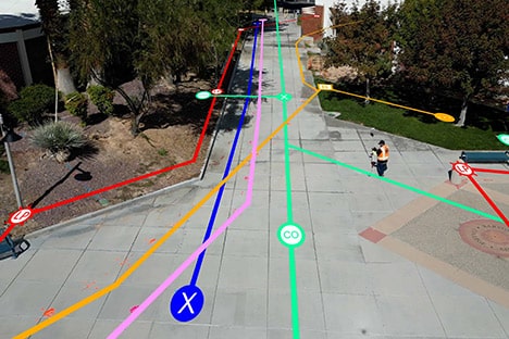
The Art of Information Upload: SiteMap® Project’s Promise in Infrastructure Development
“Skee Erwoooeeee…” No, that’s not nonsense, that’s the sound your computer used to make when it was signing online or sometimes if the phone was about to ring (and kick you offline) while you are handling some heavy data, which back in 1999, was likely just by...
Navigating the Future of Construction: Enhancing Innovation with GPS Utility Mapping and SiteMap®
Turn off your lights. Now go to your kitchen, and in the pitch dark, try to make a cup of coffee. Try to cook dinner. You may have a general idea of where everything is, and sure, you may be able to get the water in the pot, but chances are that without proper vision,...
The Human Touch: SiteMap® and the Role of Personal Support in Tech for Infrastructure Projects
Imagine calling a number and listening to soft jazz for 35 minutes as you wait for an operator to answer, only to have them transfer you as you listen to the greatest elevator hits of 1978. That used to be the norm for customer service lines, but technology has been...
Geospatial Solutions for the Modern Age: Comparing SiteMap® to Traditional Methods in Infrastructure Planning
In today's fast-paced world, the need for efficient and accurate infrastructure planning has become more crucial than ever. With the rapid growth of urbanization and the increasing demand for sustainable development, traditional methods of infrastructure planning are...
Exploring SiteMap®: A Comprehensive Guide to Personal Tier Features
Facility management and construction have long grappled with the complexities of mapping and maintaining utility infrastructure. Most people never give second thought to the city below their feet. That is, unless you live in Seattle, where you’re able to tour the...
Understanding SiteMap® Integration: Enhancing Workflows in Construction
Imagine if you could open a map and have the pages spring to life with detailed information about utilities, structures, and more? What if seeing below the ground was as easy as opening your smartphone? What if collaboration was as simple as pressing a few buttons?...
SiteMap® in Action: Real-World Examples of Effective Data Visualization
In the world of civil engineering and utility management, the ability to visualize complex data is not just a luxury—it’s a necessity. When infrastructure projects sprawl across large landscapes and need meticulous planning, professionals turn to data visualization...
Innovation Unveiled: SiteMap® and Its Contribution to Smart Cities
The surge of smart city initiatives globally has ushered in an era of unprecedented urban transformation. Smart city initiatives encompass comprehensive efforts to leverage advanced technologies and data-driven solutions to enhance the efficiency, sustainability, and...
SiteMap® & the Sustainable Future: Reducing Environmental Impact in Construction
As the world continues to grapple with the challenges of climate change and environmental degradation, the construction industry is under increasing pressure to adopt more sustainable practices. This is fueled by the understanding that construction is one of the most...
Connecting the Dots: SiteMap® Mobile App & Cross-Referencing in Facility Management
As the world of facility management continues to evolve with technological advancements, the ability to cross-reference data with efficiency and accuracy becomes crucial. The SiteMap® Mobile App (patent pending), powered by GPRS, emerges as a powerful ally for...
A Closer Look at SiteMap® Annotations: Adding Value to Facility Data
SiteMap® (patent pending) is a powerful and comprehensive tool that enhances how project managers look at their work site. Years ago, these professionals would have to rely on cumbersome physical maps that were fragile, hard to keep track of, and hard to share with...
Navigating the Layers: Understanding the GIS Platform of SiteMap®
Geographic Information System (GIS) technology is a powerful tool that enables the collection, analysis, interpretation, and visualization of spatial and geographic data. At its core, GIS integrates various data types such as maps, satellite imagery, and geospatial...
SiteMap® Mobile App: Safeguarding Critical Infrastructure Data
The age of digitization has brought about a seismic shift in the management of critical infrastructure, where access to accurate data isn't just advantageous—it's imperative. Because the vast majority (97%) of Americans own a cellphone of some kind, and 85% own...
The Collaborative Edge: SiteMap® and Team-Based Data Management
In today's fast-paced world where data is king and expansion is rapid, managing infrastructure assets efficiently is the cornerstone of any successful project. SiteMap® (patent pending), powered by GPRS, emerges as a game-changer in this realm, offering unmatched...
Practical Applications: SiteMap® in Archaeology and Historic Preservation
Archaeology and historic preservation are disciplines that require a delicate balance between modernity and tradition. As we step into an era where technology assists in unraveling the mysteries of the past, tools like SiteMap® (patent pending) backed by GPRS, become...
The Role of SiteMap® in Enhancing Construction Safety Protocols
Imagine a place where all your information and data are stored together. A place where your data is organized, tagged, aggregated, and available 24/7 in a secure online software platform where it is easy to search and share. There are many underground utility...
Beyond Utility Locating: SiteMap® and the Future of Intelligent Infrastructure Visualization
In today's rapidly evolving and expanding world, the need for efficient and reliable infrastructure (and its data) has become more crucial than ever. This is especially true in the United States, where the infrastructure is deteriorating so badly that it’s considered...
Mapping the Unseen: SiteMap® and the Science of Subsurface Utility Information
The year is 1979, and you just heard something big explode somewhere outside. You rush to your door, searching for its source. The sound was so startling and heavy that it rattled your walls, your sunburst clock fell to the avocado shag rug below it. When you open the...
SiteMap® Pro: Your Ticket to Seamless Data Access and Uninterrupted Electronic White Lining
Cartography, once the art of manhandling hulking maps, has been brought into the digital age. Within the construction industry, this transformation is both radical and vital. Here we delve into the linchpin technology of SiteMap® (patent pending) and its metamorphic...
Revolutionizing Facility Management: A Closer Look at SiteMap’s Geospatial Solution
The electric power industry is preparing for up to a tripling of US electricity demand within the next few decades. This means that there will be more facility managers in need of accurate data to help manage and lead this growth. SiteMap® (patent pending) stands as a...
The Evolution of Subsurface Mapping: A Deep Dive into SiteMap® Technology
It’s 1912, and it’s a gorgeous, clear, crisp night as you stroll the deck of one of the finest ships you’ve ever seen. Nobody has seen anything quite like it! In fact, you may have heard someone refer to the ship as nearly unsinkable. If you haven’t seen the movie,...
Elevate Your Portfolio Management with SiteMap® Team: A New Era in Data Visualization
In an era dominated by data-driven decision-making, the ability to extract meaningful insights from complex information is a game-changer. Even literal games now rely on data to make decisions, including the MLB, who uses a data collection system utilizing cameras and...
Defining the Future of Construction Tech: SiteMap® and the Internet Analogy
The evolution of construction technology mirrors the transformative journey of the internet. From its early fragmented stages to a more integrated and seamless landscape, innovation has become the cornerstone of progress. Just as the internet revolutionized...
SiteMap®: Bridging the Gap in Construction Technology
In 2021, the United States construction industry had the highest number of fatal work-related accidents resulting in 1,015 deaths, and most of these were the result of human error. In an industry as intricate and multifaceted as construction, the significance of data...