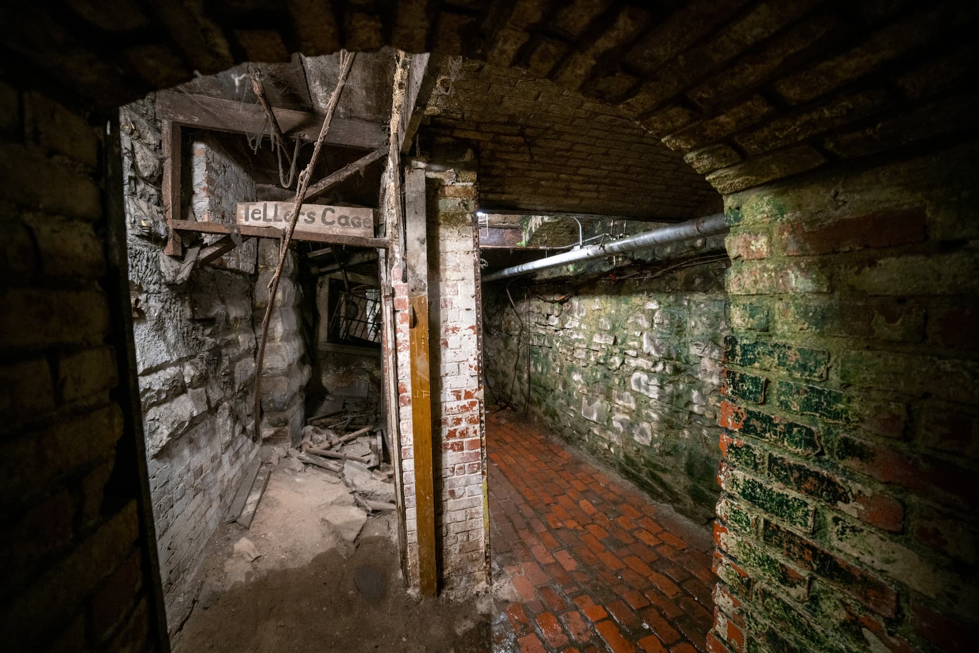
Below your feet there is a sprawling metropolis of wonder. This is true for plenty of the world’s cities and towns. Relics and ghost towns that speak of a different time and place, forever frozen below our feet. While some regions have entire towns within the subsurface, others have smaller pieces, such as old roads, and similar glimpses into the past. What they all have in common is that without modern non-destructive technology (NDT) and the ability to accurately map the subsurface, those relics pose a real threat to modern utility infrastructure.
Thanks to groundbreaking technology like ground penetrating radar (GPR), platforms like SiteMap® (patent pending), powered by GPRS, are now able to delve deeper into the Earth’s secrets, uncovering hidden structures that were previously inaccessible without a lot of ground disturbance.
Unveiling the Subsurface
Before delving into the intricacies of GPR, it’s crucial to understand the significance of mapping underground structures. Cities worldwide are built upon layers of history, with each civilization leaving its mark beneath the surface. From ancient settlements to modern infrastructure networks, these underground realms hold invaluable insights into our past, present, and future.
There are many subsurface cities throughout the world. From the Seattle Underground, which as a result of the Great Seattle Fire, to the many intricate underground tunnel systems throughout the country. There’s a lot beneath the surface, and most would have been lost to time and decay if it weren’t for the technology we use daily. There’s even an entire abandoned underground city in Ellinwood, Kansas.
Take into consideration the ancient city found in Turkey recently. In 2012, a crew of demolition workers stumbled upon a network of tunnels near Nevsehir, Turkey. After some digging and research, this discovery has turned out to be one of the most extensive underground cities ever known. The ancient city of Elengubu, known today as Derinkuyu, burrows more than 85 m below the Earth’s surface, encompassing 18 levels of tunnels. This is the largest excavated underground city in the world.
The now-abandoned wonder was in near-constant use for thousands of years, changing guards from the Phrygians to the Persians to the Christians of the Byzantine Era, and only abandoned in the 1920s. It stretches on for hundreds of miles, and there are more than 200 small, separate underground cities that have also been discovered in the region that may be connected to these tunnels, creating a massive subterranean network. It was an entire civilisation tucked safely underground. In 1985, the region was added to the Unesco World Heritage list.
This impressive Turkish jewel was uncovered with the help of technologies similar to those GPRS uses every single day. A piece by the Telegraph reports, “Geo-radiation scanning suggests the multilevel settlement is the size of about 65 football pitches…” Geophysicists estimated at first that the site was nearly five million square feet (460,000 square meters) and thought it contained corridors as deep as 371 feet.
Mapping underground cities isn’t just about uncovering historical relics; it’s also about ensuring urban resilience and sustainability. According to the American Society of Civil Engineers, the United States faces an aging infrastructure crisis, with an estimated $4.59 trillion needed by 2025 to address critical infrastructure deficiencies. Mapping underground utilities is a proactive step towards mitigating this crisis, preventing costly damages and ensuring efficient urban planning and development. By building new urban settlements, we are able to help keep our old alive and well. In fact, it was during an urban renewal project that this amazing Turkish delight was discovered.
The Role of GPR
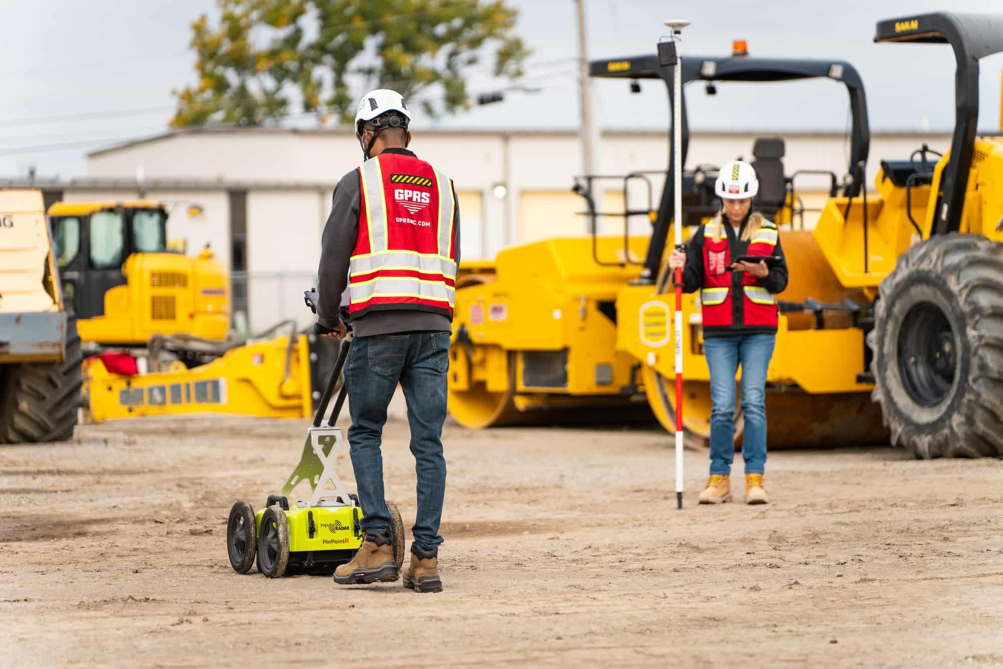
Ground penetrating radar (GPR) has revolutionized the field of subsurface exploration. GPR systems can penetrate various materials, including soil, concrete, and rock, to detect subsurface anomalies. This non-destructive technique allows researchers to create detailed maps of underground features, ranging from buried structures to utility lines.
GPR operates on the principle of sending electromagnetic pulses into the ground and analyzing the reflected signals. By measuring the time it takes for these signals to return and their strength, GPR systems can generate images of subsurface objects. These images most often present as hyperbolas, and can vary in darkness and size, depending on the material the waves bounce off of. This technology has been instrumental in archaeological studies, geological surveys, and, more recently, urban infrastructure mapping.
However, this isn’t the only technology that is used to help discover underground cities and treasures. Contemporary archaeology has developed to encompass techniques of engineering, geology, chemistry, and physics in exciting and innovative ways that serve to increase the efficiency, productivity, and findings of excavations.
Magnetometers
The use of magnetometers began sometime in the 1940s. Magnetometers are sensitive instruments capable of detecting different materials and disturbances in the subsurface and are used to record slight changes in the magnetic field. Magnetometers can detect items in the ground composed of iron, burned soil, and decayed organic remains. This type of subsurface technology is used by many archaeologists and professionals. It was even used to help discover the remnants of ancient cities such as Troy.
Underwater Archaeology
Underwater archaeology started sometime in the 1960s and is another amazing technique that allows professionals to excavate ancient shipwrecks and underwater cities. Due to technological advancements, there are several new tools in underwater archaeology. Sonar machinery and scuba diving equipment are two that have advanced in such a way that they have become valuable resources to underground discovery.
As of 2019, researchers have developed autonomous underwater vehicles (UAVs) that travel on the seafloor and operate independently without a human operator. Additionally, scuba diving gear has greatly improved, allowing divers to now explore underwater for hours instead of a few minutes at a time.
Light Detection and Ranging (LiDAR)
Light Detection and Ranging (LiDAR) was developed in the 1960s. It combines the two-dimensional mapping system Geographical Information System (GIS) software with 3D modeling capabilities to produce a detailed image of an archaeological or other job site. A LiDAR sensor sends out beams of laser light in all directions and then measures how long it takes for them to turn back to the sensor. The distance is then calculated using the velocity of light. The velocity, or speed of light, is 299,792,458 meters per second. This 3D imaging technology is generally accurate to 2-4mm and has many applications and has become a valuable tool when seeing the subsurface.
Mapping Infrastructure for the Future
The need for mapping underground infrastructure is particularly critical in rapidly growing urban areas. We also must map our infrastructure so we can better understand not only how to preserve hidden subsurface gems, but also how they relate to our current cities and structures. As cities expand and evolve, so do their underground networks of water pipes, electrical cables, and communication lines. Without accurate maps, construction projects face delays, utility conflicts, and increased risks of damage. We also risk destroying some of the gorgeous, amazing, complex historical structures below our feet.
According to a report by MarketsandMarkets, the global utility mapping market is projected to reach $1.4 billion by this year, driven by increasing urbanization and infrastructure development activities. This growth reflects the growing recognition of the importance of subsurface mapping in sustainable urban planning and development, including the discovery of, and preservation of subsurface cities and discoveries.
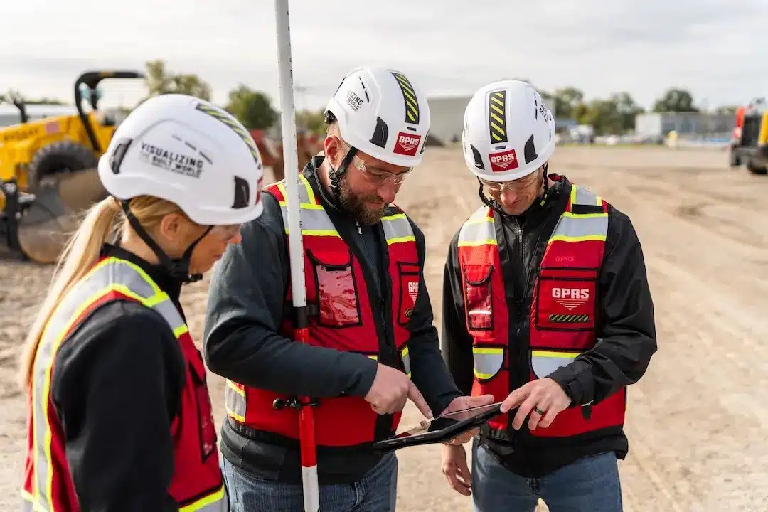
Advancements in GPR technology are enhancing the efficiency and accuracy of underground mapping efforts. These innovations enable faster data collection and analysis, allowing cities to quickly identify and address underground challenges. With the help of mapping platforms like SiteMap®, it’s easier than ever to see the subsurface, whether it be utility lines or vast abandoned cities of the past.
The discovery of hidden worlds beneath our cities is no longer the stuff of fiction—it’s a reality made possible by advances in technology like Ground Penetrating Radar (GPR). Thanks to amazing technology and dedicated teams like those at GPRS and SiteMap®, we can unlock the secrets of the subterranean realm, from ancient civilizations to modern infrastructure networks.
The utility of mapping underground cities and infrastructure extends far beyond mere exploration; it’s about safeguarding our past, optimizing our present, and building a sustainable future.
Turn myth into reality, see the subsurface like never before, contact SiteMap® today.