The Ultimate Deliverable
SiteMap® keeps all your GPRS project data organized in one GIS platform.
24/7 Access to Utility Maps, CAD Drawings, BIM Models, and NASSCO Reports.


The Ultimate Deliverable
SiteMap® keeps all your GPRS project data organized in one GIS platform.
24/7 Access to Utility Maps, CAD Drawings, BIM Models, and NASSCO Reports.

Facility Data Management Software
Centralize project data across all your locations in one construction GIS platform, including utility maps, 2D CAD drawings, 3D BIM models, and NASSCO reports to improve safety, reduce costs, and plan with confidence.
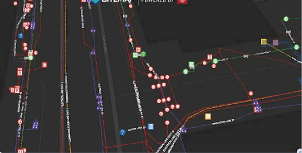
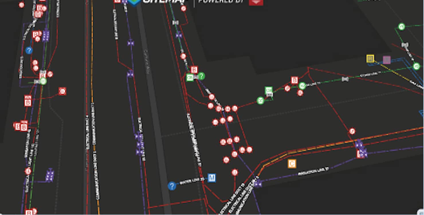
99% Accurate Utility Data
Access layered, interactive underground utility maps, PDFs, and KMZ files 24/7
Historical Data & Drone Imagery
Store historical as-built data, construction site mapping, and drone aerial video and images
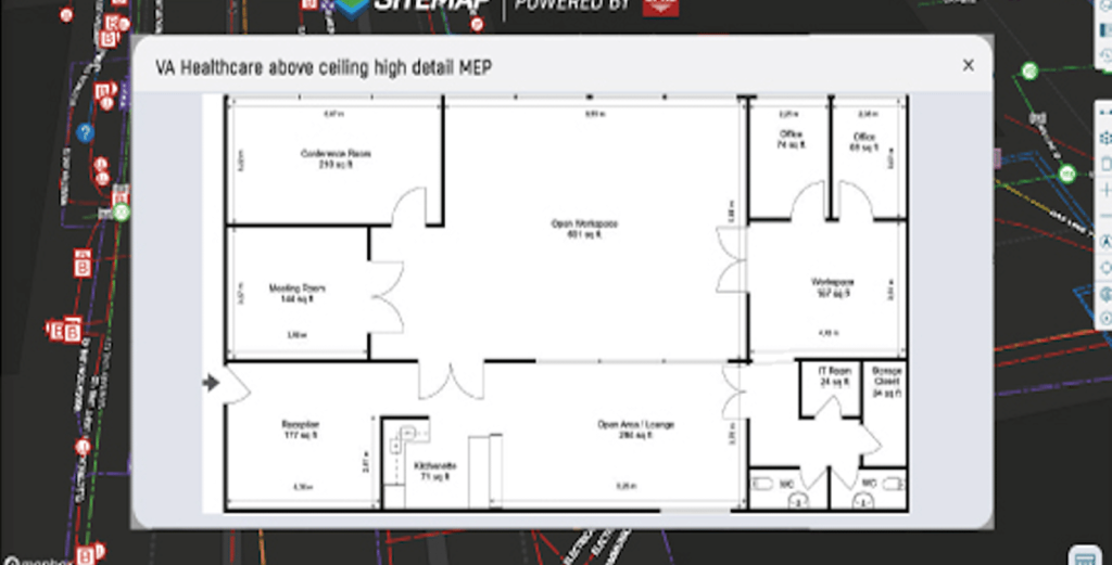
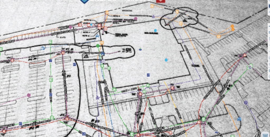
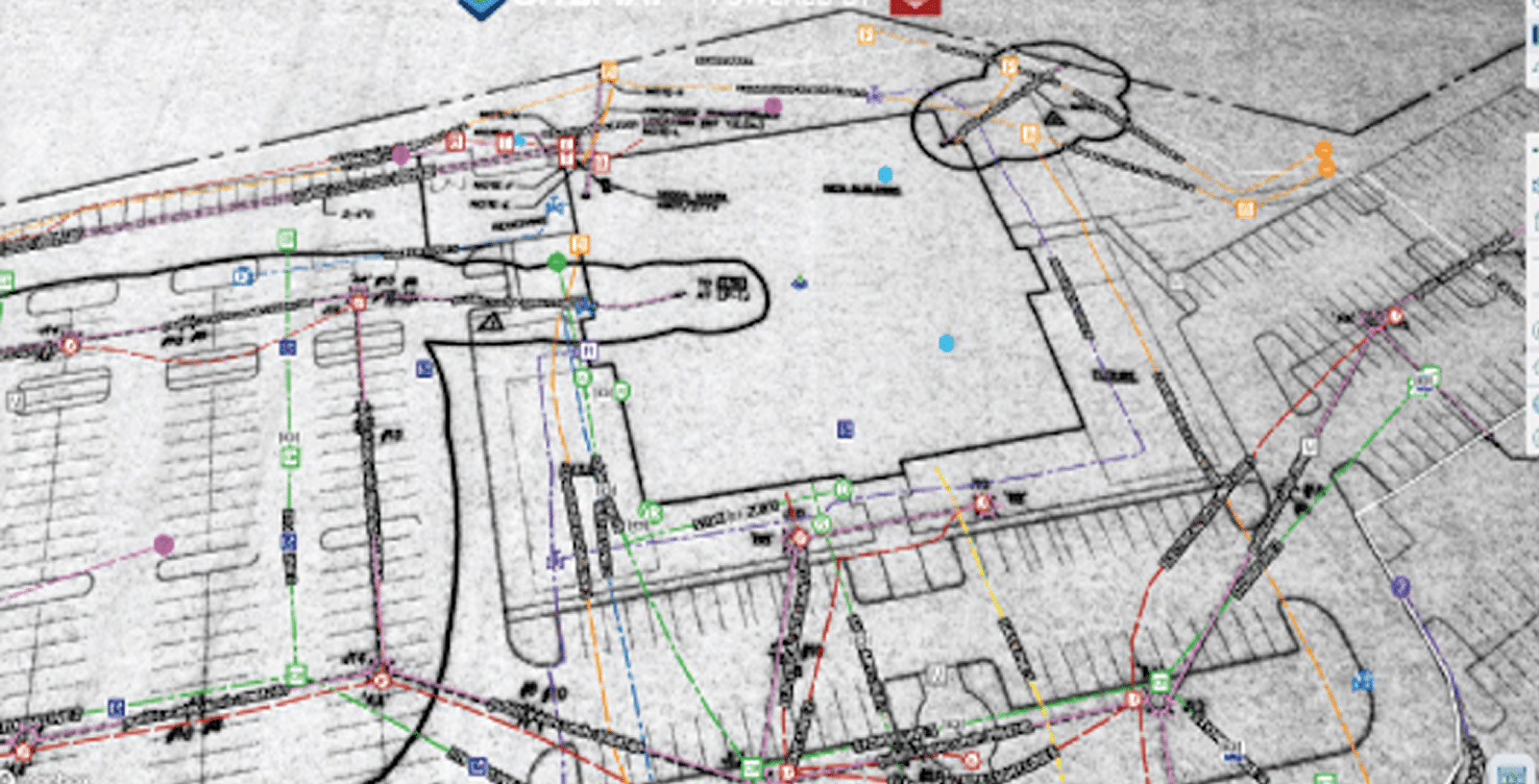
Field-Verified 2D Floor Plans, Site Plans, RCPs, & BOMA Lease Plans
Download accurate CAD‑ready geometry for design, construction, and real estate planning

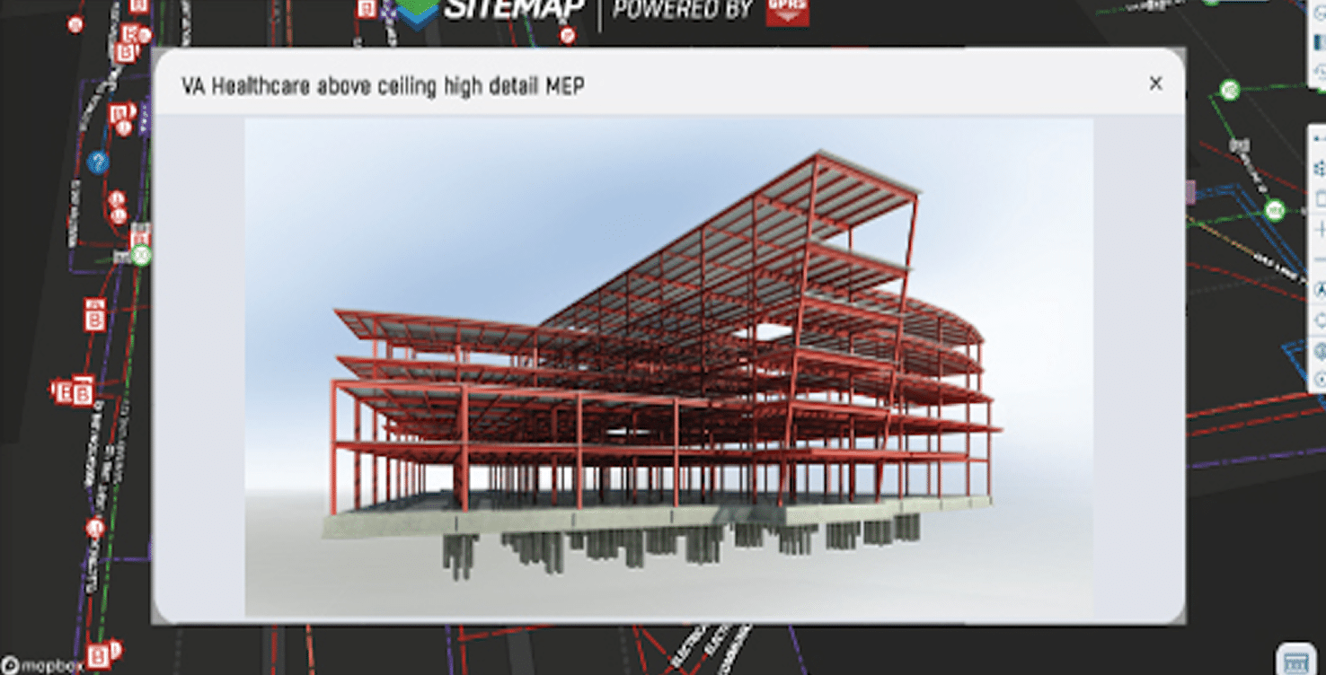
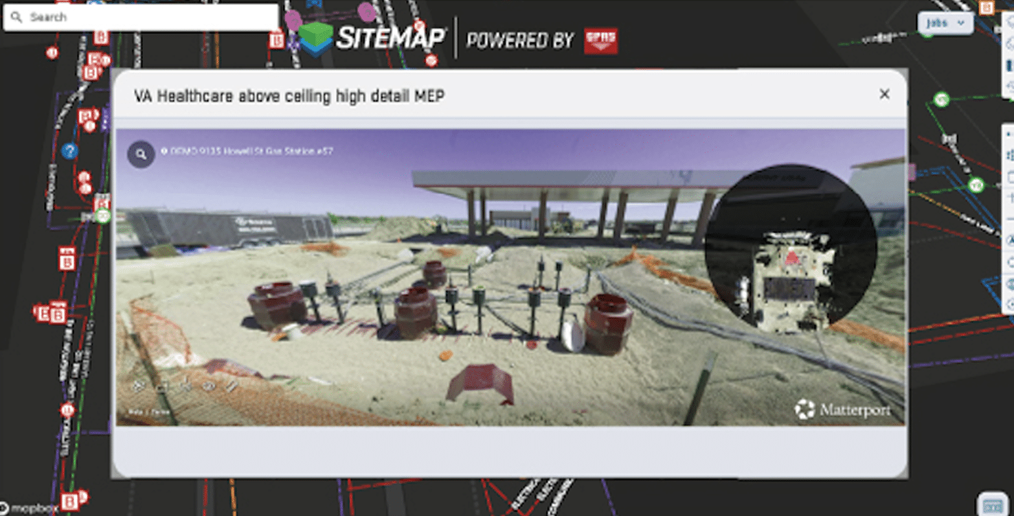
Reality Capture 3D BIM Models & Virtual Tours
Utilize scan-to-BIM models and 3D virtual tours to reduce rework, clashes, and delays

Construction Progress Tracking
Stay on schedule and on budget with multi-site facility management software
Sewer System Mapping & NASSCO-Certified Inspection Services
Gain full visibility into your sewer systems to find structural defects and damages, identify cross bores, and conduct lateral sewer line inspections.
Paper Plans Create Risk
Outdated paper plans force teams to guess, and one wrong call can derail an entire project. SiteMap geographic information system (GIS) technology eliminates the guesswork with clear, accurate digital plans of your facility. Avoid risk, stay on schedule, and keep your team safe.
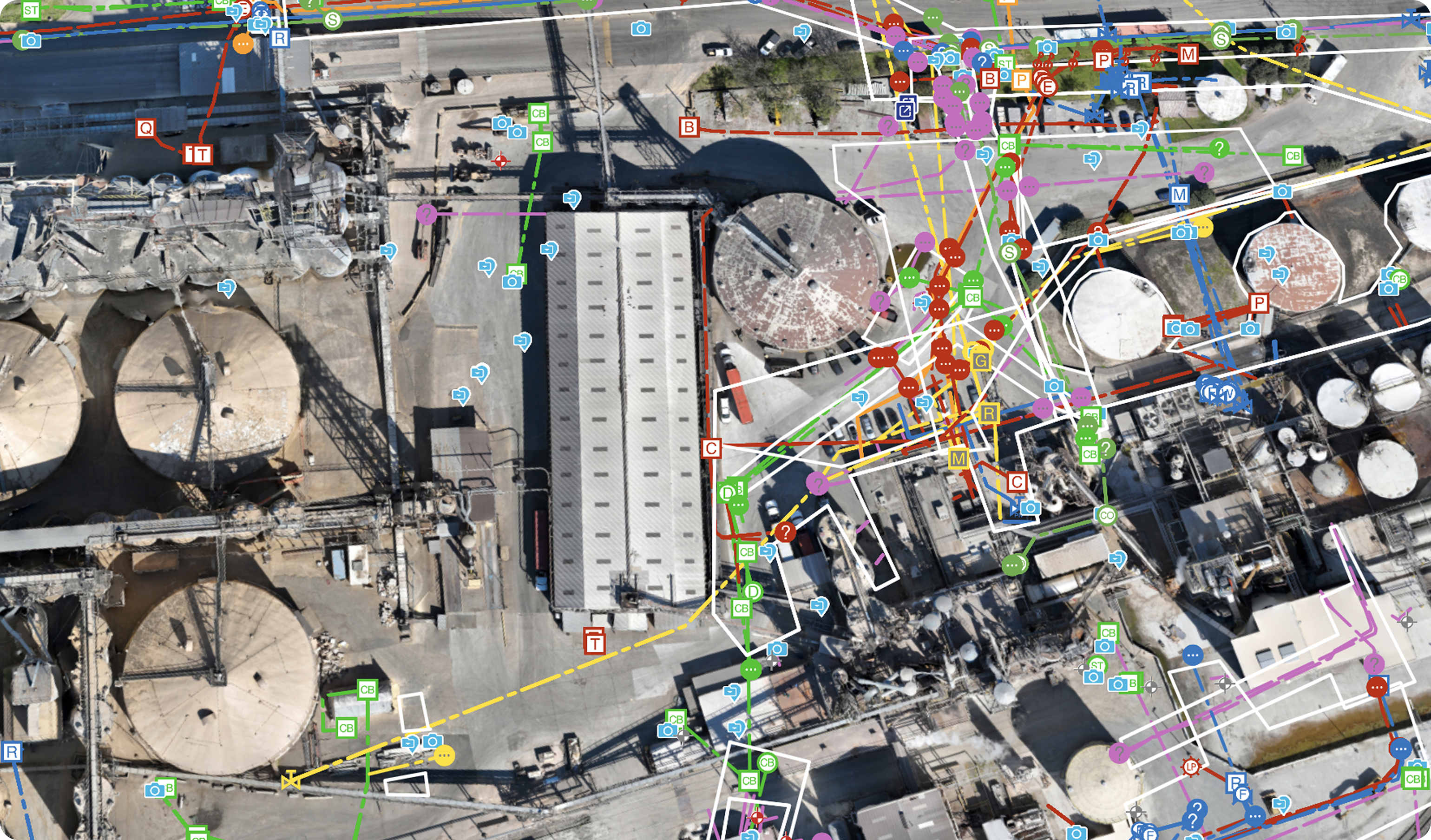
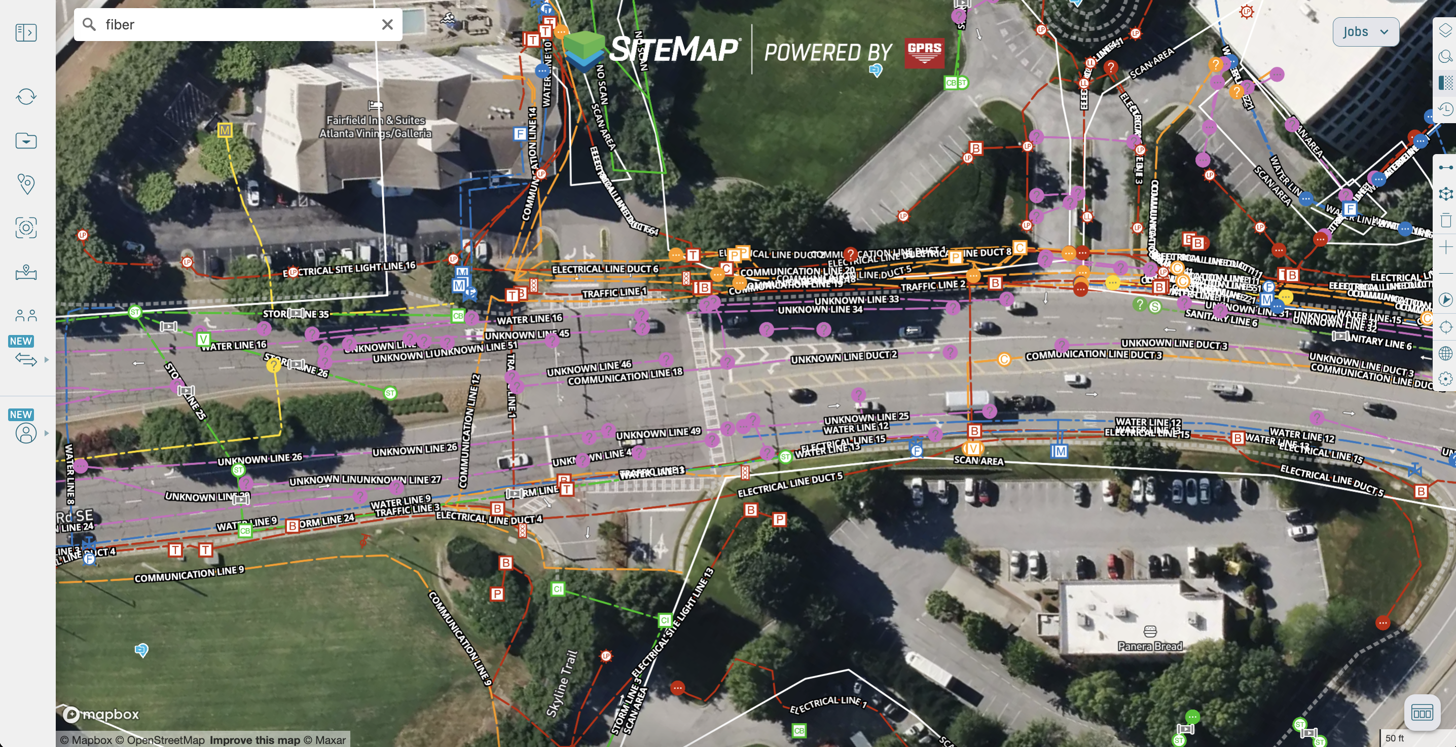
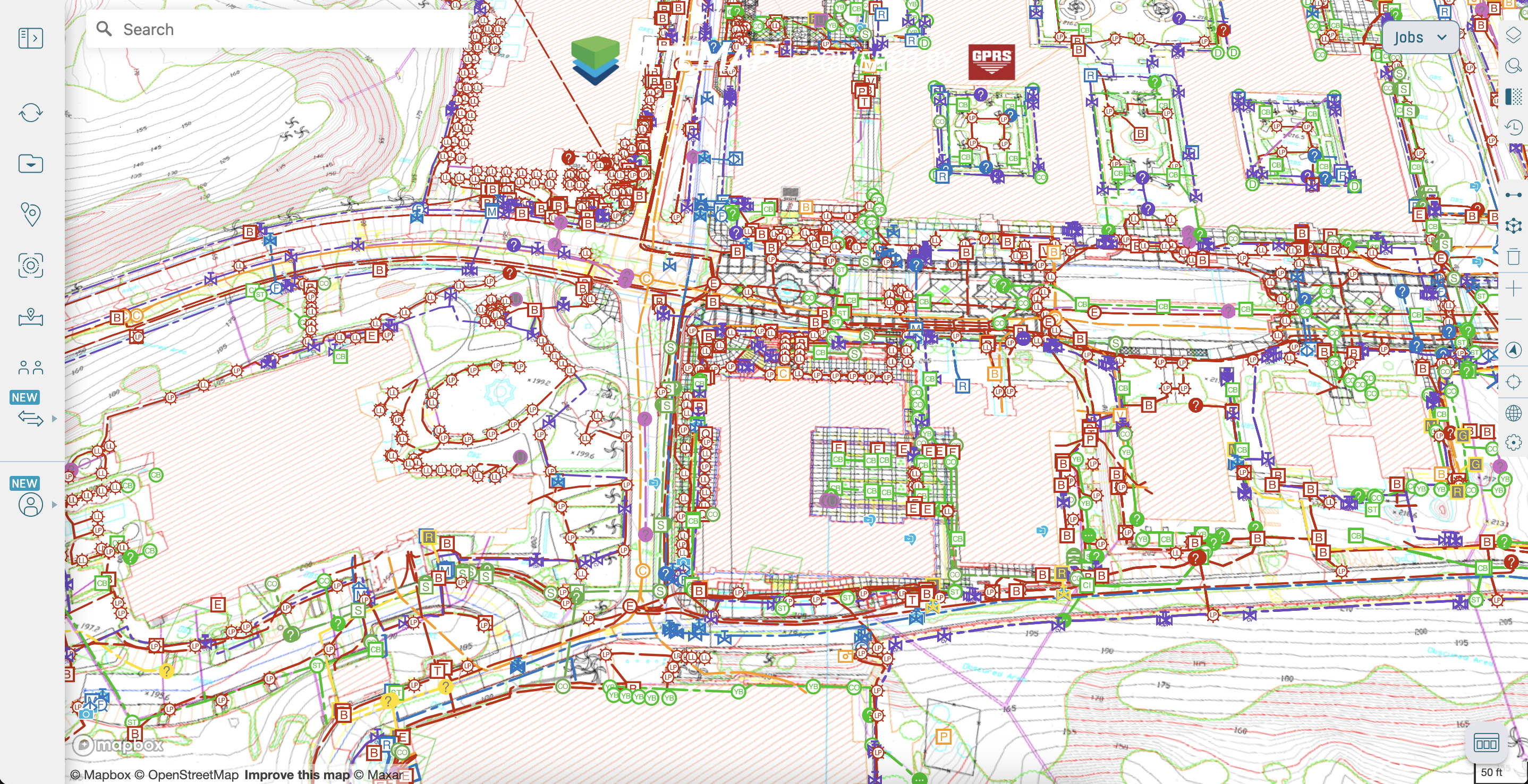
Facility Data Management Software
Centralize project documentation across all your locations in one construction GIS platform, including utility maps, 2D CAD drawings, 3D BIM models, and NASSCO reports to improve safety, reduce costs, and plan with confidence.
99% Accurate Utility Data
Historical Data & Drone Imagery

Geolocated 2D Floor Plans, Emergency Routing, & BOMA Measurements
Reality Capture: 3D BIM Models & Virtual Tours
Construction Progress Tracking & Open Trench Photos
Sewer System Mapping & NASSCO Condition Assessments
Paper Utility Plans Create Risk
Outdated paper plans force teams to guess, and one wrong call can derail an entire project. SiteMap eliminates the guesswork with clear, accurate digital plans of your facility. Avoid risk, stay on schedule, and keep your team safe.
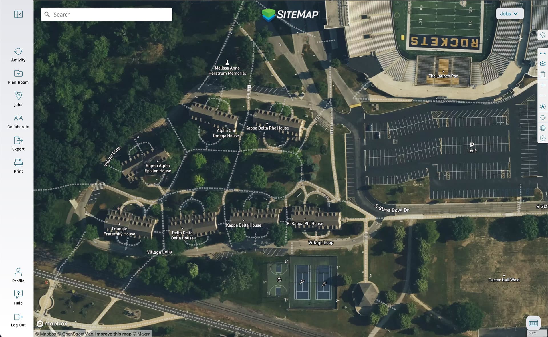
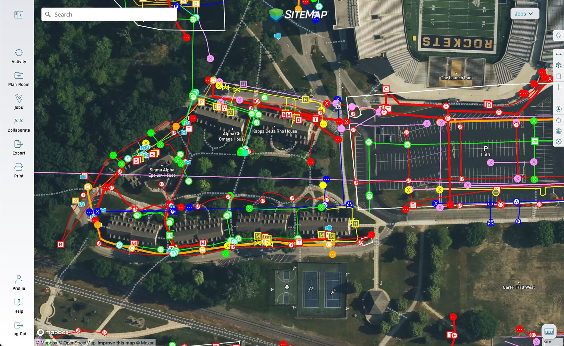
Feature Highlights in SiteMap
Innovating the future of jobsite visibility and coordination with GPRS’ SiteMap GIS technology with 2D and 3D location mapping.
My Dig Board

Augmented Reality
Feature Highlights in SiteMap
Innovating the future of jobsite visibility and coordination with GPRS’ SiteMap GIS technology with 2D and 3D location mapping.
My Dig Board
Augmented Reality
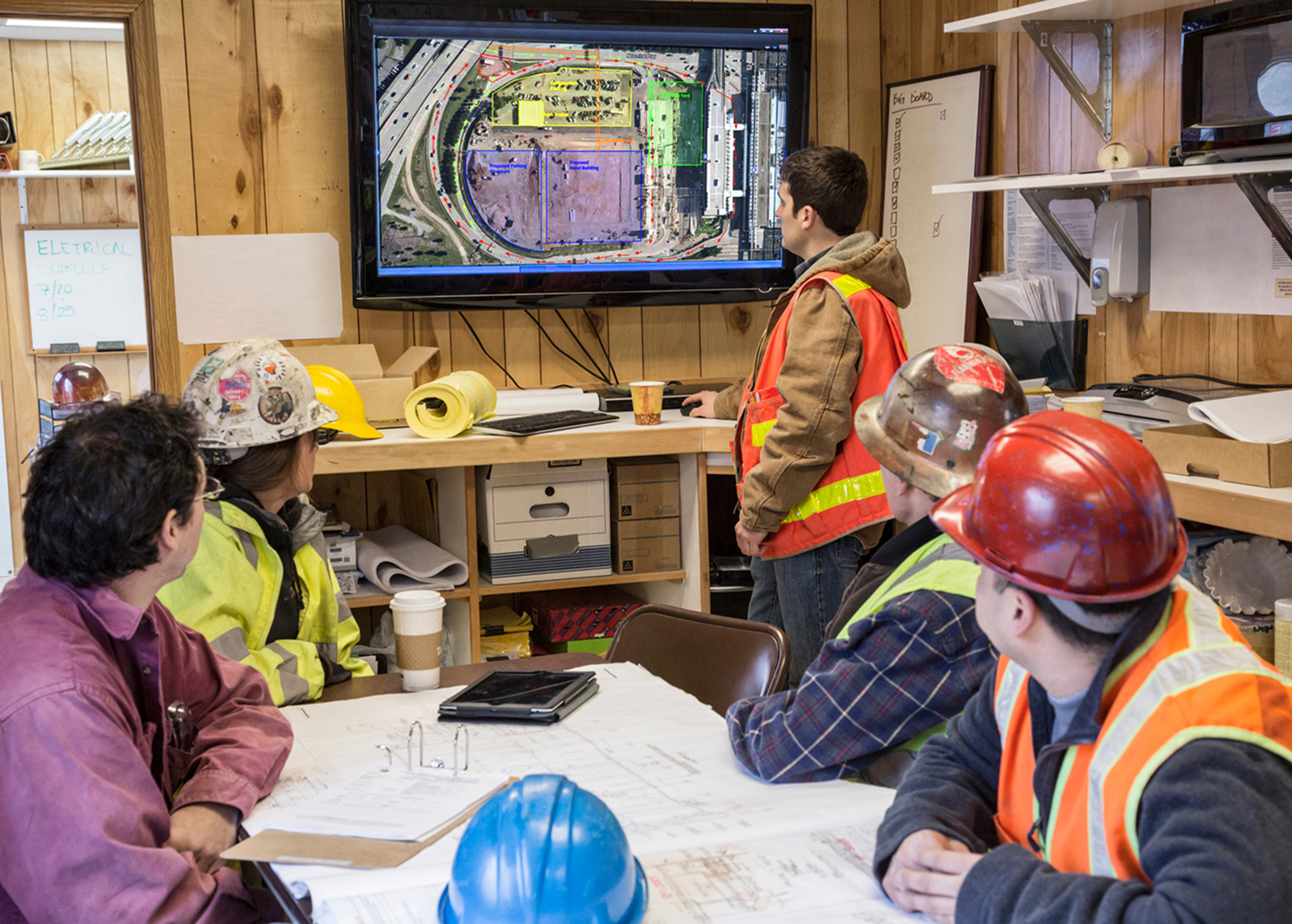
CASE STUDY
UNIVERSITY OF TOLEDO
The University of Toledo needed a better way to manage utility data. SiteMap underground utility mapping software centralized their as-builts and reports, giving the team 24/7 access and real-time visibility.
CASE STUDY
UNIVERSITY OF TOLEDO
The University of Toledo needed a better way to manage utility data. SiteMap underground utility mapping software centralized their as-builts and reports, giving the team 24/7 access and real-time visibility.
See Why Teams Choose SiteMap
Here’s what our clients say about using SiteMap GIS Services for accurate portfolio-wide infrastructure visibility and job site planning


See Why Teams Choose SiteMap
Here’s what our clients say about using SiteMap GIS Services for accurate portfolio-wide infrastructure visibility and job site planning
Find A Plan That Fits Your Team
Tailored GIS software solutions for projects, facilities, and enterprise operations.

SITEMAP® PRO
Designed for facility owners and managers, SiteMap Pro provides ongoing team access to GPRS data and deliverables across an entire facility or campus, supporting long-term planning and asset management.
SITEMAP® PROJECT
Most Popular
Ideal for general contractors, SiteMap Project provides full team access to GPRS data and deliverables for a single project site with a target completion date.

SITEMAP® TEAM
An enterprise-level solution for organizations managing multiple facilities, campuses, or projects, SiteMap Team offers unlimited user access and continuous data availability, ideal for dispersed teams operating across large geographic areas.
Find A Plan That Fits Your Team
Tailored GIS software solutions for projects, facilities, and enterprise operations.
SITEMAP® PRO
Designed for facility owners and managers, SiteMap Pro provides ongoing team access to GPRS data and deliverables across an entire facility or campus, supporting long-term planning and asset management.
SITEMAP® PROJECT
Most Popular
Ideal for general contractors, SiteMap Project provides full team access to GPRS data and deliverables for a single project site with a target completion date.
SITEMAP® TEAM
An enterprise-level solution for organizations managing multiple facilities, campuses, or projects, SiteMap Team offers unlimited user access and continuous data availability, ideal for dispersed teams operating across large geographic areas.
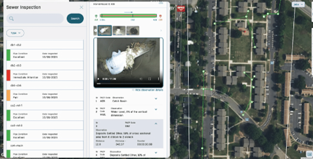
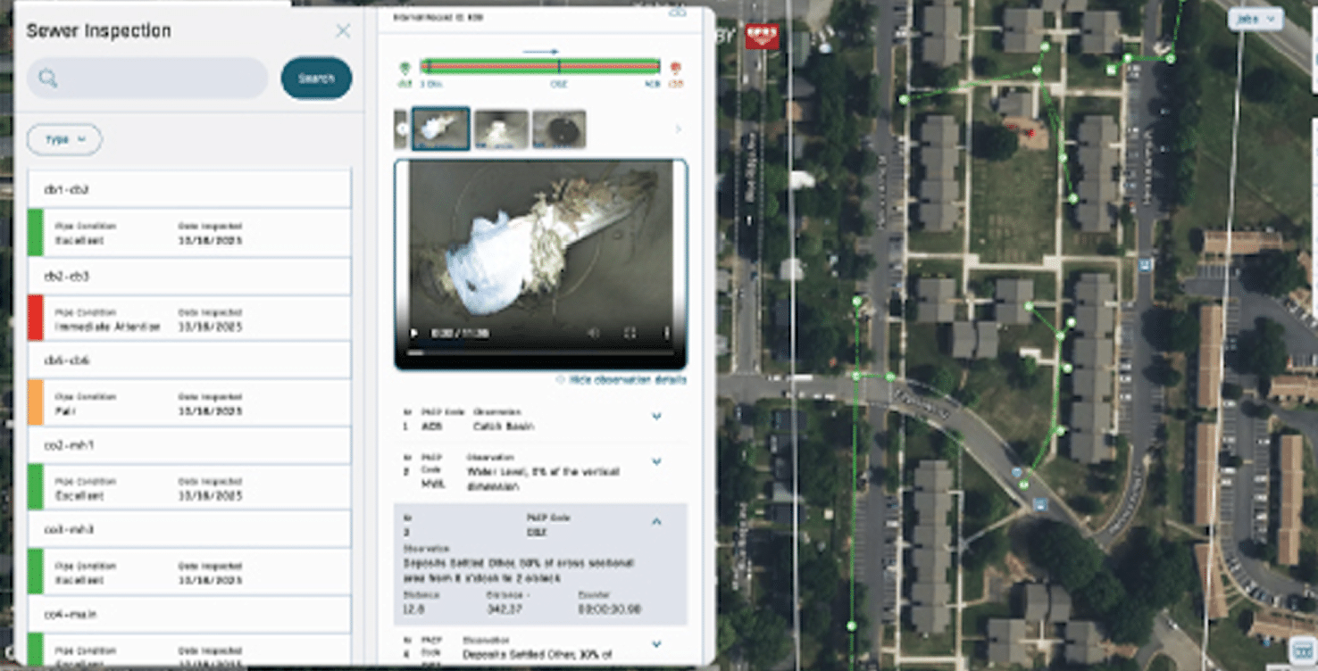
Transform Sewer
Inspections into
Actionable GIS Data
My Sewer Insights, part of the SiteMap platform, delivers NASSCO-certified PACP, LACP, and MACP coded sewer inspection reports. This allows you to access tagged videos, apply condition filters, and maintain permanent records for planning purposes.
- Navigate to any line, lateral, or feature in your sewer system
- Access geolocated, annotated video feeds at any time
- Filter by pipe condition and defect level for quick prioritization
- Share data with stakeholders to improve collaboration
- Maintain permanent records for proactive maintenance and capital planning
")
- Geolocated NASSCO inspection reports
- Visual condition assessment mapping
- Capital investment prioritization
“This feature is absolutely killer; I will have no problem presenting evidence of why I need capital stormwater funding.”
Seth Looney – Wake Forest University
Transform Sewer
Inspections into
Actionable GIS Data
My Sewer Insights, part of the SiteMap platform, delivers NASSCO-certified PACP, LACP, and MACP coded sewer inspection reports. This allows you to access tagged videos, apply condition filters, and maintain permanent records for planning purposes.
- Navigate to any line, lateral, or feature in your sewer system
- Access geolocated, annotated video feeds at any time
- Filter by pipe condition and defect level for quick prioritization
- Share data with stakeholders to improve collaboration
- Maintain permanent records for proactive maintenance and capital planning
- Geolocated NASSCO inspection reports
- Visual condition assessment mapping
- Capital investment prioritization
“This feature is absolutely killer; I will have no problem presenting evidence of why I need capital stormwater funding.”
Seth Looney – Wake Forest University
Frequently Asked Questions
What is SiteMap?
SiteMap® (patent pending) is GPRS’ cloud-based GIS software that centralizes your GPRS-collected data, including utility maps, 2D CAD drawings, 3D BIM models, virtual tours, NASSCO reports, and more for visualization and project planning. It enables seamless communication, collaboration, and data consolidation—helping prevent damage, improve accuracy, and support effective facility and project management. With a user-friendly interface, SiteMap provides secure, 24/7 access to subsurface and structural data, giving your team the information they need to plan, build, and manage with confidence.
Is SiteMap GIS Software free?
Every GPRS project includes a complimentary SiteMap Personal subscription, allowing you to view, download, and share all your GPRS-captured data. For expanded usage such as historical data aggregation, additional users, and advanced features, we offer upgraded subscriptions: SiteMap Project, SiteMap Pro, and SiteMap Team. Each option is tailored to different user needs. To learn more about SiteMap’s abilities and subscription levels, contact support@sitemap.com for more information.
What makes SiteMap different from ArcGIS/Esri?
There are two main differences between ArcGis and SiteMap:
- Data & Quality Control: Your GIS platform is only as reliable as the data behind it. In Esri platforms, your team is responsible for sourcing, validating, and maintaining accurate, up-to-date data. SiteMap delivers high-quality, GPRS-captured utility maps, CAD drawings, BIM models, sewer condition assessments, and more, all accessible within the platform. When new data is collected by GPRS, it can be uploaded directly into SiteMap for immediate use.
- Ease of Use: ArcGIS is a powerful platform that often requires specialized training or dedicated resources to manage effectively. SiteMap is designed with a simple, intuitive interface that most users can learn quickly, making it easy to export, print, share, measure, and interact with your data to visualize your built environment above and below-ground.
How do I export data from SiteMap?
Exporting from SiteMap is simple. From your Map Viewer, you can export a full view or a selected area, then download your data in formats such as DXF, Shapefile, GeoJSON, KMZ, or KML. SiteMap gives you the flexibility to choose CAD-friendly or GIS-friendly outputs, so your team can work seamlessly without conversion issues. This makes it easy to move accurate utility and project data into CAD, GIS, or other workflows. Export formats include:
DXF (AutoCAD, Civil 3D, MicroStation): Ideal for designers who need precise linework, layers, and geometry in CAD environments.
Shapefile or GeoJSON (GIS platforms, including Esri®): Best for managing geodatabases or building interactive maps.
KML/KMZ (Google Earth/Maps): Great for field coordination and stakeholder reviews when a lightweight, easily shared map is all you need.
Can I export SiteMap data into Esri platforms?
Yes. SiteMap supports data portability in formats like Shapefile and GeoJSON, making it easy to import accurate utility and mapping data into ArcGIS and other Esri workflows. This ensures your team can integrate SiteMap deliverables into your existing GIS environment without disruption.
How do I manage utility and infrastructure data across multiple facilities?
You can manage utility and infrastructure plans across multiple facilities using SiteMap, a cloud-based GIS platform that centralizes all project data in one place, organized by location. SiteMap provides visibility into subsurface utilities and structural as-builts, allowing your team to easily access, update, and share accurate site information across all locations. By bringing your facility data into a single platform, SiteMap helps streamline coordination, improve decision making, and maintain organized, up-to-date records for every facility.
Can SiteMap scale as my portfolio grows?
Yes. SiteMap is designed to scale with your needs. Whether you manage a single facility or a nationwide portfolio, the platform brings your plans into one interactive system. You can continue adding new projects using the same workflow, allowing you to grow without changing your process. To learn more about SiteMap’s abilities and subscription levels, contact support@sitemap.com for more information.