SCHEDULE A SITEMAP DEMO
SiteMap® is redefining collaboration – whether you’re managing one facility
or nationally distributed portfolio – so that you can control your data to control your damage
Call 833-569-7483 or email: support@sitemap.com
SiteMap® is redefining collaboration – whether you’re managing one facility
or nationally distributed portfolio – so that you can control your data to control your damage
Call 833-569-7483 or email: support@sitemap.com
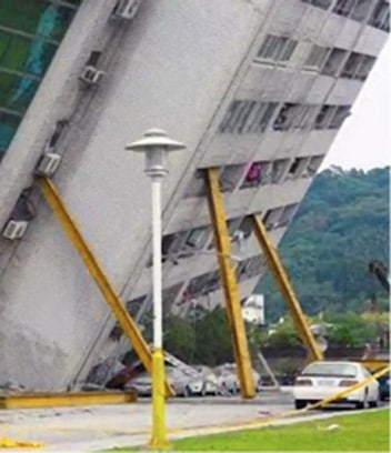
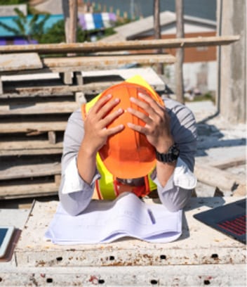
WHEN YOU’RE MISSING ACCURATE AS-BUILT DATA, MISTAKES, MISCOMMUNICATIONS, AND
ACCIDENTS CAN STOP YOUR PROJECT IN ITS TRACKS
DATA
DAMAGE
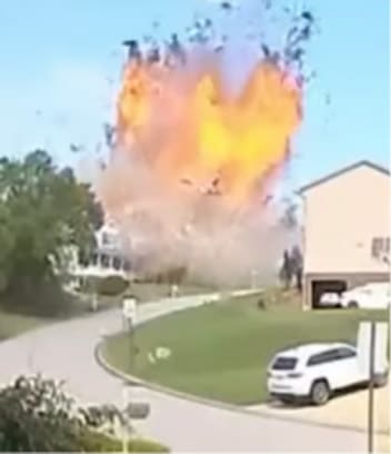
1,100 UTILITY STRIKES DAILY
76% OF REPORTED UTILITY STRIKES WERE DUE TO INACCURATE,
INCOMPLETE, OR MISSING LOCATION DATA & RECORDS
(2022 DIRT Report/Common Ground Alliance)
WHEN YOU’RE MISSING ACCURATE AS-BUILT DATA, MISTAKES, MISCOMMUNICATIONS, AND ACCIDENTS CAN STOP YOUR PROJECT IN ITS TRACKS
1,100 UTILITY STRIKES DAILY 76% OF REPORTED UTILITY STRIKES WERE DUE TO INACCURATE, INCOMPLETE, OR MISSING LOCATION DATA & RECORDS
(2022 DIRT Report/Common Ground Alliance)
SITEMAP® ALLOWS YOU TO TAKE
CONTROL OF YOUR DATA
PUT IT TO WORK TO BUST THROUGH INFORMATION BOTTLENECKS AND
KEEP YOUR JOB ON TIME, ON BUDGET, AND MOST IMPORTANTLY, SAFE
SITEMAP® ALLOWS YOU TO TAKE CONTROL OF YOUR DATA
PUT IT TO WORK TO BUST THROUGH INFORMATION BOTTLENECKS AND KEEP YOUR JOB ON TIME, ON BUDGET, AND MOST IMPORTANTLY, SAFE
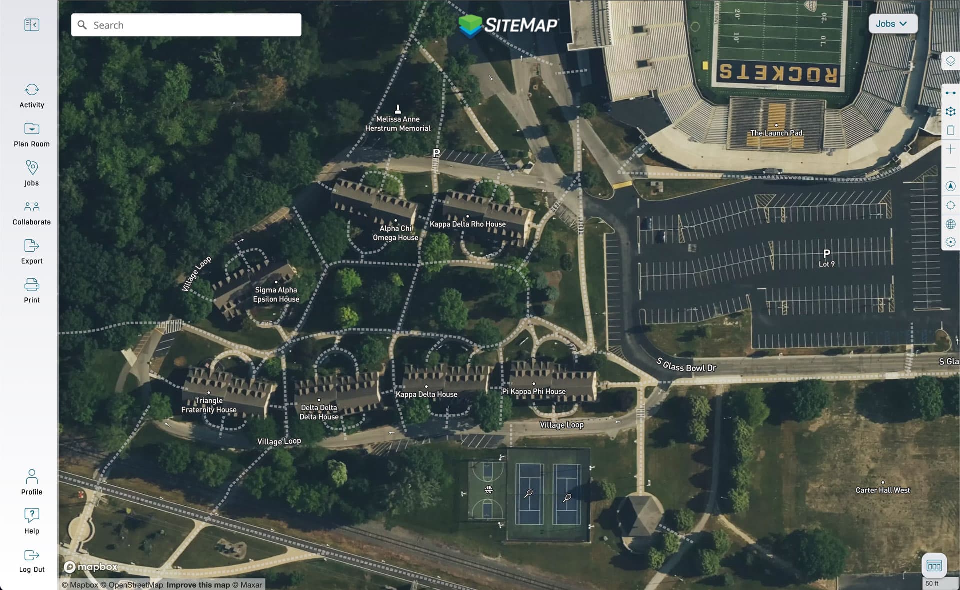
CASE STUDY
UNIVERSITY OF TOLEDO
PROBLEM
The University of Toledo has never had accurate subsurface as built data for its 150-year-old campus and for the many expansions and renovations conducted over more than a century and a half. They have suffered several damaging utility strikes, including a gas main, and costly pressurized water leaks in recent years due to inaccurate underground information.
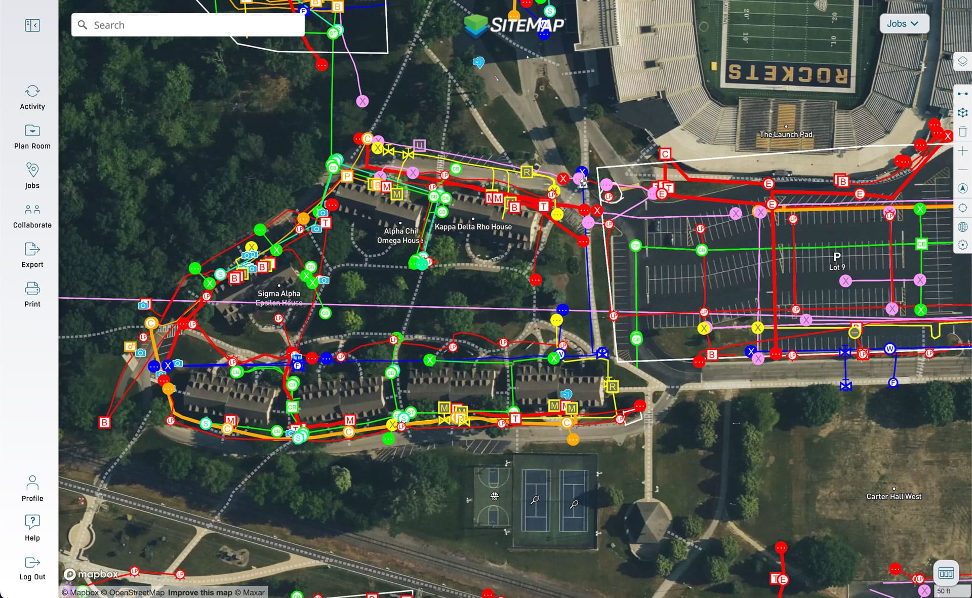
SOLUTION
GPRS & UToledo entered into a partnership that allowed the University to receive accurate as builts of their entire campus – layered, geolocated, and delivered via SiteMap®. GRPS provided its 99.8% accurate subsurface & concrete scanning data, along with leak detection, video pipe inspection (CCTV), 3D laser scanning, and drone photgrammetry to provide a comprehensive digital snapshot of the campus above and below ground.
BOTTOM LINE
The University now has accurate, complete, and updated as-builts for its subsurface infrastructure that far exceed any of its previous attempt to map utilities. This allows school officials to have an accurate picture of the risks and real costs associated with operations and maintenance, as well as planning for future projects and expansions.