Have you ever stared down at your shower drain, wondering what secrets are hidden in there? While it’s more than likely those secrets are just hair and soap scum, those pipes do lead to an underground world that most will never see. From water and sewage systems to gas and telecommunications, these underground systems overlap, weaving the lifeforce we need throughout our communities, pumping water, gas, and electricity right into our homes. However, their invisibility often conceals a host of challenges, from maintenance issues to unforeseen accidents. Yet, as we hurtle into the digital age, we are finding new ways to understand the world beneath and around us. Video Pipe Inspection is just one of many valuable GPRS services that prove to unlock new worlds entirely for our customers.
Video hasn’t quite killed the radio star, but it sure is providing things that radio could never.
Regular video pipe inspections can be part of a preventive maintenance plan, helping to detect potential issues before they become major problems, thereby extending the lifespan of the piping system.
Unveiling the Underground: The Power of SiteMap
Imagine a dynamic, interactive underground utility map of your area, accessible at your fingertips. This isn’t science fiction; it’s the future of utility management. SiteMap (patent pending), powered by GPRS, revolutionizes traditional utility mapping by digitizing and visualizing the underground infrastructure in hardly any time at all. Through advanced mapping technologies, SiteMap offers unparalleled insight into subterranean networks. This knowledge is made possible by the 99.8% accuracy of GPRS data, which is perhaps the most accurate in the nation.
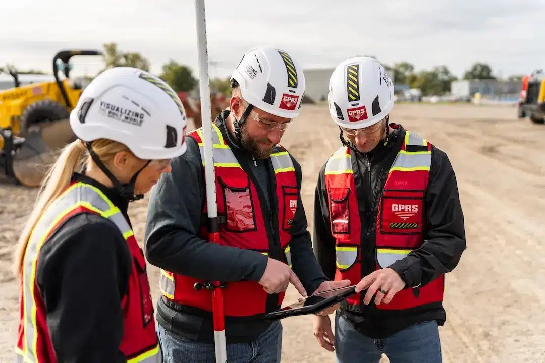
GPRS strives for 100% subsurface damage prevention, boasting a 99.8% accuracy rate nationwide. Our 500+ Project Managers employ the Subsurface Investigation Methodology (SIM) for utility mapping, concrete scanning, sewer camera inspection, and 3D laser scanning, ensuring consistent, high-quality results.
Through SiteMap, you can interact with maps of your location with ease, as SiteMap requires zero extra training to understand or navigate. Access accurate, aggregated as built data that is geolocated, layered, and securely shareable in an intuitive user interface. The Digital Plan Room acts as your data control center. You can see every file and map on any GPRS locating job. This puts you in control of your data, your job site, and your success.
Enhancing Efficiency and Safety
According to a recent survey by the American Society of Civil Engineers (ASCE), the United States alone faces an annual infrastructure funding shortfall of over $2 trillion. In this context, efficiency is more important than ever. SiteMap’s digital utility mapping streamlines operations, reducing costly excavation errors and minimizing service disruptions. By empowering utility managers with comprehensive spatial data, it enhances decision-making processes and accelerates response times to emergencies.
Utility strikes can cost your project $14,000 – $56,000 per incident, and every two minutes a water main breaks. This leaves a lot to be said for both efficiency and safety of the current system. All too often are project managers relying solely on 811 data, completely ignoring the fact that 811 only has public data, and much of it is outdated. Safety is very important to GPRS, so important that our Project Managers go through an extensive and rigorous training process. When it comes to pipe inspection, GPRS offers NASSCO certified processes and programs. NASSCO is the National Association of Sewer Service Companies. NASCO sets industry standards for assessing, maintaining, and rehabilitating underground water and sewer infrastructure. All GPRS Project Managers are NASSCO trained and certified, and provide NASSCO Video Pipe Inspection Reports via WinCan for our customers, delivered via SiteMap® for secure, accessible documentation that’s available 24/7.
Cost-Effectiveness and Sustainability
Utility mapping cost has long been a barrier to comprehensive infrastructure management. Traditional methods are labor-intensive, inefficient, and prone to inaccuracies. However, SiteMap offers a new era of cost-effective utility management. By digitizing data collection and analysis, it slashes operational expenses and optimizes resource allocation. Moreover, by minimizing excavation and repair needs, it fosters sustainability by reducing environmental impact. GPRS provides comprehensive, interactive reporting that details every inch of your pipes to help you plan repairs, maintain your system integrity, and mitigate risk.
Peering into the Depths: The Promise of Video Pipe Inspection
While SiteMap illuminates the broader landscape of underground infrastructure, Video Pipe Inspection delves into the intricate network of pipes and conduits. GPRS offers a wide range of Video Pipe Inspection services and programs, such as:
Crossbore Mitigation
More than one million cross bores – unknown & unintentional breaches of sewer lines, water lines, and other utilities – exist in the U.S. subsurface infrastructure, and more are added every day.
They cause sewer lateral backups, impact the structural integrity of pipes, and can cause severe damages that include fatal explosions. Hiring GPRS to conduct a video pipe inspection (VPI) ensures that you can find and repair existing cross bores, and prevent new ones by providing contractors with the comprehensive subsurface sewer infrastructure map they need before excavating or installing lines with trenchless technology.
Mainline Inspections
850 billion gallons of untreated sewage is discharged into U.S. waterways annually. That number does not account for untreated wastewater that leaches into the soil in the event of a cracked, broken, cross-bored, or defective pipe.
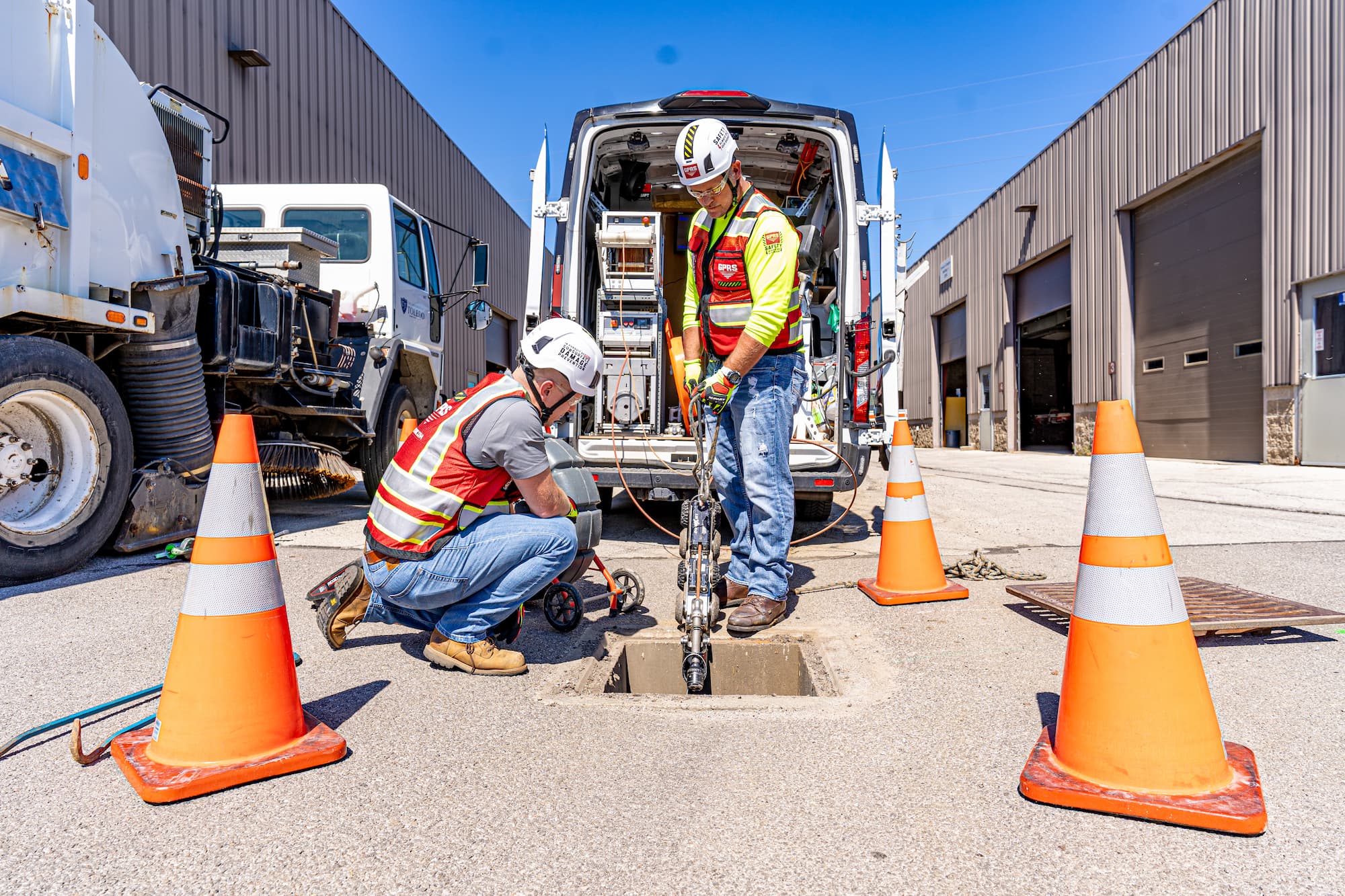
GPRS deploys sturdy, robotic mainline crawler CCTV cameras to assess pipe conditions, document all defects, laterals, etc., and map your mainline sanitary and/or storm sewer infrastructure as part of your NASSCO-certified video pipe inspection. Your WinCan VPI report and utility map are securely delivered and accessible 24/7 via SiteMap®, our proprietary project & facility management application. You receive a complimentary SiteMap® Personal subscription when you hire GPRS.
Manhole Inspections
Manholes are more complex structures than a typical pipe, so they require special attention to detail. Your GPRS Project Manager will utilize a variety of complementary technologies to gather detailed information, document all defects, and accurately document existing conditions so that you have the information you need to make repairs, maintain your infrastructure, and mitigate risk.
Sewer Lateral Inspections
Once we have assessed conditions and mapped your mainline water and/or sewer lines, GPRS will investigate all of your lateral lines with a lateral launch camera or a push camera (rodder) to document existing lateral line conditions, locate and report any cross bores, and map your entire water or sewer infrastructure.
Water & Sewer System Mapping
GPRS VPI services enhance a utility locate or full-site scan because we not only find the pipes, we deploy robotic sewer scope cameras, push cameras, lateral launch cameras, and additional technologies to inspect them, document their existing conditions in an interactive, NASSCO-certified report, and include them in a comprehensive, layered utility map, delivered digitally via SiteMap® for your use, 24/7.
And much more!
Proactive Maintenance and Risk Mitigation

The aging infrastructure crisis poses a significant challenge worldwide. In fact, some water lines in the nation are over 200+ years old and are wooden! While many wooden pipes are still completely in operation, much of our water lines are crumbling, so very much that the ASCE assigns a dismal grade of D+ to the nation’s overall infrastructure. Video Pipe Inspection emerges as a vital tool in combating this decay. By conducting proactive inspections, it enables targeted maintenance interventions, thereby prolonging asset lifespan and mitigating the risk of catastrophic failures. Moreover, by identifying potential hazards such as leaks or corrosion, it enhances public safety and environmental protection efforts.
GPRS offers two Video Pipe Inspection programs to help combat decay, and reduce risks. These programs are:
Annual Inspection
GPRS strongly recommends periodic sewer system inspections every other year to update your existing condition documentation, find new breaks, cross bores, and defects, and protect your system, facility, and community.
- Video Pipe Inspection of Sanitary or Storm Sewer Systems
- Reduces/Eliminates Service Interruptions, Contamination Incidents & Damages
- Pipe Defects Ranked by Severity in a WinCan Interactive, NASSCO-certified Report
- Recommended Every Two Years for Large Facilities, Campuses & Municipalities
Pre and Post Cross Bore Inspections
We also recommend cross bore inspections that assess pipe locations and conditions prior to the deployment of trenchless technology, and immediately following the installation of any new utilities via trenchless technology to mitigate the risk of cross bores and the dangers they pose.
- Contractors Required to Conduct a VPI Inspection Before Utilizing Trenchless Technology
- Provides a Baseline for Sewer As Built Information Before Applying Trenchless Technology
- Re-Inspection Required Immediately After Applying Trenchless Technology
- Mitigates Risk, Damage, And Potential Liability for Your Facility, Campus, or Municipality
Mapping and Reporting
GPRS Project Managers not only inspect the interior condition of water pipes, sewer pipes, sewer laterals, and manholes – they can provide a map of their location. The GPRS Mapping & Modeling Team can provide detailed GPS overlays and CAD files.
When you add a video pipe inspection to your full-site utility locate, we find and map the missing pieces of your subsurface infrastructure.
- Hard to locate Sewer Laterals and mains
- Unknown manholes and cleanouts
- Identify cross bores and pipe defects
The future of utility management beckons with promise and possibility. SiteMap and video pipe inspection represent the future of innovation in an increasingly complex and interconnected world. By embracing these technologies, utilities can chart a course towards a safer, more sustainable future, where the invisible becomes visible, and challenges become opportunities for growth.
SiteMap makes seeing simple, contact us today to learn more about how we can help.