The 1990 cinematic adventure and camp movie classic Tremors could not have happened if the location was properly mapped. All of the sand worms would have been perfectly annotated and aggregated, from tail to tail. Because we’ve proven in the 21st century that although beneath the surface of our built world, there lies a complex network of underground utilities, and thankfully no giant worm-like monsters. There are miles upon miles of water and sewer lines, electrical cables, and telecommunications networks. These assets play a crucial role in supporting our daily lives, and when they are mis-mapped or get hit, they can be just as destructive as giant sand monsters. Managing and maintaining underground utilities can often be as difficult as wrangling giant sand worms. SiteMap® (patent pending), powered by GPRS, offers a cutting-edge solution that is changing the field of underground utility mapping software.
The Challenge of Underground Utility Mapping
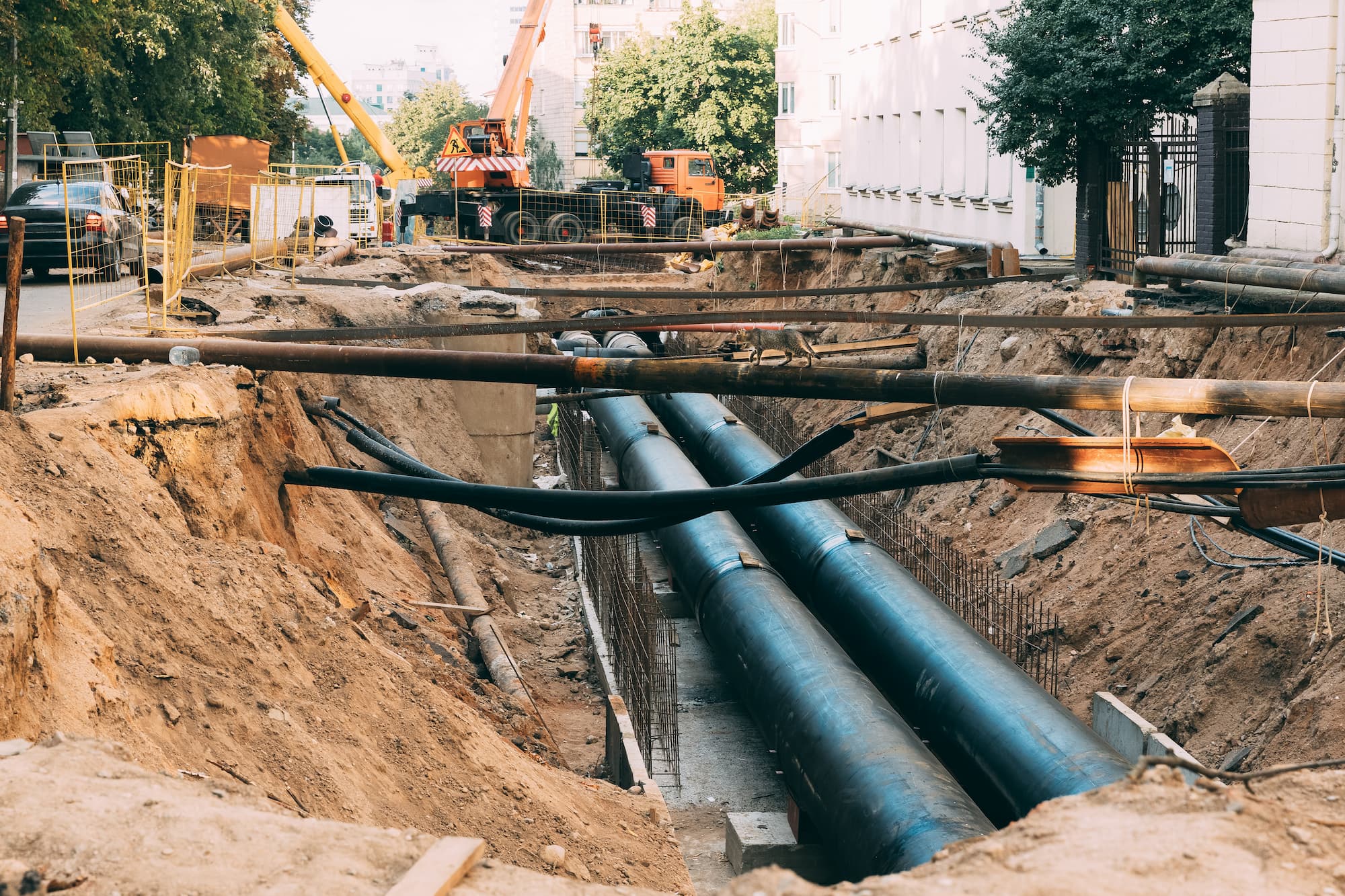
Mapping underground utilities accurately is a daunting task, given the myriad of challenges involved. Moreover, the underground environment is dynamic, with utilities constantly being installed, repaired, and replaced. As a result, organizations often struggle to maintain up-to-date and reliable records of underground infrastructure, leading to inefficiencies, safety hazards, and service disruptions.
GPRS offers a myriad of services to aid almost any field in their subsurface exploration, including:
- Private Utility Locating
65% of all on-site utilities for virtually any construction project or facility are private, meaning 811 One Call services cannot locate them for you. GPRS provides comprehensive digital .KMZ files and PDF utility maps of every utility on site, whether public or private – including depths – and can export your utility data into a wide variety of drawings, maps, and models that provide seamless communication and collaboration on any project.
- Facility Mapping
We provide comprehensive above and below ground facility and infrastructure mapping for the construction, facility management, engineering, architecture, manufacturing, and related industries.
- Utility As-Built Creation
GPRS provides a complimentary PDF, .KMZ file, and a SiteMap® Personal subscription with every outdoor utility locate. Our Project Managers utilize the data from your utility field markings to create digital, layered utility maps inside SiteMap®, and our in-house Mapping & Modeling Team can provide you with TruBuilt plan views and even a comprehensive 3D BIM or Conceptual Site Model (CSM) that accurately visualizes your entire utility infrastructure to communicate, collaborate, and manage your project or facility better.
- Soil Boring Clearance
Environmental consultants require soil borings when providing due diligence in a property transfer or when investigating environmental hazards in contaminated areas and brownfields. Knowing what utilities and features exist underground before you drill can help mitigate additional damages and risk in an already hazardous situation.
- Directional Drilling Clearance
When installing fiber and telecom lines, you have to know where to drill to avoid striking existing underground utilities. Cross bores caused by trenchless technology risk utility infrastructure and community safety. Avoid damages and confirm the safety of your work with pre and post-installation cross bore inspections that capture accurate existing conditions underground before you drill, and confirm the safety of your completed work.
- Environmental Due Diligence
GPRS provides assistance in Phase I and Phase II Environmental Site Assessments (ESAs), whether for due diligence before a sale or when tracking potential contamination for regulatory concerns. We provide accurate utility locates that map preferential pathways for contaminants and can provide detailed and 99.8% accurate conceptual site models (CSM) for 3D site visualization.
- One Call Locating Services
One Call cannot provide locates for the private utility lines on site, nor do they provide depths for public utility lines. GPRS professional private utility locating can locate both public and private utilities, provide accurate field markings, including depths, and give you complimentary digital and PDF utility maps of your utility infrastructure.
- UST Locating
Finding underground storage tanks (USTs) on any site is crucial to remediating risk before excavation. Abandoned tanks and lines can be easily found and comprehensively mapped by our SIM-certified Project Managers, and our Mapping & Modeling team can create a comprehensive map and/or conceptual site model (CSM) of your facilities for risk mitigation and recording purposes.
The Role of SiteMap® in Underground Utility Mapping

SiteMap® offers a-one-of-a-kind, comprehensive solution for underground utility mapping, leveraging advanced technology and innovative features to overcome the challenges of mapping underground utilities. Here’s how SiteMap® enhances water utility mapping software, utility mapping services, and underground mapping:
High-Resolution Mapping
SiteMap® provides high-resolution mapping capabilities, enabling organizations to interact with detailed, geolocated, and layered maps of underground utilities with unprecedented accuracy.
By accurately depicting the location, depth, and type of underground utilities, SiteMap® helps organizations minimize the risk of utility strikes, damage, and service disruptions during construction activities.
99.8% Accuracy
Our 99.8% accuracy rate demonstrates that our equipment, training, and methodology consistently allows your Project Manager to deliver high-quality results, near you, or nationwide. Our commitment to quality and consistency extends to our world-class customer service Project Coordinators. GPRS’ field-to-finish process is underpinned by our 99.8% accuracy rate. Our skilled project managers employ various collection devices such as ground penetrating radar, electromagnetic induction, CCTV crawler cameras, LiDAR, and acoustic leak detectors to gather built world data. This data is then compiled into deliverables by our in-house mapping and modeling team.
Expanding Technologies
We strive to provide the most accurate and advanced process and results. GPRS was one of the first companies in the country to focus on concrete scanning and utility locating, primarily using ground penetrating radar (GPR). In 2019, We saw an accuracy rate of over 99.8% on 72,000 concrete scanning and utility locating projects while using the SIM process and we have maintained this industry leading accuracy rate through over half a million jobs. While we lead the locating industry, we are not satisfied with these results. We will pursue all avenues of technology, training, and methodology in order to deliver this goal of safety for our clients.
Share With Ease
Strip away confusion by providing customized communication that reinforce each team member’s individual objectives with specific geographically segmented data. Print, save, or copy your SiteMap® data to communicate real-time subsurface as built information in whatever format suits your needs. Put everyone on the same page with a single source of truth that is accessible to everyone who needs it for the life of your project, 24/7 from any computer or mobile device.
Exploring the Benefits of SiteMap®-Enhanced Underground Utility Mapping
SiteMap-enhanced underground utility mapping offers a multitude of benefits for organizations across various sectors. Here are some key advantages:
Improved Accuracy: SiteMap® provides accurate and up-to-date mapping of underground utilities, reducing the risk of errors, utility strikes, and service disruptions.
Enhanced Safety: Safety is one of the core values at GPRS and is a significant part of our company’s culture. Through the GPRS Safety Program, OSHA classes and certifications, operator qualifications, The GPRS Training School, Fall Protection Training, Confined Space Training, CPR Training, First Aid Training and Classes, ERail Safe, and countless site other specific trainings, we are confident that our Project Managers will locate your subsurface obstructions safely and accurately.
Cost Savings: SiteMap® helps organizations avoid costly repairs, delays, and downtime associated with utility strikes, leading to significant cost savings over time.
Operational Efficiency: SiteMap® improves operational efficiency by enabling proactive maintenance and minimizing downtime.
Regulatory Compliance: SiteMap® helps organizations comply with regulatory requirements related to underground utility mapping, reducing the risk of fines, penalties, and legal liabilities.
SiteMap®-enhanced underground utility mapping software offers a unique and comprehensive solution for organizations seeking to overcome the challenges of mapping and managing underground infrastructure. From water utility mapping software to utility mapping services and underground mapping, SiteMap® empowers organizations to navigate the complexities of underground infrastructure with confidence, changing the way we interact with the subsurface, and how we develop our cities. Seeing the subsurface is simple with SiteMap®, are you ready to go beyond the subsurface? Contact us today.