VIEW YOUR
INFRASTRUCTURE
WITHSITEMAP
ACCURATELY MAPPED ■ DIGITALLY ORGANIZED ■ EASILY ACCESSIBLE
VIEW YOUR
INFRASTRUCTURE
WITH
SITEMAP
ACCURATELY MAPPED ■ DIGITALLY ORGANIZED ■ EASILY ACCESSIBLE


DOWNLOAD
our brochure
SiteMap is a singular subsurface infrastructure mapping solution that allows customers to experience their facility data with ease. SiteMap provides map data, subsurface utility information, and a common repository for facility artifacts. This geospatial solution also acts as an all-inclusive digital storage space for blueprints, as-built drawings, maintenance logs, permits, and more. The beauty of SiteMap is that it can geolocate every piece of information so the content can be located and cross-referenced on demand.
SiteMap simplifies facility management by providing its users with a powerful all-in-one solution.

SiteMap simplifies facility management by providing its users with a powerful all-in-one solution.
FACING THESE PROBLEMS
MANAGING YOUR INFRASTRUCTURE?
- Record drawings stored in multiple locations
- Unorganized plan rooms/document control rooms
- Complicated gis systems
- Inaccurate record drawings and as-builts
- Poor pre-planning due to lack of accurate information
- Utility damages when excavating
ARE YOU
FRUSTRATED
WITH
- Unorganized Drawings?
- Not having everything in one place?
- Inaccurate Information?
- Change orders?
FACILITY DISORGANIZATION
IS STEALING YOUR TIME
INFRASTRUCTURE DATA POSES
A RISK TO SAFETY
AND INCREASES COSTS.

WE POLLED FACILITY MANAGERS, ADMINISTRATORS, AND DIRECTORS.
YOU TOLD US THESE ARE
YOUR CHALLENGES:


AS-BUILT VS
ACTUAL AS-BUILT DRAWINGS

AS-BUILT

ACTUAL AS-BUILT
WE POLLED FACILITY MANAGERS, ADMINISTRATORS, AND DIRECTORS.
YOU TOLD US THESE ARE
YOUR CHALLENGES:
AS-BUILT VS
ACTUAL AS-BUILT DRAWINGS
AS-BUILT
ACTUAL AS-BUILT
INTRODUCING
 DIGITAL PLAN ROOM
The Digital Plan Room acts as the central repository for facility documents. These documents are directly viewable in the Map Viewer when appropriately tagged with the location information. The Digital Plan Room is a secure space to store essential and relevant facility documents.
- File Storage
- Historical Drawings
- Site Photos
- Drone Footage
- Digitized Blueprints
 MAP VIEWER
The Map Viewer makes viewing facility data easy as it allows the user to attach locational data to specific uploaded documents. This feature enables facility managers to track and locationally designate documents for reference quickly. Additionally, this makes sharing and updating location documentation a more fluid experience.
- Viewable, Searchable Maps
- 3D Modeling Viewer
- Tag Site Features to Maps
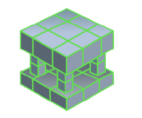
YOUR INFRASTRUCTURE
- Accurately Mapped
- Digitally Stored
- Easily Accessible
VIEW SITEMAP IN YOUR OFFICE OR ON YOUR MOBILE DEVICE

YOUR INFRASTRUCTURE
- Accurately Mapped
- Digitally Stored
- Easily Accessible
VIEW SITEMAP IN YOUR OFFICE OR ON YOUR MOBILE DEVICE
Case Study

GPRS is providing our 99.8% accurate utility locating and mapping to UToledo’s campus in exchange for field training for our Project Managers.
of SITEMAP

L
Case Study
GPRS is providing our 99.8% accurate utility locating and mapping to UToledo’s campus in exchange for field training for our Project Managers.
of SITEMAP
L
SITEMAP GIVES YOU INSTANT ACCESS
TO VIEW EVERY SQUARE INCH OF YOUR FACILITIES – ABOVE AND BELOW GROUND.

DRONE & AERIAL IMAGERY
Drone imagery is a great way to view up-to-date conditions of your campus with higher spatial resolution than typical satellite generated images. Existing drone imagery and can be added to your map or you can have it collected and uploaded by GPRS.
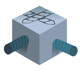
3D DIGITAL SPATIAL INFORMATION
This layer will allow you to digitize your building, automatically create 3D tours, create dollhouse views, create schematic floor plans, view structural reinforcement and utility layouts, and more. This can all be done from the comfort of your own office.
CONCRETE SLAB COMPONENTS & THICKNESS
Structural and utility components within concrete slabs are critical features to map and record prior to construction planning, coring, or saw cutting. SiteMap allows you to view concrete slabs via uploaded structural drawing or even 3D models and tours.
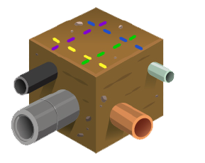
UNDERGROUND UTILITY & PIPE INSPECTION DATA
Knowing the location of underground utilities is crucial in the planning phase and also in the construction phase. The sitemap system will allow you to view the current as-built position of site utilities as well as sewer and manhole video inspection data.

UNDERGROUND STORAGE TANK INFORMATION (UST)
Sitemap is a great way to document the horizontal and vertical position of your site UST’s. It will also store documentation like periodic testing or release detection equipment, and inspections of overfill and spill prevention equipment.
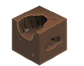
SUBSURFACE VOID INFORMATION
Information regarding the location of subsurface voids can often be discovered and mapped by GPRS. This information, stored in sitemap, can be critical when large machinery such as large cranes and concrete trucks are brought onto your site.

DRONE & AERIAL IMAGERY
Drone imagery is a great way to view up-to-date conditions of your campus with higher spatial resolution than typical satellite generated images. Existing drone imagery and can be added to your map or you can have it collected and uploaded by GPRS.
3D DIGITAL SPATIAL INFORMATION
This layer will allow you to digitize your building, automatically create 3D tours, create dollhouse views, create schematic floor plans, view structural reinforcement and utility layouts, and more. This can all be done from the comfort of your own office.
CONCRETE SLAB COMPONENTS & THICKNESS
Structural and utility components within concrete slabs are critical features to map and record prior to construction planning, coring, or saw cutting. SiteMap allows you to view concrete slabs via uploaded structural drawing or even 3D models and tours.
UNDERGROUND UTILITY & PIPE INSPECTION DATA
Knowing the location of underground utilities is crucial in the planning phase and also in the construction phase. The sitemap system will allow you to view the current as-built position of site utilities as well as sewer and manhole video inspection data.
UNDERGROUND STORAGE TANK INFORMATION (UST)
Sitemap is a great way to document the horizontal and vertical position of your site UST’s. It will also store documentation like periodic testing or release detection equipment, and inspections of overfill and spill prevention equipment.
SUBSURFACE VOID INFORMATION
Information regarding the location of subsurface voids can often be discovered and mapped by GPRS. This information, stored in sitemap, can be critical when large machinery such as large cranes and concrete trucks are brought onto your site.

WHEN YOUR SITE IS MANAGED BY SITEMAP WITH
DATA FROM GPRS, YOU HAVE THE ASSURANCE THAT
YOUR DATA IS THE MOST UP TO DATE, ACCURATE,
AND COMPREHENSIVE INFORMATION POSSIBLE.
WHEN YOUR SITE IS MANAGED BY SITEMAP WITH DATA FROM GPRS, YOU HAVE THE ASSURANCE THAT YOUR DATA IS THE MOST UP TO DATE, ACCURATE, AND COMPREHENSIVE INFORMATION POSSIBLE.


Utility Locating
GPRS accurately locates underground utilities and obstructions to provide clients with a comprehensive view of their subsurface infrastructure to maintain project safety ■


Video Pipe Inspection
Video Pipe Inspection is a service used to inspect water, sewer, and lateral pipelines. We use VPI to investigate cross-bores, structural faults and damages, and lateral lines ■


Mapping & Modeling
Our Mapping & Modeling department can take your communication and documentation to the next level by delivering GPS satellite image overlays, CAD files, and 3D modeling ■

UTILITY LOCATING
GPRS accurately locates underground utilities and obstructions to provide clients with a comprehensive view of their subsurface infrastructure to maintain project safety ■


Leak Detection
Leak Detection services help municipalities, utilities, and industrial facilities maintain safe, efficient water distribution within a domestic supply network and fire protection systems ■


3D LASER SCANNING
Using sophisticated lasers, we can create a rendering of a space with 2-4mm accuracy. This accuracy is vital for engineering projects and survey services ■

DRONE IMAGERY
Our state-of-the-art drones, equipped with an array of cameras, have the ability to identify malfunctions that impact facility performance, in addition to void detection, electrical inspection, and UAS magnetic imaging ■
MANAGE YOUR FACILITY MORE EASILY.
SITEMAP, POWERED BY GPRS, GIVES YOU THE TOOLS TO DO YOUR JOB MORE SAFELY AND EFFECTIVELY
- Accurate and up-to-date as-built drawings in one place.
- Cloud-based digital plan room.
- Intuitive and easy-to-use portal.
- Permanent record of site assets.
- Infrastructure knowledge.
- Safety excavations, saw cutting and core drilling.