In an ever changing world, it’s easy to lose touch with what used to be there. After all, we exist on a highway of technology and information where it’s often hard to pull off and take a glimpse of what used to be. Sometimes this means hitting a piece of a fence leftover, that your new map didn’t yet account for. When it comes to infrastructure utility management, digitizing facility artifacts is more important than you’d believe. Why? And how does SiteMap® help bring yesterday’s data into tomorrow’s platform?
The Importance of Digitizing Artifacts
It’s often said that if you don’t remember history, you’re doomed to repeat it. Well, that is definitely true in the subsurface world. If you’re unaware of what is there, or used to be there, you’re putting your next project at major risk.
Reducing Risks
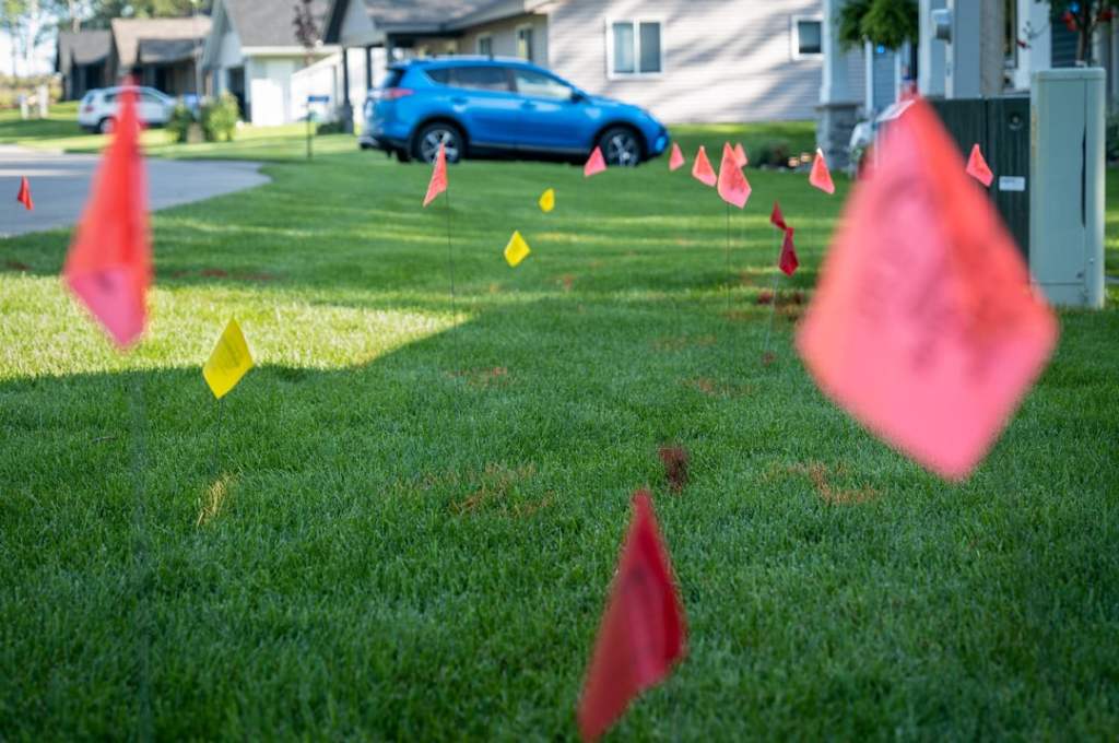
Did you know that 36 percent of homeowners who plan to dig this year for projects like building a deck, a pond, or a patio have no intention of calling 811 a few days beforehand to learn the approximate location of underground utilities? And even worse, even if they do, it’s likely that the information carries a substantial chance of being incorrect.
Accurate utility as-builts can save time, money, and expense for homeowners as well as builders.
When you start a project without knowing the approximate location of underground utilities you put yourself, your community, and your team at great risk. The average cost of hitting a utility line is $56,000, which is a huge setback for just about anyone.
For homeowners, 47 percent have no experience with the 811 process. While GPRS and SiteMap® usually deal with industries, and not homeowners looking to plant a garden, the data we collect can still benefit those people too. When subsurface data both old and new is accurately digitized and presented, it becomes available for use, and that means it helps reduce risks for everyone from professionals to grandma’s looking to plant a rose garden.
We can’t promise to solve all of your locate issues (yet) but we can promise you a platform that is easy to use, easy to understand, and comprehensive.
Decrease Delays
An underground utility line is damaged once every 60-62 seconds in the USA. This is often due to human error, such as negligence, or lack of proper data. By digitizing artifacts, your subsurface is more complete, meaning that professionals and others are able to see anything that may pose a risk or a delay to their project, even if it’s an older artifact.
Further, not all subsurface components are utilities. Some are remaining fragments of buildings and other structures that still need to be accounted for. When one of these is hit, your project will need to go on a delay as a new plan is drawn up, which can take days or even weeks. By understanding the subsurface, you’re not only reducing delay risks, but possibly saving money, and saving history too.
SiteMap® is powered by the amazing technology of GPRS, such as 3D laser scanning, CCTV video pipe inspection, and an in-house mapping & modeling team. This provides an accurate and comprehensive view of the site in question, and when paired with digitized artifacts, SiteMap® is able to aggregate this data, showing historical and current artifacts, giving users the full picture.
Preserve History
There is history all around and below us, and while it doesn’t always affect our utilities, the digitization of artifacts still matters for the purpose of locating and preserving history. Often, artifacts are forgotten, especially when they exist in the subsurface. When these artifacts are digitized, they get to enter the light yet again, and knowing about them can save you time, money, and accidents on a project.
Technology similar to what GPRS has utilized has been shown to be efficient in archaeology studies, identifying artifacts below the surface. When these artifacts are appropriately mapped and digitized, we can better preserve them. If nobody knows they are there, it puts their integrity at risk. SiteMap® allows for users to aggregate historical data on some subscriptions, allowing you to toggle this data at will. This can help lead to the re-discovery and preservation of historical artifacts and sites within the subsurface.
Understanding Subsurface Changes
Perhaps one of the more unusual benefits of digitizing artifacts is the study of seismic activity in relation to how these artifacts have shifted below the ground. When comparing such activity to the historical and modern subsurface data, researchers can understand better how seismic activity, as well as aboveground production, is affecting our soil, our subsurface, and even the world above the ground. Because all of these things affect one another, visualizing artifacts is helpful for many researchers who are trying to understand the movement of the subsurface and what that means going forward for society, architecturally, and more.
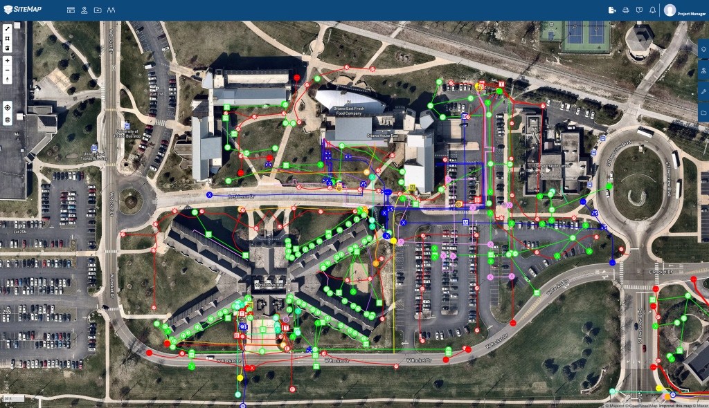
Color-coded, layered utility information, digitally displayed in SiteMap
The Important Role of SiteMap’s Blueprint Storage
There are many reasons why digitizing artifacts and preserving historical data is crucial to the progression and expansion of utilities, as well as other research and processes. SiteMap® can make digitizing artifacts easier than ever, with our comprehensive and simple blueprint storage. When it comes to facility infrastructure visualization, SiteMap® offers a view like no other.
When you sign up for your complimentary SiteMap® Personal subscription, you’re given access to all of your project data, whether ordered by you or subcontractors. If GPRS did the work, you’ll be able to see it all in your SiteMap® account. From there, you’ll be able to retain and access every iteration of your digital as builts. This helps you to securely document and reference your project’s progress.
At some subscription levels, if you’ve ordered services with GPRS before, you’ll be able to toggle your job overview, showing you your old data as well. This allows users to compare and contrast the data collected, giving the most complete view of your site. For researchers, this data can also be compared against historical records, which they can obtain from other sources.
Digital Plan Room
With your Digital Plan Room, you can secure your subsurface files, maps, and drawings all in one centralized space. This is accessible only to you and those you designate, and depending on your subscription level can be accessed through the life of your project and beyond. This means you can effectively safeguard the real-time accuracy of your subsurface data against unauthorized uploads or edits.
A Single Source of Truth
IT’S YOUR DATA – PUT IT TO WORK WITH SITEMAP®
Putting your data to work is what you can do easily when all of your data, whether new or old, is located in one spot. SiteMap® allows you to streamline communications, by providing customized communication that reinforces each team member’s individual objectives with specific geographically segmented data.
You’re able to print, save, or copy your data, allowing real-time subsurface communication in whatever format suits your needs. With our intuitive and interactive platform, digitizing your artifacts, and also interacting with your future data, is as simple as it gets.
Because SiteMap® is powered by GPRS, your subsurface utility data is 99.8% accurate, and is updated in real-time, giving a multi-layered and highly detailed understanding of your subsurface infrastructure. Digitizing artifacts with SiteMap® brings them into the world, and allows you to consider them in new ways. Further, with SiteMap®, your entire team is able to see this data seamlessly, as long as you want them to. Whether your data is ancient history, or the information you need for your next biggest project, SiteMap® and GPRS are here to help you Intelligently Visualize the Built World® .
Contact us today to hear more about our subscription levels and how they can work for you.