Rudolph Libbe required a comprehensive subsurface map and 3D model of a northwest Ohio medical center to plan for its expansion. “No one has gone to this extent to map a site above and below ground,” said Jaime Althauser, Field Support Director at GPRS. It was imperative that Rudolph Libbe had accurate as built site data and utility maps with critical structural and utility tie-in information.
Location:
Toledo, Ohio
Task:
Complete subsurface mapping and millimeter-accurate aboveground measurements for a top-down, 360° visualization of a hospital wing and parking area to support hospital expansion.
Rudolph Libbe, a longtime GPRS client and partner, oversaw the construction on the expansion of a northwest Ohio medical center. The addition is designed to occupy an existing parking lot for hospital employees, patients, and visitors. GPRS performed utility locating, video pipe inspection, and 3D laser scanning to create a comprehensive map and 3D model of the medical center’s infrastructure, both above and below ground.
Problem:
- With parts of the medical center’s campus dating back to the mid-1800s, inaccurate as built data and unknown subsurface obstructions could have jeopardized construction planning by Rudolph Libbe.
- It was imperative that the proposed locations of the structural foundation and planned utilities coordinated with the existing conditions because the project required the installation of some 100 foundational concrete caissons.
- Rudolph Libbe desired 3D as builts to coordinate design and construction, such as structural and utility tie-in information, to plan and complete the building addition.
- Traditional exploration methods typically include destructive means to verify the location of underground utilities. The congestion of the utilities on site would require any sort of excavation or potholing methods to be “soft,” and to extend over the entire building footprint. This option is expensive, time consuming, and requires tremendous coordination.
Solution:
- GPRS utilized ground penetrating radar (GPR) and electromagnetic (EM) locating to map the hospital’s utilities.
- Video pipe inspection (VPI) recorded the precise location and condition of the facility’s sewer and drainage lines.
- 3D laser scanning documented as built site data and utility maps to create 2D CAD drawings and a 3D BIM model for virtual design and construction.
- GPRS participated in coordination meetings with construction and design team members.
- GPRS utilized its above and below ground as built data to create an accurate, integrated 360° BIM model that included all existing and planned above and below ground construction elements and features.
Benefits:
- GPRS Project Managers are highly trained in the most advanced technology to document site information and to work with the Mapping & Modeling team to deliver accurate and comprehensive maps and models.
- Rudolph Libbe received millimeter-accurate laser scan data and an integrated as built 3D model to better control the design and planning of the building addition during preconstruction.
- GPRS’ findings allowed Rudolph Libbe to plan the new foundation and identify areas where further investigation would be warranted to prevent design and utility clashes.
- With comprehensive field services provided by GPRS, Rudolph Libbe saved time and money on change orders, and eliminated subsurface damage during the construction process
- Non-destructive utility locating methods eliminated nearly all unknown utilities and obstructions for the design and construction teams.
- Deliverables were utilized to narrow down the number of locations utilities were exposed via potholing to confirm their precise location.
GPRS Field Servies:
- Utility locates feature high-detail markings and depths of subsurface utilities.
- Video pipe inspections collect, map, and provide complete NASSCO certified WinCan VPI reports on all pipe defects and their severity, including raw video footage from within the pipe.
- 3D laser scanning of the site, including building exterior, interior, MEP, and subsurface locate markings, all tied to the site coordinate system to verify locations.
GPRS Mapping & Modeling Services:
- Virtual tour of point cloud and HDR images captured from the laser scanner.
- Colorized point cloud data delivered in Autodesk Recap.
- 2D CAD drawings, including as built site data and utility markings, created from MicroStation and AutoCAD Civil 3D files. The PDF file included embedded links to the virtual tour and the VPI WinCan videos at each manhole location.
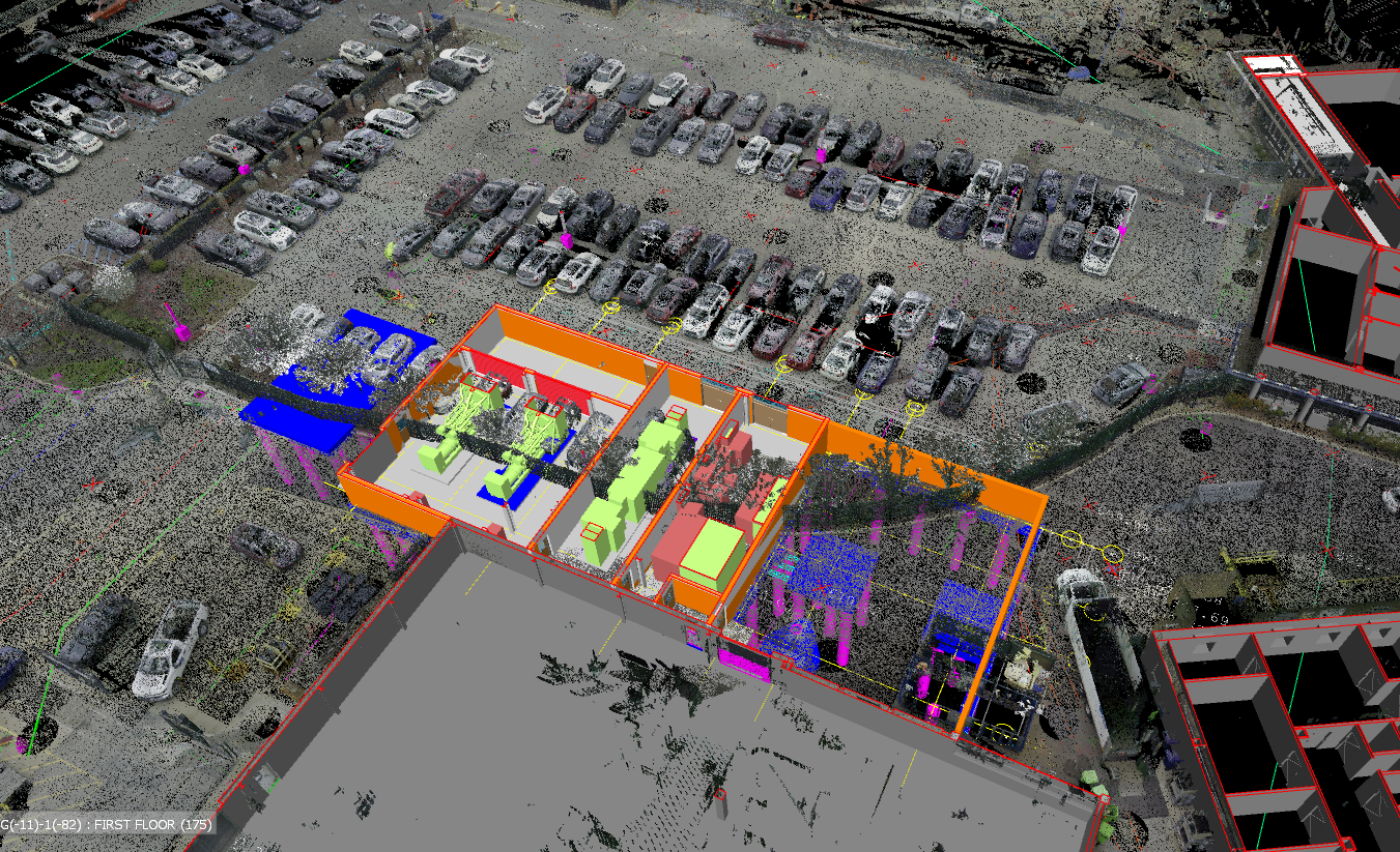
- Navisworks 3D model of findings including site features (above ground) and subsurface locate features (below ground). The model depicts depths of the located utilities, including electrical, water, sewer, sanitary, storm, steam, and communication.
- Access to SiteMap®, a complementary digital storage platform, to quickly access as built and location data.
GPRS Provided Critical Information for Rudolph Libbe:
- To construct the foundation, the contractor was drilling close to 100 caissons with a 30″ diameter, 65′ deep. GPRS integrated the 3D data captured into the architect’s design model to evaluate the proposed locations of the caissons.
- During the utility locate, a 19.5′ x 17.5′ concrete slab was discovered underground in the location that the design team intended to install three of the caissons for the foundation.
- Laser scan data exposed a three-foot deviation in the building footprint when compared to the design model created from outdated as built documents.
- A 3D as built model of the existing building gave Rudolph Libbe critical structural and utility tie-in information for the addition.
- A virtual tour let Rudolph Libbe easily view the site, add digital notes, and even measure inside the viewer.
- Video pipe inspection provided complete video files for further evaluation, documentation, and reference.
See how GPRS can Intelligently Visualize Your Built World™ with accurate data to eliminate project risks, change orders, and cost overruns. Experienced GPRS Project Managers utilize the most advanced technology to locate and record accurate site data. Clear and understandable maps and models are created by GPRS’ Mapping & Modeling team to share your construction plans with architects, engineers, and subcontractors.
What can we help you visualize?
Pull Quote:
“No one has gone to this extent to map a site above and below ground,” said Jaime Althauser, Field Support Director at GPRS.
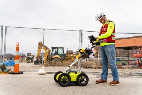
Utility Locate
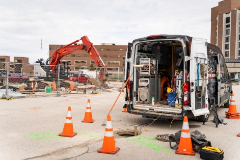
Video Pipe Inspection
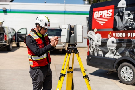
3D Laser Scanning

Rudolph Libbe was planning a hospital addition on an existing parking lot. GPRS performed utility locating, video pipe inspection, and 3D laser scanning services to create a comprehensive map and 3D model of the site.

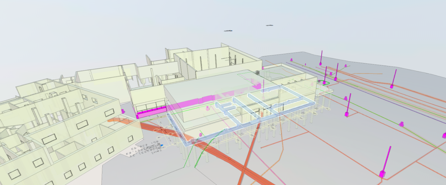
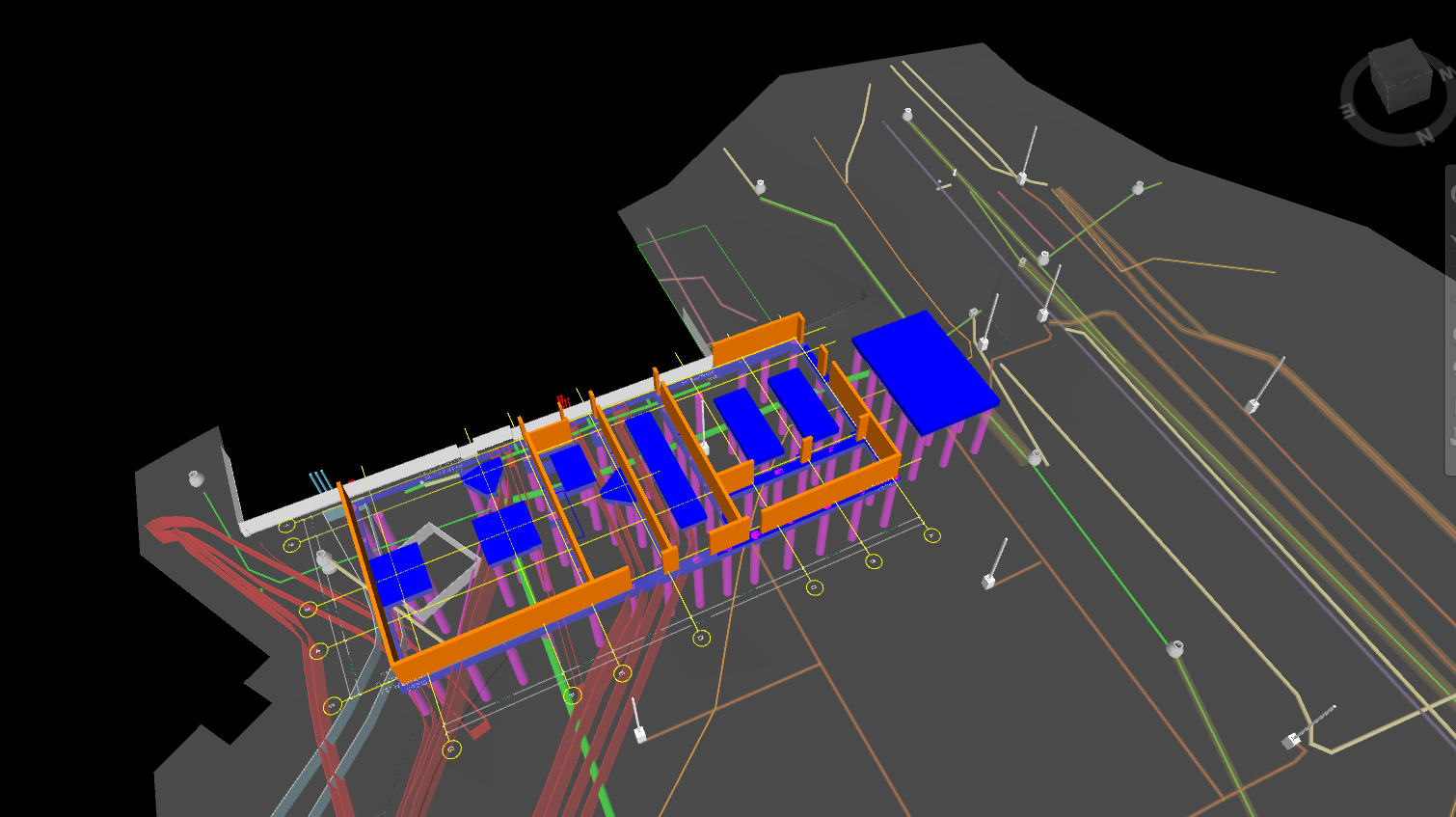
GPRS created an integrated 3D model for the client. Structural additions are shown here in orange and proposed locations of the caissons are shown here as pink pylons.
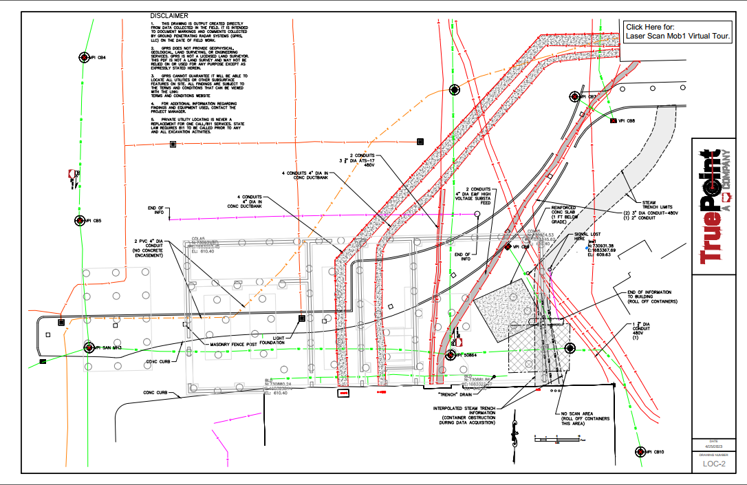
2D PDF locate plan including as built site data, utility markings, and proposed caisson locations.
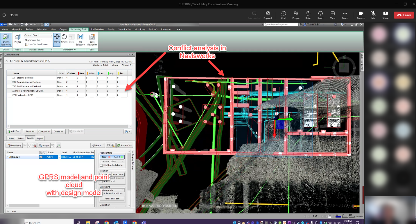
GPRS participated in coordination meetings with Rudolph Libbe’s construction and design team members. The screenshot above shows a design model conflict analysis in Navisworks
GPRS’ findings allowed Rudolph Libbe to plan the new foundation and identify areas where further investigation would be warranted to prevent design and utility clashes.
Navisworks 3D model of findings including site features (above ground) and subsurface locate features (below ground). The model depicts depths of the located utilities, including electrical, water, sewer, sanitary, storm, steam, and communication.
GPRS helps clients Intelligently Visualize the Built World™. Clear and understandable maps and models were created to easily share Rudolph Libbe’s construction plan with architects, engineers, and subcontractors.