CAD Maps Were Delivered Weekly for 2D Construction Coordination
Task:
A $1.5 billion site expansion was planned for an Ohio auto manufacturing facility to facilitate production of electric (EV) vehicles. A top construction company was hired as the general contractor to build a 2,625,000 sq. ft. addition to the facility, according to the auto manufacturer’s specifications. GPRS was contracted for underground utility locating, video pipe inspection, and 3D laser scanning services prior to excavation and construction. A GPS-enabled subsurface utility map was created in CAD by the GPRS Mapping & Modeling Team and uploaded to SiteMap® for the project team to access, visualize, and securely share accurate site data in real time. GPRS made weekly updates to the 2D CAD documents as construction progressed, to create a record of every phase of construction. A 3D BIM model was created from laser scan data to reroute storm roof drains in the plant.
GPRS Scope of Work:
- GPR Scanning and Field Markings: A team of GPRS Project Managers located all outdoor underground utilities with GPR technology on 220 acres of the automotive assembly plant’s property. This data included line depths. Electric, natural gas, water, storm sewer, sanitary sewer, and other utilities were marked on the surface using paint, flags, and other appropriate means.
- GPS MAP & CAD Drawings: A GPS map was created in CAD with detailed outdoor utility locate markings on an appropriate coordinate system. The linework was added to the client’s existing
CAD drawing and overlaid on aerial drone imagery. KMZ and PDF maps were created of the 220-acre site and updated weekly for the client. - Video Pipe Inspection: 7,500 lft of main sewer lines and 20 laterals were traced with CCTV sewer inspection crawlers from accessible cleanouts by a NASSCO-certified Project Manager, and reports were delivered with video and photography of pipe defects, geolocation of defects, and their severity, ranked from most to least severe.
- 3D Laser Scanning: GPRS captured millimeter-accurate as-built data of the plant’s ceiling and trusses with a Leica laser scanner for the Mapping & Modeling Team to develop a 3D BIM model to reroute storm roof drains in the plant.
- SiteMap® Project Subscription: SiteMap® Project stored subsurface as-built data in an intuitive user interface for the life of this project – mapped, layered, and securely shareable, 24/7. The subscription hosts up to 25 users and was updated as GPRS collected data and updated GPS maps.
Problem:
- As-builts of the existing 3,700,000 s.f. facility spanning 419 acres were out of date
- The client wanted updated subsurface utility data to provide the construction company accurate as-builts to plan the expansion, and avoid injuries and delays
- Trusting the plant’s existing documentation caused a water line in the fire protection system to be hit, requiring costly repairs
- Hydro excavation had previously been employed to daylight utilities. Uploading 99.8% accurate GPRS data into SiteMap® eliminated the need for heavy equipment and excavation
- The design and engineering team requested a 3D model to reroute the storm roof drain and ensure there was a clear path for the drain pipe
Solution:
- In 25 working days, GPRS delivered subsurface utility infrastructure data for the 220-acre site with 99.8% accuracy prior to construction planning so the auto manufacturer could design the facility expansion
- After preconstruction utility locating was completed, the client asked GPRS to make weekly updates to the data as construction progressed, to create a progressive construction record of
the project - The construction company accessed accurate subsurface utility data in SiteMap® to expedite decision making and eliminate the need to go back to the design and engineering team
- Each week, the client printed a 72″ x 72″ poster of the CAD map to scale and hung it in the trailer for planning and discussion
- 200+ laser scans were taken with the RTC360 Leica laser scanner, capturing a 350,000 sq. ft. area at the south end of the facility to document the locations of existing roof drains, columns, trusses, overhead piping, and cable trays
- A 3D BIM model delivered accurate architectural, structural, and MEP data in the area from the trusses to the roof to assist in the process of rerouting the storm drains
Benefits:
- GPRS was able to offer the client additional valuable technologies: video pipe inspection to identify cross bores and defects, and 3D laser scanning to capture exact building dimensions and layouts – to comprehensively visualize their infrastructure
- The client could then share subsurface as-built infrastructure data with subcontractors, engineers, and stakeholders via SiteMap® to eliminate miscommunication and data fragmentation to keep this project on time, on budget, and safe
- Every member of the field team has their own login to SiteMap®, so they can access accurate site information via mobile devices, on and off-site, to take ownership of the project and make critical decisions
The Bottom Line:
Progressive project capture allowed the client to review the construction progress for their entire 2,625,000 sq. ft. facility on a weekly basis.
We had existing data of a previous subsurface utility locate at the automotive manufacturing facility uploaded to SiteMap®. Once the Project Manager saw that he could virtually walk through the site, he knew SiteMap® would be essential to project planning.” -Nate Stair, Market Segment Leader for GPRS
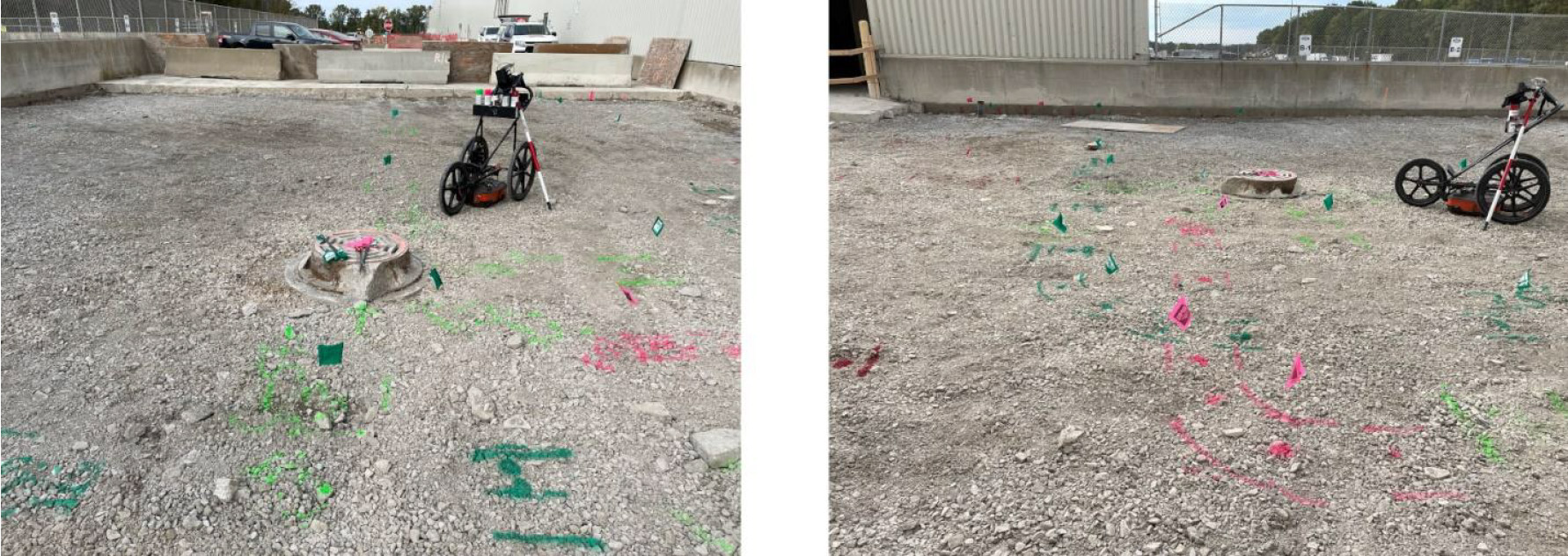
GPRS located all outdoor underground utilities with GPR technology for approximately 220 acres of the automotive assembly plant.
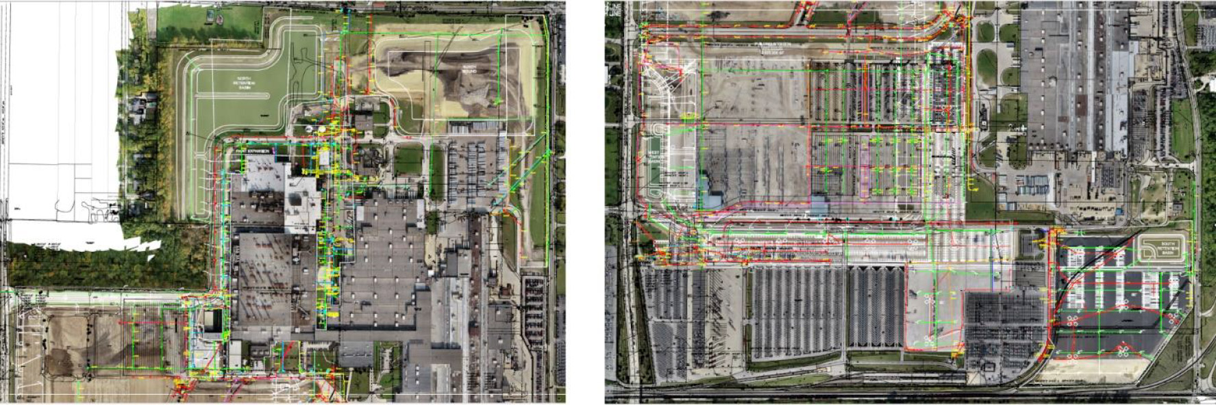
A GPS map was created in CAD with detailed outdoor utility locate markings on an appropriate coordinate system.
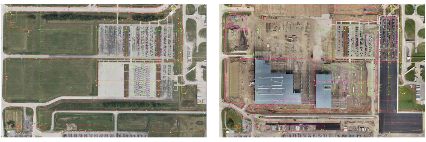
After preconstruction utility locating was completed, the client asked GPRS to make weekly updates to the data as construction progressed.
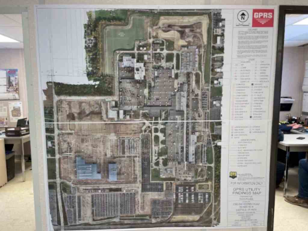
Each week, the client printed a 6′ x 6′ poster of the CAD map to scale and hung it in the trailer for planning and discussion
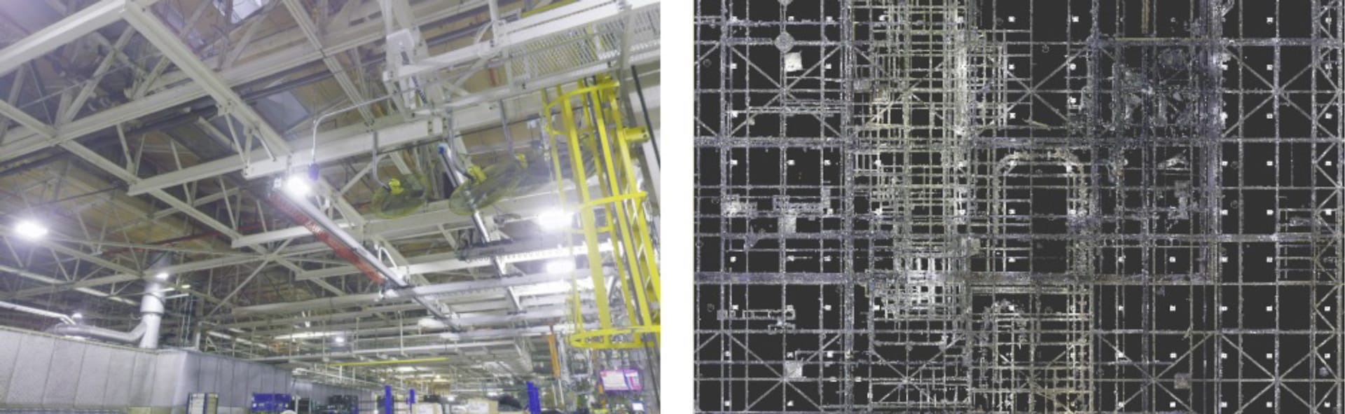
3D laser scanning captured 350,000 sq. ft. of area at the south end of the automotive facility to document the locations of existing roof drains, columns, trusses, overhead piping, and cable trays with millimeter accuracy.
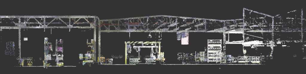
The point cloud provided the general contractor visualization and spatial analysis to reroute the storm drains in the existing structure.
Comment from Nate Stair: One of the biggest issues we were solving was scanning and collecting the data proactively ahead of the project rather than waiting until the construction phase. This gave them the subsurface information they needed to design and plan with accurate information that we updated from the out of date and inaccurate as builts