Imagine that it’s December of 1812, you’re a young professional, standing in the center of the town of Alta California, and the ground starts to shake. Pandemonium takes hold, buildings let out terrible groans, and as you drop to the floor you notice that the church over your shoulder is cracking. It’s crumbling and the cross that once stood proudly is now blurring out the early morning sunlight as it falls. The disaster ends up killing 40 parishioners of your community who were enjoying service inside the seemingly safe church walls. You have no idea how those buildings should be rebuilt, if the town’s well and early utility systems are safe, and have nothing to go off but the basic science and understanding of the enormous world below your feet.

1812 Earthquake Ruins Mission San Juan Capistrano
This was a real situation, known as the Capistrano earthquake or the 1812 San Juan Capistrano earthquake, which wrought havoc and caused destruction and uncertainty in a new frontier Thanks to modern technology, this situation would still be disastrous, but our preparation and the repair of utility systems would go much more smoothly. The technology to Intelligently Visualize The Built World® is what GPRS uses, providing geospatial data that not only helps build the world, but also helps enhance the decision-making process for professionals everywhere. This same geospatial data is available in your SiteMap® (patent pending) account.
Overview of SiteMap®: A Comprehensive Geospatial Solution
SiteMap® serves as a leader in dynamic and user-friendly infrastructure management software that combines cutting-edge geospatial technologies and data gathering to streamline data management and analysis. It serves as a centralized hub for geospatial data, offering a suite of features designed to enhance accessibility, visualization, and interpretation of critical subsurface information.
When you order GPRS services, you’re given access to a complimentary SiteMap® account. Within this account, you’re able to view your subsurface & infrastructure data in new and exciting ways. Depending on your subscription level you can store and access a plethora of maps, including layered subsurface utility maps, as-builts, blueprints, and more. Your data is presented in a way that is easy to see, and easy to understand. When using Team tier, your subscription can be shared by everyone on your team, making it easier than ever to stay connected. SiteMap® visualizes your data, because data visualization is important to avoid mistakes, expensive change orders, and injury on site.
Your SiteMap® serves as the ultimate infrastructure asset management software, keeping your data in one place. You’re able to customize your experience and can break down each layer and bit of information in a way that is easily viewed and digested. This platform is a great tool when it comes to decision making practices.
How SiteMap® Works for You
Centralized Data Repository
SiteMap® functions as a secure data storage infrastructure for all geospatial data, enabling easy storage and retrieval of information pertinent to subsurface investigations and facility management. When you and your team can easily visualize and understand the subsurface data at hand, it’s easier to make informed decisions. Data-driven decisions are smarter decisions, especially when more than half of all Americans rely on “their gut” to make decisions.
Your gut always doesn’t know when the sewers were re-rerouted, just as those standing in that small California town didn’t know exactly if their drinking water was safe after the earthquake. They overcame their gut by applying the science available to them, which is what GPRS does well. When your data is available forever, it means that your decision-making process is better informed for years to come, especially when comparing data from previous orders and years.
Interactive Mapping Tools
SiteMap® provides interactive mapping tools that give a visual representation of subsurface structures, utilities, and anomalies, allowing users to interpret data more comprehensively. Maps are an effective method of data conveyance with multiple applications. With GPRS and SiteMap®, you can receive layered utility maps, as-builts, 3D BIM walkthroughs, conceptual site models, abandoned pipes, USTs, and so much more.
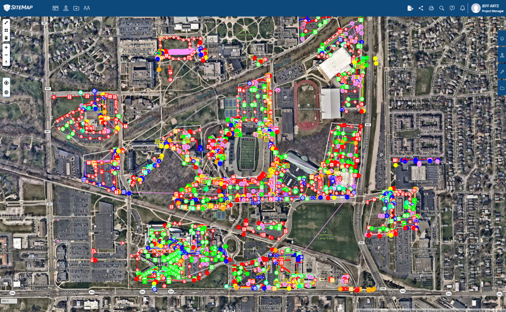
An example of SiteMap®’s infrastructure data display
Of course, the data you see depends on the services ordered, but all your data is interactive, easy to understand, and is displayed in real-time, often within five minutes of project completion by one GPRS’ elite Project Managers. It’s your data, and it’s there when you need it, fueling your decisions in a way that is intelligent and well-informed.
Real-Time Collaboration
SiteMap® allows you to easily collaborate with your team, sharing your data intuitively, and in real-time. SiteMap® fosters collaboration among teams, allowing for seamless data sharing, annotations, and discussions, facilitating better-informed decision-making, from the construction trailer to the board room. Data sharing is important when fueling data-lead decisions, and those decisions are not only more successful, but they’re also becoming more sought after. In fact, 85% of business leaders have suffered from decision distress, and 97% of them want help from data. When you’re able to share information seamlessly, you’re able to collect the ideas and the concerns of your team on every level, leading to well-rounded decisions.
SiteMap®’s Role in Subsurface Infrastructure Mapping
Subsurface infrastructure mapping is a critical aspect of numerous industries, including construction, engineering, education, transportation, and utilities. GPRS plays a pivotal role in this domain by offering precision, safety, innovation, and efficiency in subsurface investigations. GPRS Project Managers go through heavy training, including OSHA 10, OSHA 30, Hazwoper Training, Confined Space Training and Fall Protection, eRail Safe, and the industry-leading Subsurface Investigation Methodology (SIM) training. GPRS is committed to excellence in subsurface mapping and safety, as we continue our pursuit of 100% subsurface damage prevention.
Precision Mapping and Analysis
GPRS Intelligently Visualizes the Built World® above and below ground with a verified 99.8% accuracy rate for utility locating & concrete scanning, using the most advanced ground penetrating radar (GPR) and electromagnetic (EM) imaging technology available, and when it comes to concrete scanning & imaging, we back it up with our Green Box Guarantee. Our NASSCO-certified video pipe inspection (CCTV) & leak detection services find pipe defects, blocks, and leaks with pinpoint accuracy, and our 3D laser scanning, CAD design, and BIM modeling services are accurate within millimeters.
With SiteMap®, you’re given access to advanced analysis tools that empower users to interpret their project data effectively, enabling the precise planning and execution of construction projects, dig policies and utility locating before excavation, or infrastructure upgrades, among other projects. Precision is important, and it could save you $56,000. Why $56,000? Because that’s how much it costs on average to fix it when a facility utility strike occurs. That’s if the accident wasn’t fatal, which no amount of money could fix. GPRS uses technology that is always evolving and improving. However, GPRS also used methodology and SIM training that allows for non-destructive testing standard which exceeds all industry expectations. This allows for data that works for you, protects you, and better enables good choices for years to come.
Simplifying Facility Management with SiteMap®
Facility managers and other professionals often struggle with the complexities of maintaining infrastructure integrity while minimizing disruptions. This can often cause delays, cost money, and sometimes even lives. GPRS simplifies this process by providing insights that aid in proactive facility management and mapping. Operating as more than just a GIS platform, SiteMap® offers infrastructure asset management that includes your 3D utility mapping, and other important data, all at a glance.
Proactive Maintenance Strategies
By visualizing subsurface information, GPRS and SiteMap® assists facility managers in creating proactive maintenance plans, detailed project plans, utility data reports, and more. These serve to reduce the risk of unforeseen utility damage and costly repairs, or even fatalities. Geospatial data is an excellent tool for multiple industries, even the public health sector.
The platform’s real-time collaboration features enable effective communication among maintenance teams, higher-ups, project managers, and anyone else on board, which enhances efficiency in addressing infrastructure issues promptly. By allowing quick, simple data access, GPRS can help save lives by promptly highlighting problem areas, such as LUST sites or other dangerous infrastructure anomalies. Keep your teams connected with up-to-date subsurface data, powered by GPRS.
In the realm of subsurface investigation and facility management, GPRS stands as an innovative leader, empowering clients with actionable insights derived from geospatial data. By using SiteMap® and its comprehensive features such as its precision mapping capabilities, and simplification of facility management barriers and complexities, GPRS contributes significantly to informed decision-making across various industries.

Unlock the most innovative tool for strategic insights, powering informed decision making in your endeavors. Intelligently Visualize Your Built World® today, and make better, data-driven decisions as a result.
GPRS continues to revolutionize the landscape of subsurface investigations, empowering professionals with the tools necessary to navigate the complexities of infrastructure management. Embrace the power of geospatial data with SiteMap®, and unlock the most innovative tool for strategic insights, powering informed decision making in your endeavors. Intelligently Visualize Your Built World® today, and make better, data-driven decisions as a result. Contact us today to hear more about how GPRS can help superpower your decision-making process.