Understanding the intricacies of data can be as complex as the infrastructure projects it supports. For construction professionals tasked with tackling ever-evolving infrastructure challenges, a firm grasp of data terminology is not just beneficial; it’s indispensable. In the realm of subsurface infrastructure, GPR (Ground Penetrating Radar), Subsurface Utility Engineering (SUE), and Geographic Information Systems (GIS), where precision is paramount and errors are costly, clarity in communication is critical. This is where SiteMap® (patent pending), powered by GPRS, and a glossary of common terms comes into play—featuring a tool tailored to demystify the process and access of data for those in the trenches of construction and infrastructure development.
Key Terminology in Data Analytics
The construction industry’s future lies in its capacity to leverage data. Knowing the lingo is the first step towards harnessing the power of analytics to inform decisions, anticipate complications, and streamline operations.
Common Data Terms:
-
- Big Data: Large sets of data that require advanced tools to manage and analyze patterns and trends relevant to infrastructure project planning.
- Data Mining: The process of extracting valuable information from a larger dataset, which can inform patterns of wear, tear, and necessary maintenance.
- Geospatial Analysis: Using geographic data to evaluate construction site conditions, such as soil composition, utility pathways, and environmental considerations.
- BIM: Building Information Modeling or Building Information Management. It is a highly collaborative process that allows architects, engineers, real estate developers, contractors, manufacturers, and other construction professionals to plan, design, and construct a structure or building within one 3D model. GPRS has a team of highly skilled professionals who excel in BIM.
- Data Visualization: Presenting geospatial data in a visual format, often through maps, charts, or 3D models.
- Data Annotation: Labeling and annotating the data so that it can be used as training data for geospatial machine learning algorithms;
Each term has specific relevance to infrastructure projects. For instance, Big Data can predict traffic patterns around a new construction site, while Geospatial Analysis can optimize the placement of underground utilities.
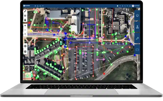
SiteMap® Glossary for Construction Professionals
![]()
SiteMap® arises as a way to utilize subsurface data without the need for a glossary. However, it’s always wise to understand certain aspects and terms pertaining to the field, some terms include:
Vital Glossary Entries:
-
- Quality Level A (QL-A): The highest level in SUE, referring to the precise location of utilities as verified by direct exposure and seeing the utility in place.
- Quality Level B (QL-B): Information determined by employing non-destructive geophysical methods to indicate the existence of subsurface utilities.GPRS does not conduct SUE. However, our utility locating accuracy supports QL-B level SUE activities.
- SUM: Subsurface Utility Mapping, the process of mapping utilities within the subsurface for various projects.
- Remote Sensing: This involves collecting satellite imagery, aerial images, or drones to monitor changes in the Earth’s surface, such as deforestation or land use changes.
- Spatial Statistics: These statistical methods are specifically designed to analyze spatial data. They include spatial autocorrelation, spatial interpolation, and point pattern analysis.
- As Builts: As-built drawings are revised sets of drawings submitted by contractors upon project completion. They reflect all changes made during construction, showing the exact dimensions, geometry, and location of elements in the completed work. These drawings serve as a record of the actual construction, capturing modifications that deviate from the original design.
SiteMap® utilizes technology and processes related to these terms among others, like ‘gis utility mapping’ and ‘3D utility mapping,’ which reference the use of GIS technology to create three-dimensional maps of utilities.
Benefits of Using SiteMap®
![]()
SiteMap® equips infrastructure specialists with a shared language, hence bolstering communication efficiency. With a familiar set of terms and processes:
- Teams can reduce misunderstandings that lead to construction delays.
- Data-driven decision making becomes more reliable.
- Understanding nuanced data analytics results in potentially saving costs by avoiding underground utility strikes and other on-site issues.
History of SUE and GIS Solutions
The idea of using advanced technology to streamline infrastructure projects is not new. The industry has relied on GIS software and SUE techniques for some time, with SiteMap® not offering SUE, but building upon this legacy. What sets it apart is a comprehensive and intuitive approach that transcends traditional silos—making data management more accessible and reliable across the board.
Historical Timeline:
- 1986: American Society of Civil Engineers (ASCE) established SUE as a set of standards.
- 1994: GIS became commercially available, and its use in infrastructure projects proliferated.
- 2023: SiteMap® is introduced, offering data visualization and mobilization capabilities to streamline utility mapping processes.
The integration of data visualization and the subsurface through SiteMap® has opened new frontiers in infrastructure project management. With the inclusion of emerging technologies like AI and augmented reality, the horizon of data dynamics promises to be more agile and accurate than ever before.
SiteMap® for construction professionals is more than a collection of technical terms—it’s an invitation to master the language and see your data in a way that has become synonymous with modern infrastructure projects. Data-driven decisions are now indispensable in the industry, and with SiteMap®®, construction professionals can reap the benefits of a truly informed approach. Don’t just speak the language of data; master it with SiteMap®.
Whether you’re laying the foundation for a skyscraper or paving the way for a new highway, mastery of data is your blueprint for success. Contact SiteMap® today to learn more about how we can help you visualize your next project.