Imagine calling a number and listening to soft jazz for 35 minutes as you wait for an operator to answer, only to have them transfer you as you listen to the greatest elevator hits of 1978. That used to be the norm for customer service lines, but technology has been changing that for better or worse, and that’s true even in the realm of infrastructure and geospatial planning. Amidst the geospatial simulations and cloud-based data crunching, there’s an often-overlooked entity—personal support. SiteMap® (patent pending), powered by GPRS, is an innovative utility mapping application, blending cutting-edge tech with personalized aid to enhance infrastructure projects. But how does SiteMap® blend the lines of technologically advanced and personal?
The Need for Personal Support in Tech
As professionals in the infrastructure domain navigate the complexities of underground utilities, they’re often faced with less-than-ideal scenarios. From outdated maps to sudden changes in geological information, even when using the 811 System, each day on the field poses unique challenges that conventional tech can’t always address. What’s clear is the need for “the personal touch” to navigate these complexities – a support system that goes beyond algorithms and user manuals.

The Human Element
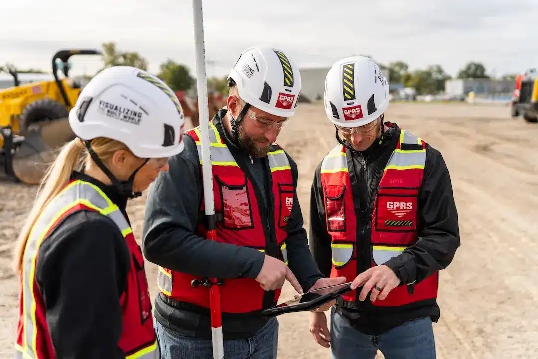
The accuracy and relevance of utility mapping are inherently human-dependent. Machines can process data at lightning speed, but they lack the nuanced understanding and adaptability of the human mind. When tech encounters the unexpected, it’s the human operator’s judgment and experience that kick in to ensure project success. GPRS utilizes real humans in plenty of ways, from our elite team of Project Managers who go out to collect the data, to our Mapping & Modeling Team, who make each map look and act with nearperfection.
Let GPRS’ in-house team create an as-built (TruBuilt) for your project – showing actual existing conditions above or below ground… or both. Our 3D Laser Scanning, reality capture, and 3D Photogrammetry services deliver up-to-date and accurate construction as-builts, existing condition drawings, 2D CAD drawings, 3D BIM models, 3D mesh models, digital twins, point clouds, updated floor plans (FLRPLN), and more for construction design, prefabrication, clash detection, facility modifications, and asset management.
Real-time Decision-Making
In the dynamic world of infrastructure, real-time decisions can mean the difference between disruption and smooth progress. The support infrastructure professionals require is not just about technical know-how; it’s about instant counsel and problem-solving that personal interaction provides. With the help of SiteMap’s support team, decisions regarding SiteMap® products or help with SiteMap® issues is simplified. You can reach a real person with ease, whether you like soft jazz or not.
The Totem of SiteMap®
As touched on above, SiteMap® emerges as the synthesis of tech and the human touch, offering a utility mapping platform that is robust and responsive to the user’s needs. It covers a spectrum of features from detailed underground maps to personalized customer service, setting a new standard for tech in infrastructure projects.
GPRS operates on that same principle. At GPRS we help you to visualize the built world of your campus and facilities by providing seven different core services. These services provide you a one stop shop for all your above and below ground mapping and modeling needs. We specialize in utility locating, concrete scanning, leak detection, 3D laser scanning, video pipe inspection, and drone imagery, and our experience and expertise are second to none.
GPRS was one of the first companies in the country to focus on concrete scanning and utility locating, primarily using ground penetrating radar. Since we started in September 2001, we have built a nationwide network, with our team strategically placed in every major metropolitan area in the United States. Since our founding, we have worked on some of the country’s largest and most significant construction projects. On average, each of our Project Managers performs 300 jobs per year.
A Revolutionary Utility Mapping App
At its core, SiteMap® is a revolutionary app that harnesses the power of GPRS’ 99.8% infrastructure data accuracy to deliver detailed utility maps. What sets it apart is its commitment to support – features that allow users to interact with SiteMap® support and consultants with ease, who provide immediate guidance in the face of uncertainties, ensuring project continuity without a hitch.
Seamless Integration with Existing Processes
One major challenge with new tech adoption is compatibility. SiteMap® rises to this challenge, seamlessly supporting existing project management systems and workflows with data portability. By focusing on a user-friendly design, the platform ensures that even the least tech-savvy team member can utilize its benefits.
Benefits of The Personal Support in Tech
Tech can help with a multitude of things, including increased efficiency, cost savings, enhanced accessibility, improved accuracy, better organization, faster information sharing, environmental sustainability, data security, scalability, and integration.
The infusion of personal support in technology reaps an array of benefits that directly impact the successful execution of infrastructure projects. Let’s examine each one and how they contribute to the broader project goals. With smartphone ownership increasing 50% in the last decade in the United States, reaching support has become a skewed dance of real interaction and bot substitutions. SiteMap® strives to provide real, accessible support and solutions for those who seek it, and with good reason.
Increased Efficiency and Productivity
SiteMap’s blend of easy interaction and human support streamlines the mapping process, removing bottlenecks and inefficiencies. The platform offers not just maps but also the expertise of live professionals, accelerating decision-making and task execution.
Reduced Errors and Risks
The support provided by w® significantly reduces the chances of errors and the inherent risks associated with infrastructure projects. Such guidance ensures that the most accurate and up-to-date information is used, safeguarding projects against costly mistakes. This is backed by the accuracy and skill of GPRS, which is something that nobody else can provide you.
Enhanced Project Management and Coordination
Personal support isn’t just about fixing issues as they occur; it’s about proactively managing the project with a personalized touch. SiteMap’s consultants can almost become an extension of the project team – ensuring that the right information is available at the right time. The comprehensive package that SiteMap® provides is one that strives to reduce the instance of utility strikes while also creating seamless and successful projects nationwide.
In a busy field and busy world, it’s clear that the future of technology in infrastructure projects is not just about the tools but the people who wield them. The SiteMap® approach is a testament to the symbiosis of tech and human interaction. It strikes the perfect balance, enhancing the capabilities of infrastructure professionals and ensuring that projects are completed efficiently and with the highest standards of quality.
If you’re an infrastructure professional looking to future-proof your approach, you owe it to your projects – and yourself – to explore tools like SiteMap®. See the subsurface as simply as possible with SiteMap®, contact us today.