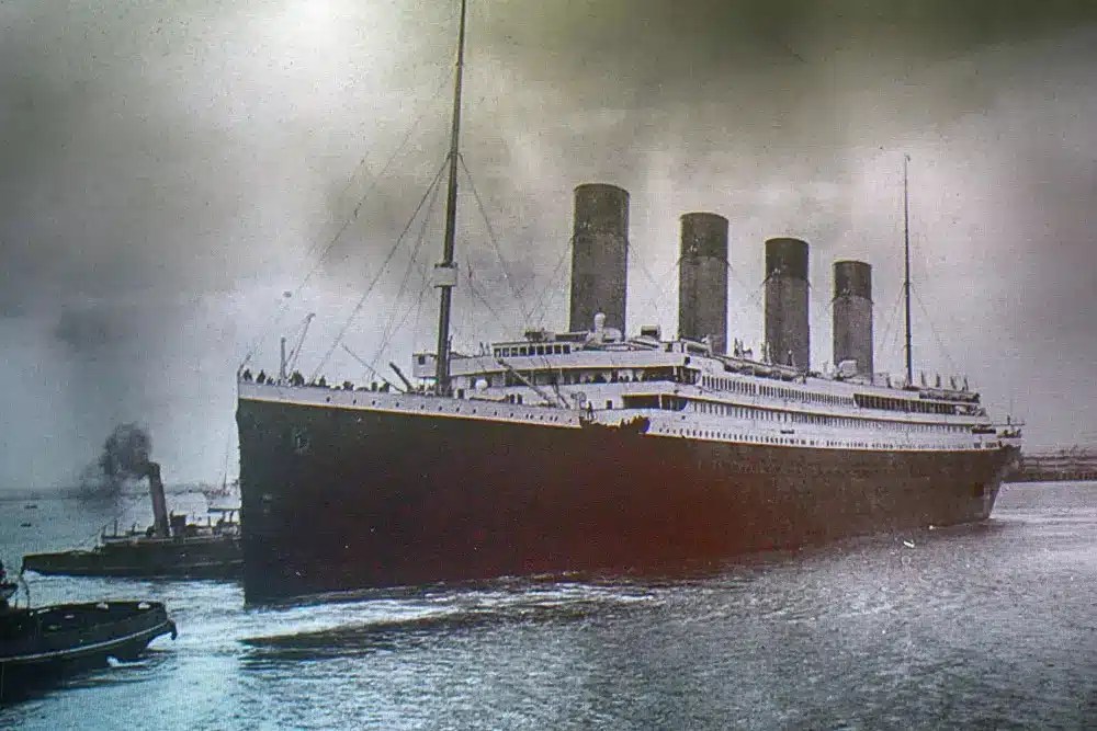
It’s 1912, and it’s a gorgeous, clear, crisp night as you stroll the deck of one of the finest ships you’ve ever seen. Nobody has seen anything quite like it! In fact, you may have heard someone refer to the ship as nearly unsinkable. If you haven’t seen the movie, the ship, the Titanic sinks.
But the Titanic didn’t sink in any way that you’d expect the ship to sink, which is what made finding the wreckage so difficult to do. As the starboard side of the hull struck the iceberg, it created a series of holes below the waterline. The hull was not punctured, but was dented in such a way that the steel plates of the hull began to buckle and separate, allowing water to rush in. Five of the sixteen watertight compartments were breached, and the ship could only stay afloat if four of the sixteen were breached.
While SiteMap® didn’t discover or map the Titanic wreckage, we do have the technology to back some amazing industries that serve to make a huge difference in the lives of communities everywhere.
Titanic began to quickly progress in her sinking. The vessel would end up sinking almost like a torpedo, with pressure of its descent sending the pieces in a corkscrew fashion below the water.
It wasn’t until many years later that we learned how the Titanic sank, and it was thanks to subsurface mapping technology that we continue to learn more about its trajectory. Without this incredible technology, no one could have mapped the wreckage, or even located it. It took years and a secret Cold War mission, equipped with advanced technologies such as subsurface technologies to finally discover the wreckage in 1985. Subsurface mapping technology has come a long way since 1985, and even more so since 1912, and SiteMap® (patent pending) is on the forefront of this evolution of the science that exposes the world below us.
Early Subsurface Mapping
Since the beginning of cartography, subsurface mapping has been a focus for many industries. Knowing what lies below our cities is important to the integrity and sustainability of these cities. The 1969 book “Fundamentals of Cartography” highlighted the fact that cartography skills bring together geographic science, including technical and artistic skills, which remains a key combination for cartography today. And it’s this early map-making study that fueled the science behind subsurface discovery and mapping.
Subsurface mapping dates back at least to ancient Egypt, with some crediting the Turin Papyrus Map as one of the earliest forms of a geographic map or subsurface map, as it shows deposits of gold and stone in Egypt. However, the earliest geologic map of the modern era is often considered to be the “Map of Part of Auvergne or figures of, The Current of Lava in which Prisms, Balls, etc. are Made from Basalt. To be used with Mr. Demarest’s theories of this hard basalt. Engraved by Messr. Pasumot and Daily, Geological Engineers of the King.” This map was created in 1771, and is based on Nicolas Desmarest’s 1768 study of the Auvergne volcanoes, along with a comparison of the Giant’s Causeway of Ireland. This 1768 report was incorporated into the 1771 compendium by the French Royal Academy of Science.
From there, many would consider the first geological map of the U.S. to be the 1809 geological survey by William Maclure. Maclure undertook the enormous task of making a geological survey of the United States. He traveled, studied, and mapped nearly every state in the Union. During this rigorous two-year period, he crossed and recrossed the Allegheny Mountains about 50 times. For the time period, this map is impressive and extensive, as it shows the distribution of five classes of rock in what are now only the eastern states of the nation.
From these early maps, the science of mapping the structures around us would develop, with some of the first digital geographic maps coming mid-21st-century. Some of these include MERLIN, FIELDLOG, and G-Map, among others. Over time, simple hand drawn maps would develop into the impressive and accurate technologies that GPRS uses daily. SiteMap® helps take this raw data and transform it into maps you can easily read, study, and share, keeping you and your team informed at all times.
The SiteMap® Evolution
While these early maps were impressive for their time, and while they have served a huge benefit to the science of geospatial mapping and studies, they are often elementary, and the technology is constantly improving.
The technology we have today is much better than what we had even just 10 or 20 years ago and will continue to improve as GPRS finds new ways to serve and visualize the communities that trust us. Our progression is easily broken down:
Early Techniques and Limitations
From traditional well exploration to rudimentary seismic surveys, early attempts at subsurface mapping were constrained by limited accuracy and scope. These methods often provided fragmented and incomplete views of what lay beneath. Further, the methods of visualization were cumbersome and impractical, as physical maps and data were fragile, took up space, weren’t easily shared, and would degrade over time. Technological Advancements
The advent of advanced imaging technologies, such as ground penetrating radar (GPR), LiDAR (3D laser scanning), and magnetic resonance imaging (MRI), revolutionized subsurface mapping. These technologies offered more detailed and precise insights into subsurface structures, enhancing our understanding of geological formations and resources. GPRS offers a 99.8% accuracy rating in utility locating, making it one of the most accurate utility mapping services on the market. When combined with the stunning visuals and easy to use layout of SiteMap® (patent pending), you have an accurate, easy-to-use, and comprehensive geospatial solution that can be accessed anywhere you need. This is a huge improvement on early tools and feather pen sketches.
The SiteMap® Revolution
SiteMap’s technology represents the pinnacle of this evolution. It transcends the limitations of traditional mapping techniques by combining cutting-edge imaging technologies and visualized data analytics. This fusion empowers unparalleled accuracy, depth, and real-time insights into subsurface landscapes. SiteMap® helps support and visualize many types of techniques that help display the data you need, when you need it.
SiteMap® Technology: Redefining Subsurface Mapping Dynamics
SiteMap® strives to provide the most comprehensive subsurface mapping solution that one could utilize. From high accuracy to easily searchable maps, and more, we have the subsurface solutions you seek.
Multi-Layered Insights
SiteMap® doesn’t just visualize subsurface data; it deciphers multi-layered complexities. Whether it’s geological formations, underground utilities, or complementing environmental assessments, SiteMap® provides a comprehensive view, enabling informed decision making. Further, you’re able to click through your aggregated data, seeing every piece on its own layer, allowing for the easiest viewing and interaction experience. With SiteMap®, we make the subsurface a simple experience that anyone can explore.
Real-Time Mapping and Analysis
The platform’s real-time capabilities allow for on-the-fly mapping and analysis. SiteMap® is updated quickly, and depending on the subscription tier you choose, can be integrated with your existing GIS component, despite SiteMap® already carrying such capabilities. This allows for real-time updates and observations, giving you the most updated and comprehensive view of your data. This helps reduce risks greatly, as the data is up to date and easily shared.
The Ease of SiteMap®
SiteMap® was developed with you in mind, and that means that not only do you get access to your accurate GPRS data quickly, you also get to interact with this data in a way that works for you. Your data is layered, aggregated, and secured. This allows you to view each layer separately, or as a single layer. You can interact with your data pieces, allowing a better understanding of the entire site, both above and below. Further, your data is searchable and shareable with those who need it, and never those who don’t.
Impact Across Industries
Construction and Engineering
SiteMap® revolutionizes site planning, enabling the precise mapping of underground utilities and geological structures, reducing project risks and costs. Every year, more and more projects end in disaster, with utility line strikes becoming an increasingly expensive and dangerous problem. The 2022 DIRT report states that over 200,000 incidents occurred over the year, with over 37% of them being due to substandard utility locating practices. With SiteMap®, powered by GPRS’ unmatched 99.8% accuracy rate, that number would be much closer to zero than ever before.
Resource Exploration
In the realm of mining and oil exploration, SiteMap® enhances resource discovery by providing detailed subsurface imaging, optimizing extraction processes. This is crucial for safety and progression. If contractors can accurately see what’s below them, it will allow for less damage, and better productivity which can further fuel industry progression. This is important, especially when it comes to natural gas, which comprised 63% of facility damages in the 2022 DIRT Report.
Environmental Management
SiteMap® can also help to aid environmentalists in monitoring groundwater resources, assessing pollution migration, and mitigating ecological risks, fostering sustainable practices. GPRS’ environmental services lend a hand at helping safeguard our nation’s environment and subsurface for generations to come.
We have come a long way from artfully crafted maps with faded edges. No longer do scientists and workers need to carry bundles of fragile maps and tools to understand the world below them. SiteMap® is on the front end of subsurface mapping technology, backed by the stunning accuracy and varying technology of GPRS, there’s little that SiteMap® can’t do when it comes to subsurface mapping and interaction. The world below you is complicated and vast, from oceans to the soil below your garden. SiteMap® is committed to making the subsurface simple, powering an evolution in underground utility maps, utility infrastructure, and subsurface exploration in general.
What will you discover? Contact SiteMap® to learn more.