“Skee Erwoooeeee…” No, that’s not nonsense, that’s the sound your computer used to make when it was signing online or sometimes if the phone was about to ring (and kick you offline) while you are handling some heavy data, which back in 1999, was likely just by downloading a picture of a puppy that a friend emailed to you.
In the digital age, the ability to effectively manage and upload information is crucial. Over the last 30 years, the way you manage information and access information has rapidly changed. From the first email sent in 1971, to the last episode of your favorite show you downloaded to watch on your commute, things have changed. Information management is important, especially when you’re trying to organize all of your cat photos, or less importantly- build and maintain entire cities. This is where the SiteMap® (patent pending) Project, powered by GPRS, comes into play. It promises to revolutionize infrastructure development by providing a comprehensive and efficient system for information management.

Uploading data online makes information easily accessible from anywhere with an internet connection. This accessibility is particularly important for construction projects that may involve teams working from different locations or on-site where access to physical documents may be limited.
The Concept of Information Upload
Information upload refers to the process of transferring data from a local system to a remote system. This process is integral to many aspects of modern life, from social media updates to uploading documents on cloud storage. In the context of infrastructure development, information upload can include the transfer of project plans, blueprints, progress reports, and other relevant data. SiteMap® makes it easy to upload and access underground infrastructure data, while taking it wherever you need to go. From the time GPRS Project Managers hit the ground, to the moment your GPRS locate data is available in SiteMap®, there are steps in play to ensure that you have the best information available, on a platform that is easy to access, easy to understand, and easy to share.
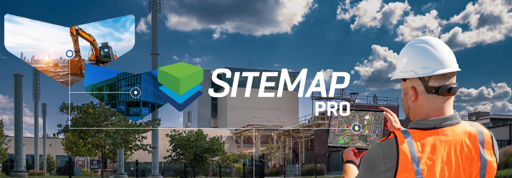
The Role of SiteMap® Project
SiteMap® Project is a tool designed to streamline the process of information upload in infrastructure development projects. It provides a platform where all relevant data can be stored, accessed, and managed efficiently. This not only saves time but also ensures that all stakeholders have access to the same, up-to-date information. Access to up-to-date information is crucial, as utility strikes remain prominent, threatening the progress and maintenance of cities everywhere. According to the 2022 DIRT Report, damages per million dollars of construction spending and damages per one thousand 811 center transmissions increased 12.35% and 9.34% respectively from 2021 to 2022. We are on a three year trajectory of rising accidents, which is simply unacceptable, and even worse, totally preventable with the use of services like GPRS and SiteMap®.
The nation’s infrastructure is important, so important that it’s a multi-billion dollar industry. This includes our roads and transportation systems. About 39% of 2022 federal transportation and infrastructure spending was for highway transportation and 28% was for rail and mass transit. The rest was for air travel (22%) and water (9%.) Without proper infrastructure data, these projects come to a halt, or they continue with incorrect data and cause utility strikes. Neither is a great option.
Promises in Infrastructure Development
Enhanced Collaboration
With SiteMap® Project, professionals can upload, access, and interact with project data in real time. This fosters collaboration as everyone can see the latest updates and contribute accordingly. Put everyone on the same page with a single source of truth that is accessible to everyone who needs it for the life of your project, 24/7 from any computer or mobile device.
Improved Efficiency
By centralizing information, SiteMap® Project eliminates the need for multiple data sources, thereby reducing confusion and improving efficiency. Strip away confusion by providing customized communication that reinforces each team member’s individual objectives with specific geographically segmented data. Print, save, or copy your SiteMap® data to communicate real-time subsurface as built information in whatever format suits your needs.
Better Decision Making
Having access to up-to-date and comprehensive information enables project managers to make informed decisions. They can track construction progress, identify issues early, and implement solutions promptly. They can also gain a greater understanding of the subsurface intricacies that lie below their feet. Sometimes, even mis-mapping that’s off by a single inch can spell disaster. GPRS has a 99.8% accuracy rating, giving your team the best chance to follow accurate subsurface data, wherever they need it, when they need it. With SiteMap® Project, you can secure your subsurface files, maps, and drawings in one centralized Digital Plan Room accessible to only those you designate through the life of your project. This allows you to safeguard the real-time accuracy of your subsurface data against unauthorized uploads or edits. When you have the right information, you make the right decisions.
Room For Improvement
The SiteMap® Team is constantly looking for ways to improve and serve those who need it most. With technology constantly in a fluid state of improvement, it’s easy to conclude that SiteMap® will continue to improve and undergo changes. With the release of Apple’s Vision Pro, it’s not completely unrealistic to visualize a future where the technologies can collide, creating a platform that can be seen in real time, superimposed over the real world. Imagine being able to look at the ground, and like the promises of X-Ray Spex in the 50s, be able to see below the concrete, the sediment, and the soil, and see the complex veins and arteries that run through our subsurface. While these plans currently do not exist with SiteMap®, it’s important to declare the innovation that SiteMap® holds and continues to stride toward day in and day out. Nobody knows for certain what the future holds, but we do know that SiteMap® will be there to help you see it.
SiteMap® Project’s promise in infrastructure development lies in its ability to simplify and enhance the process of information upload. By breaking down and layering important subsurface features, the way you interact with information is completely revolutionized. By fostering collaboration, improving efficiency, and aiding decision-making, it has the potential to significantly improve the way infrastructure projects are managed. As we continue to embrace digital transformation, tools like SiteMap® Project Level will undoubtedly play an important role in shaping the future of infrastructure development.
Are you ready to see the subsurface in a new way? Contact SiteMap® today to learn more.