SiteMap® FAQ: How Accurate Is This System, and Is Data Updated In Real Time?
In partnership with FINCH Brands, SiteMap®, powered by GPRS, conducted a large-scale survey of 110 qualified facility managers actively working within the construction industry. This study aimed to identify the major pain points for facility managers today, and the best possible solutions to address them. To collect data which would best reflect the current state of the industry, each participant’s level of experience and management responsibilities were fully vetted, ensuring they were responsible for making capital expenditure decisions for their facilities and managing one or more building projects across multiple sites.
When presented with SiteMap’s concept of a singular subsurface infrastructure mapping solution, 90% of the facility managers surveyed by FINCH, who were not currently using a cloud-based system for data storage, expressed interest in utilizing SiteMap® for their future projects. When asked to further explain which features of the platform appealed most to them, the following statistics were collected…
- 60% facility managers surveyed noted the 3D digital spatial information, i.e., mapping and modeling as a major benefit to SiteMap’s capabilities
- 55% participants expressed interest in using the underground utility & pipe inspection capabilities offered through GPRS and mapped/modeled via SiteMap®
SiteMap goes above and beyond that of any standard GIS or cloud-based platform, allowing facility managers and their teams to store, map, model, and share their facility data with ease. With SiteMap®, facility managers and their teams can communicate better than ever before, maximizing organization and safety on any project.
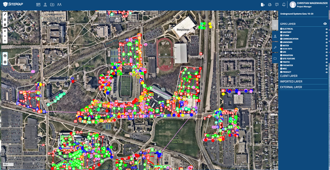
The unique capabilities of this platform is made possible through SiteMap’s two key pillars; the Map Viewer and Digital Plan Room. Within the Digital Plan Room feature, all necessary facility documents can be securely stored within this collaborative-friendly repository. All of a project’s maps, models, photos, reports, and as-built documents can be easily uploaded and shared across multiple project teams. This way, all members involved in a project can operate with the most up-to-date data files. These files can then be directly linked, cross-referenced, and fully visualized within SiteMap’s Map Viewer feature. In the Map Viewer, comprehensive 3D maps and models of the entire project site can be rendered. Data from subsurface utility and void discoveries all the way to drone and aerial imaging evaluations can be integrated together, providing 3D site visualizations which represent every aspect of the project at hand above and below ground. For this reason, the Map Viewer is especially useful for facility managers, helping them save time and money by improving overall communication across all project teams.
While SiteMap’s platform received positive responses during the survey, there were a few additional questions concerning the functionality of the product, convenience of use, and necessary maintenance. One question that was raised a few times was “How accurate is this system, is data updated in real time?” By addressing this question directly, we hope to ease any lingering concerns over SiteMap’s accuracy.
Frequently Asked SiteMap® Software Question:
“How accurate is this system, is data updated in real time?”
With a continuous influx of data to the SiteMap® platform, it is imperative that the system be capable of supporting large amounts of complex data. Within five minutes of a Project Manager uploading the file, it will be displayed within SiteMap. This keeps all data files up to date and readily available, almost from the moment the reports and models from the project site are completed.
As for the accuracy of the visualization rendered in the system, it comes down to how the data is collected and what equipment was used to evaluate the job site. These factors greatly influence how SiteMap® can support the project at hand. Generally, our GPRS location and evaluation services paired with SiteMap’s visualization capabilities can provide 3D maps and models with submeter and even millimeter accuracy.
With this said, it is important to recognize that the accuracy of these results are only as trustworthy as the as-builts they’re referencing. If, for instance, these as-builts are obtained via our state-of-the-art GPRS services, then you can be assured that any video pipe inspection data is NASSCO certified, 3D laser scanning data (even raw point cloud files) is accurate within millimeters, and concrete imaging or utility locating data collected is backed by our 99.8% success rate.
However, SiteMap® is well aware that some jobs might discover these capabilities midway through a project, and/or are operating with archival documents to support their construction project. For this reason we take a “layered” approach to integrating different sources of information. We recommend using our GPRS evaluation methodologies and their results as the “base” layer supporting the majority of the models. The additional documents can then be added in to further supplement the final visualizations. This is why SiteMap’s platform was designed for customizability from the start, aiming to support projects of any size or complexity accomplish their goals while saving time and money.
SiteMap®, powered by GPRS, is Collaboration Redefined™. By providing accurate, comprehensive, and secure methods of infrastructure management, facility managers and their teams are supported with the most reliable digital planning tools they need. These customizable mapping and modeling solutions unique to SiteMap® helps those looking to Visualize the Built WorldTM like never before. Learn more by downloading our brochure, and contacting us for a quote today!