In the realm of infrastructure management, success stories often paint the clearest picture of a service’s effectiveness. SiteMap®, the frontrunner in comprehensive infrastructure management solutions, is poised to transform various sectors with its innovative approach. Let’s delve into some compelling case studies highlighting SiteMap’s real-world impact. Powered by GPRS, SiteMap® gives you their 99.8% accuracy rating in concrete scanning & utility locating, which translates into a lot of success for a lot of different projects.
The University Of Toledo Partnership
SiteMap® is made possible by the outstanding technology of GPRS, a leader in subsurface locating technology and procedures. GPRS Project Managers go through extensive training, including OSHA 10 and OSHA 30 training. The GPRS Academy on Silica Rd. in Toledo helps to train many Project Managers every year, providing cutting-edge utility locating & mapping training, and other subsurface investigation protocols for the excellent Project Managers of tomorrow. Because hands-on experience is important, allowing Project Managers to navigate complex scenarios, GPRS was thrilled to partner with The University of Toledo (UToledo) in 2021. Doing so helped continue GPRS’ commitment to putting Project Managers in real-world field conditions.
In return for the outstanding training, GPRS provides UToledo with our 99.8% accurate scans and maps of their utilities, gas lines, state-of-the-art CCTV Video Pipe Inspection (VPI) of sewer pipes, and complete 3D scans and maps of their entire campus, above and below ground. Using our expanded 3D laser scanning services and SiteMap® pilot program, we were able to provide UToledo with comprehensive and interactive subsurface and facility infrastructure data.
GPRS spoke with Daniel Perry, The University of Toledo’s Electrical Maintenance Manager about how our partnership and campus mapping were progressing, “We’ve got a little bit of everything here, with steam, condensate [drains], water, gas. You name it, we’ve got it on site.”
Perry understood this all too well, as his position at the University of Toledo encompasses everything from electrical and telecom to life safety, building operations, and construction project management. And it is all those complex systems that make UToledo an optimal field experience for our Project Managers. It’s precisely this reason that we wove this campus into GPRS’ SIM Certification program education.
Evan Soto, GPRS Field Support Training Specialist, had this to say about the partnership. “We have this pretty unique partnership with the University of Toledo. They’re essentially letting us use the campus as a training ground so we can do different scenarios. And in the process, we’re helping them to locate and map all of their underground utilities throughout the entire campus. So, it’s really cool because we can bring each new training class out here, take them to different areas of the campus, locate, collect it with GPS, put it on a map. And eventually, The University of Toledo will have this nice built-out map.”
Although UToledo has strong reporting and updating guidelines for their facilities, they recently experienced a serious gas line strike. The University does its best to keep up-to-date drawings, as-builts, and records, which are evaluated to be about 90% accurate. However, most of this data is still on paper.
GPRS’ digital products proved to be a revelation, “[The graphics] are so much better. There’s all that detail that you can add, notes you want to add. It has further enhanced what we have… taken it to a whole new level for us,” Perry said in a recent interview.
“We’ve got the same, but yours is so much better. The definition, the detail, and all that. We don’t show all the manholes, we just show lines. We’ll show lines ending here and there. The detail that we’re being provided is so much better.”
Since the partnership program began, GPRS has been providing 99.8% accurate utility location & concrete scanning, NASSCO-certified VPI reporting, 3D laser scanning, leak detection, and mapping to UToledo, which has greatly improved their capabilities to see their entire utility infrastructure at a glance. As we expand our product offerings, UToledo will continue to receive updated maps and as-builts, providing a complete and comprehensive view of the university.
With SiteMap’s interactive digital experience, The University of Toledo will have instant access to enhanced 3D imaging and walk-throughs, actual video of plumbing and lateral pipe defects, and cross-referenced contextual materials to greatly reduce the risk of another utility strike.
Case Studies
GPRS and SiteMap® have had loads of success throughout many different industries. Here are a few of our case studies to help reflect the different challenges we face in the field every day.

Case Study 1: Team Fishel
The Challenge: Installing new power utility through directional drilling. Team Fishel had been contracted by Dominion Energy to complete installation for new power distribution utilities throughout the VA market. Public locates had not been reliable and completed onsite. The third-party locator that was being utilized was not providing adequate locates, still resulting in line strikes. Line strikes were occurring on the project, causing delays, additional expense, and damage to the residential homes on the project.
SiteMap’s Solution: National Standard – SIM Certification for GPRS Project Managers achieving 99.8% accuracy. Utilizing GPRS for private locates has helped identify unknown utilities onsite. GPRS has dedicated multiple team members to expedite response and create efficiencies.
Results: Known location of utilities identified prior to mobilizing to site through mapping capabilities, PDF, KMZ files, and a complimentary SiteMap® Personal subscription.
Project Savings – No damage to utilities, kept the project on track from design to execution phase of project. Team Fishel increased their productivity and remains in good standing with Dominion Energy for project renewals.
Safety – Keeping team safe while performing work onsite.
Case Study 2: SPI Engineering
The Challenge: To 3D laser scan a Water Treatment Plant and deliver raw point cloud data to the Engineering Firm. SPI Engineering was generating construction drawings to expand an existing Water Treatment Plant. No as-built drawings existed for the water treatment plant. The firm also needed accurate field conditions to create new layouts and plans for the facility expansion.
Further, exact dimensions were required to plan modifications and fabricate pipes. There were location discrepancies, as The engineering firm was in California, the water treatment plant was in Texas. It was important that they had accurate information digitally to begin design planning.
GPRS’ Solution: Using a Leica ScanStation, GPRS’s Project Manager completed 40 laser scans of the building to capture architectural, structural and MEP features.
The client received a colorized point cloud in ReCap (.rcp files and related supporting files) and JetStream Viewer files.
Benefits: Laser scanning is an extremely efficient and accurate way to gather data necessary to put together construction drawings of a building or space. 3D laser scanning eliminated the firm’s travel to the water treatment plant. In one day on site, enough scans were taken to create a complete colorized point cloud of the space. 3D laser scan data provided the Engineering Firm with the critical tie points on top tanks and lines, information that was crucial to the expansion.
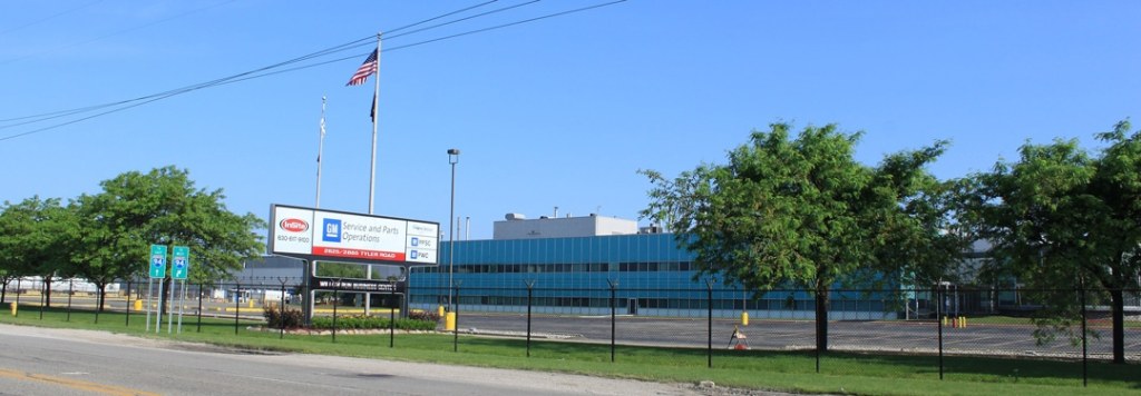
Case Study 3: In Site Real Estate (Willow Run Plant, Ypsilanti, MI)
The Challenge: To pinpoint a leak in their fire suppression system that had been leaking for close to 11 months. For close to 11 months this fire loop was losing 1 gallon per second. They had multiple jockey pumps constantly running to keep the pressure up to 150 psi.
GPRS’ Solution: Use of the Leak Noise Amplification System (DXMic/S30 listening devices), and the Leak Noise Correlator (Tri Corr Touch Correlator) to successfully pinpoint the leak. GPRS listened to every contact point (hydrant, piv, valve, meter pit, etc.) and concluded that the noise was predominately near two hydrants. We correlated to the pipe and pinpointed the leak on the sidewalk.
Benefits: The customer was able to dig only where the leak was located, instead of digging up the entire fire loop or a certain section of the pipe. Another benefit was they were able to dig down, repair the leak and not lose any more water or money.
These case studies illuminate GPRS’ diverse capabilities and their transformative impact across various sectors. SiteMap’s solutions have proven instrumental in driving efficiency, sustainability, and cost-effectiveness. In a world where effective infrastructure management is key to progress, GPRS & SiteMap’s success stories serve to showcase the tangible benefits of innovation and forward-thinking solutions.
We’d love to discuss more about what SIteMap could do for you. Contact us today to learn more.


