Archaeology and historic preservation are disciplines that require a delicate balance between modernity and tradition. As we step into an era where technology assists in unraveling the mysteries of the past, tools like SiteMap® (patent pending) backed by GPRS, become invaluable. The integration of high-accuracy subsurface mapping allows for the safe and efficient exploration of archaeological sites, ensuring that the vestiges of history are protected while accommodating the need for progress and urban development. While we have few archaeological clients, our technology is certainly used to help map sites all over the U.S.
Understanding the nuances of historical sites goes beyond mere speculation and educated guesses. With SiteMap’s ability to visualize the world around us, backed by GPRS’ impressive 99.8% accuracy in subsurface data collection, archaeologists and historians can approach their excavations with unprecedented precision—guarding both their jobsites and the invaluable historical artifacts that lay hidden beneath.
Protecting History with Precision
The protection of a historical site is crucial to discovery and preservation. A single misstep can lead to utility strikes or the damaging of unrevealed artifacts, which can not only cause project delays but also result in financial repercussions or, worse, the loss of irreplaceable historical information. GPRS and SiteMap® technology can help professionals to step in as guardians of these treasured places, providing them with the comprehensive subsurface data and easy to access visualizations that they need to navigate the complexities of their sites confidently.
The Case Study of the Württemberg-Stambol Gate in Belgrade (Serbia)
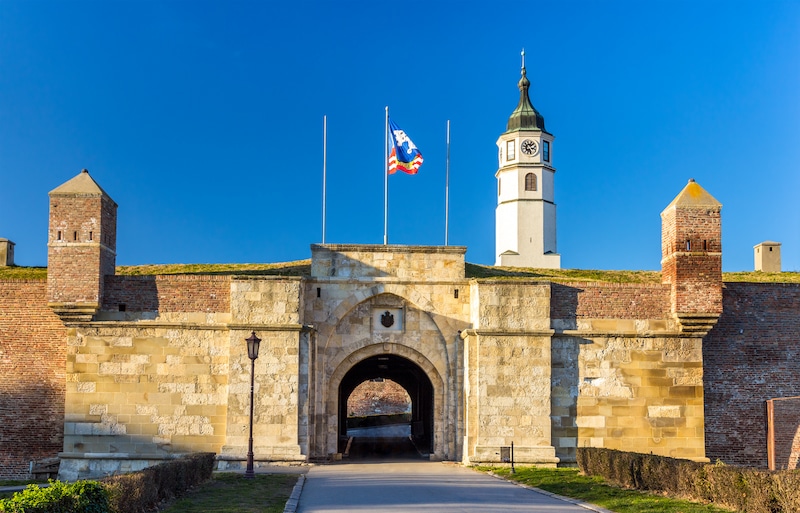
Constructed during the Austrian rule in the 18th century and was named after the city of Stuttgart in the Württemberg region of Germany and Istanbul.
One fine example of how similar technologies have helped with archaeological finds is the case of the Wurttemberg Gate, and its buried remnants. IOn this case, GPR was successfully used to reveal some of the remains of the Württemberg-Stambol Gate in the subsurface of Republic Square, in Belgrade, Serbia. GPR investigations were carefully carried out in the renovation works in the square. This process involved rearranging traffic control, expanding the pedestrian zone, renewing the surface layer, and valorising existing archaeological structures.
The study was conducted on the site after the presence of the gate remains was suggested by historical documents and information from previous restoration works. To complete this task, a pulsed radar unit was used for the survey, with antennas having 200- and 400-MHz central frequencies. Important data was recorded over a grid and two three-dimensional models were built, one for each set of antennas.
The used grid was the same for both sets of antennas, which allowed the two models to be compared. Multiple horizontal cross sections of the models were plotted, which corresponded to different depths. The images were then carefully examined and interpreted, paying particular attention to signatures that could originate from the sought archaeological structures. The result was astonishing, as reflections coming from the gate remains were identified in both models. Further, they were also found in the same region of the survey area and at the same depth; the geometry, size, and layout of the gate columns, as well as of other construction elements belonging to the gate, were determined with exceptional accuracy. The presence of the remains was confirmed, with various columns and side walls, serving to prove the efficacy of GPR in archaeological ventures.
Many other archaeological findings have since been completed using GPR, and it’s likely that this will increase as the technology improves.
How SiteMap® Can Change the Game in Archaeology
We no longer have to rely solely on traditional methods like potholing that can be invasive and sometimes destructive to gather information about an archaeological site. SiteMap® is powered by GPRS, a professional infrastructure visualization company that uses non-invasive ground penetrating radar technology to penetrate the ground and reflect images of what lies underneath without disturbing the soil. Through these radar wave reflections, called hyperbolae, experts can identify and categorize potential utilities, voids, and even recond the nuanced differences in soil types that suggest human activity—all before the first shovel hits the ground. SiteMap® usually assists universities, cities, utility and facility managers, and other professionals, but the future may hold some grand discoveries.
This same technology is what the US National Park Service is using for their archaeological studies, even in frozen conditions. The use by the National Park Service serves as a stunning example that demonstrates that GPR is effective at mapping semi-subterranean house remains in several contexts. These contexts include houses with no surface manifestation.
The National Park Service has also found that GPR technology is also shown to be effective at mapping anomalies from the skeletal remains of a late Pleistocene mammoth frozen in ice. The potential for using GPR in ice and snow patch archaeology is great. This is an area of increasing interest fueled by global environmental change exposing new artifacts and materials each year. For many scientists and archeologists, the level of detail displayed not only means that they can precisely locate potential artifacts, but also that they can avoid them if necessary which keeps the integrity of both the site and the project intact. This is important for future research and preservation, especially for sites that are especially vulnerable.
Budget Management and Timely Project Execution
In the world of historical preservation, time and budget are tediously monitored. Many of these projects operate off of grant funds, and when those funds run out, other means must be used to continue with the project. Unforeseen project delays due to strikes and damage soar project costs and can extend timelines significantly, or even completely shut down a project altogether. Utilizing technologies like SiteMap® mitigates these risks, ensuring that the project stays on track both financially and temporally. This means that archaeologists can be more aggressive with their timelines and project budgets, allowing for a more efficient allocation of resources. SiteMap® also would allow archaeologists to easily share their data on the field, which could be crucial when handling a large team with tight deadlines.
Digging Deep With SiteMap®
Real-world applications have shown that SiteMap® can be a game changer. For instance, in a city undergoing urban upgrades, SiteMap® and GPRS were used to map out a decently sized area, successfully identifying unknown utilities, stopping utility strikes, and allowing the project to continue without fault. This is one example of many that highlights the importance of proper utility location data and gis mapping. There are many things hidden beneath the soil, and it sometimes takes underground utility mapping to help make them relevant.
In the delicate dance of preserving our past while embracing the future, technology like GPRS’ SiteMap® plays an important role. It offers a bridge between what was and what could be, allowing us to protect our historical legacy with the tools of tomorrow.
By incorporating this advanced radar technology into their standard excavation practices, archaeologists and preservationists can not only protect their job sites and reputation but can also do their part in ensuring that history’s physical witnesses remain untouched for future generations.
The stories of our ancestors and the lives they lived deserve to be told with respect and precision. The future can hold great things for SiteMap® and GPRS, who are here to help you discover the undiscoverable.
Are you looking for non-destructive GPR services? Are you looking for advanced utility mapping? Contact SiteMap® today.