Meta has enlisted longtime GPRS safety partners Turner Construction, DPR Construction, and M.A. Mortensen Company to construct a 4-million-square-foot data center campus in Richland Parish, Louisiana.
The development marks Meta’s largest investment in artificial intelligence (AI) to date, according to a company press release.
“Once completed, the Richland Parish Data Center will reflect a total investment of over $10 billion in Louisiana and will support more than 500 operational jobs,” the statement reads. “We’re also dedicating over $200 million to local infrastructure upgrades. At peak construction, over 5,000 workers will be on-site, with a strong emphasis on hiring local labor and sourcing materials locally. In addition, we aim to contribute directly to the community in a meaningful way. Job postings for the data center will be available on the Meta Careers page in the coming weeks.”
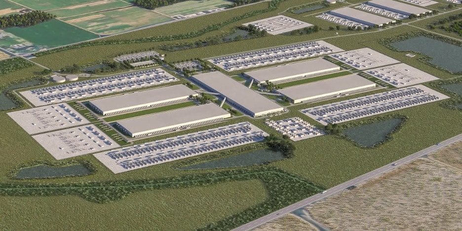
Meta’s planned Richland Parish Data Center project is the tech giant’s largest artificial intelligence (AI) investment to date.
Meta highlighted Richland Parish’s “excellent infrastructure access, reliable power grid, business-friendly climate, and supportive community partners” as the main factors for selecting the location for its new campus.
Richland Parish, a rural farming community founded in 1868 in northeast Louisiana, spans 576 square miles and is known for its network of rivers, creeks, and bayous.
“We’re excited to join the Richland Parish community and are committed to supporting its long-term well-being,” Meta stated in its release.
As part of its commitment to the local community, Meta plans to launch its Community Action Grants program after the data center becomes operational. The program will support local schools and organizations with technology-driven resources aimed at enhancing STEAM education and community development. Meta also intends to offer free digital skills training to support the growth of small businesses and nonprofits throughout Louisiana.
In addition, Meta will contribute $1 million annually to Entergy’s customer assistance program, which provides utility bill relief to low-income seniors and customers with disabilities.
“We’ve worked closely with Entergy from the start to plan for our energy needs,” the company noted. “To meet those needs, we’re adding enough clean, renewable energy to the grid to offset 100% of the data center’s electricity consumption.”
According to the release, Meta will bring at least 1,500 megawatts of new renewable energy to the power grid.
The Rise of Data Center Construction in the U.S.
The demand for data center construction in the U.S. has surged since the COVID-19 pandemic, driven by increased online shopping and the resulting expansion of data processing capabilities by companies like Amazon and Walmart.
As of March 2024, there were 5,381 data centers operating in the United States – by far the most data centers in any country in the world.
GPRS: Supporting Safe, Efficient Construction
GPRS delivers a comprehensive array of services for subsurface damage prevention, existing condition documentation, and management of construction and facility projects, ensuring that initiatives like data center builds remain on schedule, within budget, and safe.
Our offerings in concrete scanning, utility locating, video pipe inspection, and leak detection help prevent subsurface damage during excavation, or when drilling or slicing through concrete. Leveraging cutting-edge tools like ground penetrating radar (GPR), electromagnetic (EM) locating, and remote-operated sewer pipe inspection rovers, our SIM and NASSCO-certified Project Managers (PMs) equip you with an in-depth view of your site’s subsurface structures.
For a clear depiction of above-ground conditions and to document our PMs’ findings in utility locating and concrete scanning, our 3D laser scanning and photogrammetry services deliver 2-4 mm-accurate data useful for both project design and future operation and maintenance (O&M) tasks. And our in-house Mapping & Modeling Department can tailor this data into any required format and software.
With SiteMap® (patent pending), GPRS’s cloud-based application for project and facility management, you have around-the-clock access to all this field-verified data, enhancing the protection of your assets and personnel.
SiteMap® enables seamless collaboration, allowing you and your team to securely access and share crucial data anytime and from anywhere, using any computer, tablet, or mobile device.
GPRS’ SiteMap® team members are currently scheduling live SiteMap® demos. Click below to schedule yours and see how SiteMap® can help you plan, design, manage, dig, and build better today!
Frequently Asked Questions
What are the Benefits of Underground Utility Mapping
Having an updated and accurate map of your subsurface infrastructure reduces accidents, budget overruns, change orders, and project downtime caused by dangerous and costly subsurface damage.
How does SiteMap® assist with Utility Mapping?
SiteMap®, powered by GPRS, is the industry-leading infrastructure management program. It is a single source of truth, housing the 99.8%+ accurate utility locating, concrete scanning, video pipe inspection, leak detection, and 3D laser scanning data our Project Managers collect on your job site. And the best part is you get a complimentary SiteMap® Personal Subscription when GPRS performs a utility locate for you.
Does SiteMap® Work with my Existing GIS Platform?
SiteMap® allows for exporting of data to SHP, GeoJSON, GeoPackage, and DXF directly from any user’s account that either owns or has a job shared to their account. All these file formats can be imported and utilized by other GIS packages if manually imported by the user. More information can be found at SiteMap.com.