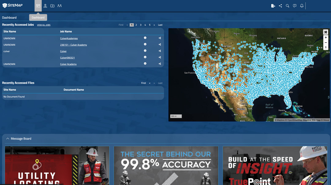
SiteMap®, powered by GPRS, aims to empower facility managers and their teams as they pivot to completely paperless, centralized methods of data storage with industry leading infrastructure management software capabilities.
The move towards paperless forms of working has been seen across a range of professional industries, and the construction industry is no exception. As reported by Construction Dive, “moving from paper to digital… has created administrative efficiencies and provided better insight into actual project performance,” across the construction industry.
Additionally, in recent research conducted by FINCH Brands, a major pain point reported by a majority of facility managers is that there are too many files stored in various locations. With some data saved as hard copies and some as digital files, all in multiple locations, the process of project planning can feel daunting to any construction team. In fact, 62% of facility managers expressed that they are frustrated by the fact that they “have to look in many places to find subsurface utility information before breaking ground.”
These obsolete and disorganized storage methods can be cumbersome and confusing, leading to miscommunication across teams as they are left to constantly re-referencing and aimlessly searching for important documents in separate files. Not only can inefficient filing processes waste an immense amount of time, the resulting miscommunication can jeopardize the safety of a project. If proper access to the most recent data is not provided, a project can lose thousands in funds in damages in, for instance, accidental utility strikes from relying on inaccurate and/or outdated records.
SiteMap®, powered by GPRS, aims to empower facility managers and their teams as they pivot to completely paperless, centralized methods of data storage with industry leading infrastructure management software capabilities. By avoiding the rough guesswork of slow, inaccurate data storage systems, SiteMap® provides on-demand, virtual access to fully view every square inch of any project site. Regardless of size and complexity, these advanced digital tools help to fully visualize an entire job site’s infrastructure above and below ground. With SiteMap®, the Digital Plan Room provides a central repository for all necessary facility maps, models, photos, reports, and other necessary as-built documentation. These uploaded files can then be directly linked, cross-referenced, and fully visualized using the Map Viewer. This modern platform technology comprehensively models the following layers of every site and exactly how they relate to each other spatially…
- Drone & Aerial Imagery
- 3D Digital Spatial Information
- Concrete Slab Components & Thickness
- Underground Utility & Pipe Inspection Data
- Underground Storage Tank Information (UST)
- Subsurface Void Information
Moreover, SiteMap’s innovative digital tools support lean, streamlined, and collaborative techniques to facility management. Lean Construction is a process of project delivery and execution which relies on “emphasizing collaboration between teams on a project,” with a key goal of increasing “productivity, profits, and innovation in the industry.” For facility managers, this further alleviates the stress of miscommunication as all project teams are encouraged to collaborate and constantly communicate needs and new information with each other. SiteMap’s collaborative mapping, modeling, and easily accessible data storage technologies provide customers looking to Visualize The Built World™ with a powerful, all-in-one service to maximize their project’s success.
Ready to redefine collaboration? Learn how SiteMap®, powered by GPRS, can provide complete facility visualization and a unique tool to help you collaborate better by downloading our brochures, and contacting us for a quote today!
