Utility Mapping for Northeast Power Line Expansion: 5.4 Miles of Critical Subsurface Data Delivered via SiteMap® Software
To support the installation of new power lines across several municipalities in the Northeastern U.S., a local contractor required accurate utility mapping along a 5.4-mile roadway corridor. The objective was clear: avoid utility strikes that could result in traffic disruptions, service outages, and significant liability.
GPRS Project Managers Michael Layon and Zachary Boebel partnered with the contractor to execute a comprehensive utility locate across multiple jurisdictions. The team worked in variable traffic conditions, conducting scans during both day and night shifts to maintain safety and operational continuity.
“While scanning, I realized I was seeing double everything,” said Zachary Boebel, Project Manager at GPRS.

Layon (Left) and Boebel (Right).
The assignment posed unique challenges. Utility locates on active roadways require elevated safety protocols compared to traditional construction sites. Public exposure increases the risk of accidents – open manholes, live traffic, and pedestrian interference require strategic mitigation.
GPRS worked both day and night to provide utility mapping services of a roadway spanning 5.4 miles.
“Someone, either a vehicle or pedestrian, will end up in your work area,” Boebel noted.
To control the environment, GPRS implemented safety solutions including manhole protection systems, strategic barricades, and coordination with local law enforcement to establish controlled traffic zones. These measures ensured both public and team safety throughout the scan.
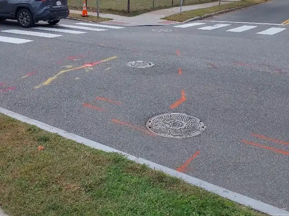
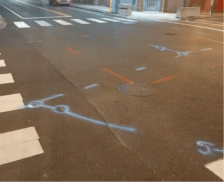
GPRS utility markings of gas/oil, phone & cable, and electric. Each manhole was carefully inspected.
From a technical perspective, GPRS applied a multi-layered subsurface mapping approach. Ground penetrating radar (GPR) served as the primary scanning technology, detecting utilities such as electric, water, gas, storm, and telecom lines. This was supported by electromagnetic (EM) locating to detect signals from energized lines and trace metallic utilities using connected risers or tracer wires.
“We used every single tool at our disposal from ground-penetrating radar to the electromagnetic locator,” added Boebel.
Multiple manholes were opened and carefully inspected, including stormwater, electrical, and sewer access points. These inspections validated surface findings and clarified complex subsurface utility layouts.
During the process, Boebel uncovered both new and legacy infrastructure in one area affected by prior storm damage.
“A few years ago, a powerful tornado had flattened an entire street. And now, new houses had been built on the same property,” said Boebel. “While scanning, I realized I was seeing double everything. That’s because they had left all those old utilities, alongside new ones going to these buildings.”
Distinguishing outdated infrastructure from active systems was essential. GPRS maintained accurate utility records throughout the process, helping the contractor avoid false positives and ensure safe excavation planning.
Though the original scope called for curb-to-curb scanning, the contractor requested an extension beyond the sidewalks into grassy areas. To maintain full utility traceability to their sources, GPRS expanded its scans an additional five to six feet outside the right-of-way where necessary.
“The customer did not have to deal with the obstacles we ran into because we took care of them,” said Layon. “We made sure we had the right team on site at the right time, allowing the customer to complete their project within the expected timeframe.”
All collected utility data – 5.4 miles of verified subsurface records – was uploaded into SiteMap®. SiteMap® delivers a centralized, cloud-based solution where contractors and facility managers can view, share, and manage layered utility maps and supporting documentation anytime, from anywhere.
Deliverables Powered by SiteMap® Software
GPRS clients receive both field-level and digital deliverables:
- On-site markings using paint, flags, and stakes
- Digital utility records stored in SiteMap®
- Downloadable PDF and KMZ files for documentation
- Optional 2D and 3D CAD files for project planning and as-built updates
SiteMap® provides an interactive software interface that simplifies utility data access, improves decision-making, and ensures a single source of truth for subsurface conditions across a site.
Why Interactive Utility Mapping Matters
Each year, 400,000–500,000 utility strikes occur in the U.S. Accurate and up-to-date utility records are a foundational part of risk reduction and compliance.
By combining GPR, EM locating, and real-time data sharing through interactive software solutions like SiteMap®, GPRS helps teams:
- Avoid costly utility strikes
- Access visual records of underground infrastructure
- Plan and execute construction with confidence
- Ensure compliance with federal and local regulations
Whether your team is preparing for directional boring, facility upgrades, or infrastructure expansion, SiteMap® provides a secure, centralized platform to store and access your utility records. Ensuring your project remains safe, efficient, and compliant.
Click below to schedule your live, personal SiteMap® demo today!