Each year, around 1 million people die from lead poisoning. Sadly, millions more, many of them children, suffer from low-level lead exposure. These low levels can cause lifelong health problems, including anemia, hypertension, immunotoxicity, and reproductive issues. The effects of lead exposure can be irreparable, making it a primary goal of city, state, and federal governments to mitigate the risk.
Despite advances in water treatment and infrastructure, lead water service lines, lead paint, and lead dust still pose significant public health risks. With an estimated nine million lead pipelines still in use across the country, water utility companies are now increasingly seeking help from citizens to identify and address these hazards. This collaborative effort, combined with innovative technologies such as subsurface utility mapping provided by SiteMap® (patent pending), powered by GPRS, can play a crucial role in reducing the dangers posed by lead pipes.

The Scope of the Problem
The use of lead in pipes and materials like paint was once common. However, in 1986, Congress amended the Safe Drinking Water Act to prohibit the use of pipes that were not “lead free” in public water systems or plumbing that supplies water for human consumption.
At the time, “lead free” was defined as solder and flux with no more than 0.2% lead and pipes with no more than 8%. Despite this crucial ban, many older homes and neighborhoods still rely on these outdated, hazardous pipes, which can leach lead into the water supply. Lead exposure is especially harmful to children, causing developmental issues, lower IQ, and behavioral problems. For adults, long-term exposure can lead to hypertension, mental illness, kidney damage, and reproductive issues. There is no safe level of exposure to lead.
The Safe Drinking Water Act authorizes the EPA to establish regulations for public water systems, which created the Lead and Copper Rule in 1991, meant to reduce exposure to lead in drinking water. This rule was revised in 2021, offering more detailed and stringent requirements. UNICEF has estimated that 1 in 3 children, with up to 800 million children globally have shown blood lead levels at or above 5 µg/dl. Because of this, it’s recommended that immediate global action is needed to address this problem. Lead is toxic to multiple body systems, including the central nervous system and brain, but also the reproductive system, kidneys, the cardiovascular system, the blood, and even the immune system. WHO estimates that lead is responsible for 30% of idiopathic intellectual disability, 4.6% of cardiovascular disease and 3% of chronic kidney diseases.
A study conducted by VOX and the Washington State Department of Health identified two main factors contributing to lead exposure risk: the age of homes and poverty. The study published a map showing risk levels across the U.S. on a scale from 1 to 10, with corresponding colors. It revealed that cities and metropolitan areas tend to have the highest levels of lead exposure risk. For instance, in places like New York and Chicago, one in five census tracts—geographic areas with typically between 1,200 and 8,000 people—have very high risks of lead exposure.
In a younger city like Los Angeles, the risks are smaller but still present; 12% of census tracts there have risk scores of 10. Despite the clear issue of lead exposure, cities and states aren’t required to report data on how many children have lead poisoning, nor are they required to test all children for exposure. This lack of testing poses another problem, as states that conduct very little testing might report very few cases of lead poisoning, creating a false sense of safety due to insufficient data.
Lead exposure risk is greatest in urban areas and less common in Western states. Regions with lower risks, such as Nevada, Arizona, or Colorado, typically have more than 25% of areas with a lead risk score of 1. Southern states like Florida and Texas also have more than 15% of their census tracts with a lead risk score of 1. On average, 8% of census tracts in a state have a high risk of lead exposure. However, four states—Rhode Island, New York, Ohio, and Pennsylvania—stand out as particularly problematic, with more than 20% of their census tracts having a lead exposure risk of 10. Of the 7,224 census tracts with the highest possible risk score of 10, 92% are in urban areas. In New York and Chicago, about 20% of census tracts also have the highest risk score.
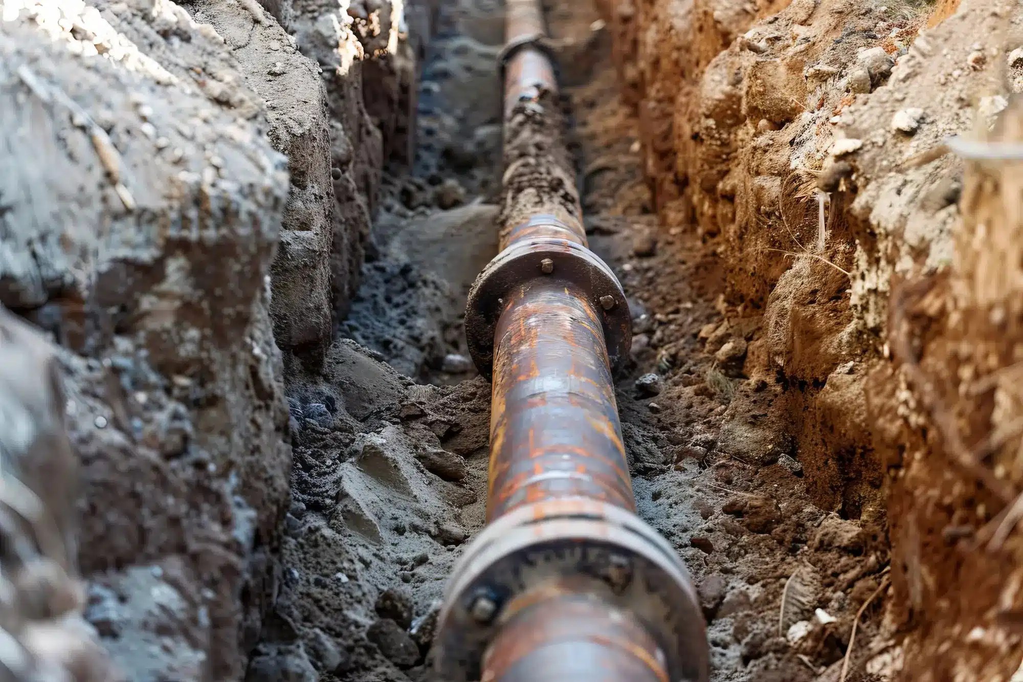
There are approximately nine million lead pipelines in the U.S., often difficult to locate and replace due to their age, complex underground infrastructure, and incomplete historical records. While every state has at least a few thousand lead pipes, two states stand out for their elevated estimated numbers. Florida leads the nation with an estimated 1.16 million lead pipes, accounting for 12.62% of the country’s total. Illinois comes in second with a little over 1 million pipes.
In 2021, the Biden administration announced it would allocate $15 billion from the Bipartisan Infrastructure Law to replace all lead water pipes in the country within the next decade. According to data from the White House, as many as 10 million homes still rely on lead service pipes, and 400,000 schools and childcare facilities are also at risk of exposure. The administration has also allocated $6.5 billion to states for drinking water infrastructure upgrades, with nearly $3 billion specifically for “lead service line identification and replacement.” Florida will receive more than $376 million, and Illinois will receive $332 million due to their high numbers of lead pipes. This is a significant step towards addressing a widespread public health issue.
Before these pipes can be replaced, they must first be located. This task wouldn’t be possible without the services and technology provided by companies like GPRS. Through SiteMap®, lead pipe locations, inventories, and other subsurface components are easily identifiable, shown through accessible, aggregated, and annotated maps.
The Role of Citizens in Identifying Lead Pipes
In an unexpected turn of events, water utility companies are now encouraging homeowners and residents to participate in identifying and testing for lead in their water supply. This grassroots effort is different, but is also essential for several reasons:
Access to Private Property: Utility companies often have limited access to private properties where many lead service lines are located. By involving citizens, utilities can gather crucial information about the presence of lead pipes on private land.
Historical Knowledge: Long-term residents may have valuable knowledge about the history of their property and its plumbing, providing insights that utility records might not capture. However, historical knowledge should never be taken as the be all-end all. It’s always recommended that a utility locating company, such as GPRS, is hired to properly locate and map all utilities. Doing so ensures that lead service lines will be reported, and eventually replaced, with minimal issue or damages.
Cost Efficiency: Engaging citizens in the identification process can reduce the financial burden on utility companies, allowing resources to be allocated more effectively toward pipe replacement. This is only true in some cases, and as mentioned above, it’s always recommended that a professional confirm before any digging is started.
To facilitate this process, utility companies are providing resources such as testing kits, instructional materials, and online reporting tools. By empowering citizens with the tools and knowledge to identify lead pipes, we can begin to understand the depth of lead service lines, prioritizing areas for further identification and eventual replacement.
Within the municipal water system industry, Lead Service Line Inventories must be completed and submitted to the EPA in October, 2024 for communities of 50,000 or more. So, in addition to resident-self reporting, municipal water managers will need to hire the services of a professional utility locating company near them to locate and map their water systems.
That’s where GPRS and SiteMap® (patent pending) come in. Our 99.8% accurate utility locating services and industry-leading, interactive digital subsurface infrastructure maps provide municipal managers with the tools they need to track their systems, and their lead service line replacement efforts.
Ground Penetrating Radar (GPR) and Subsurface Utility Mapping
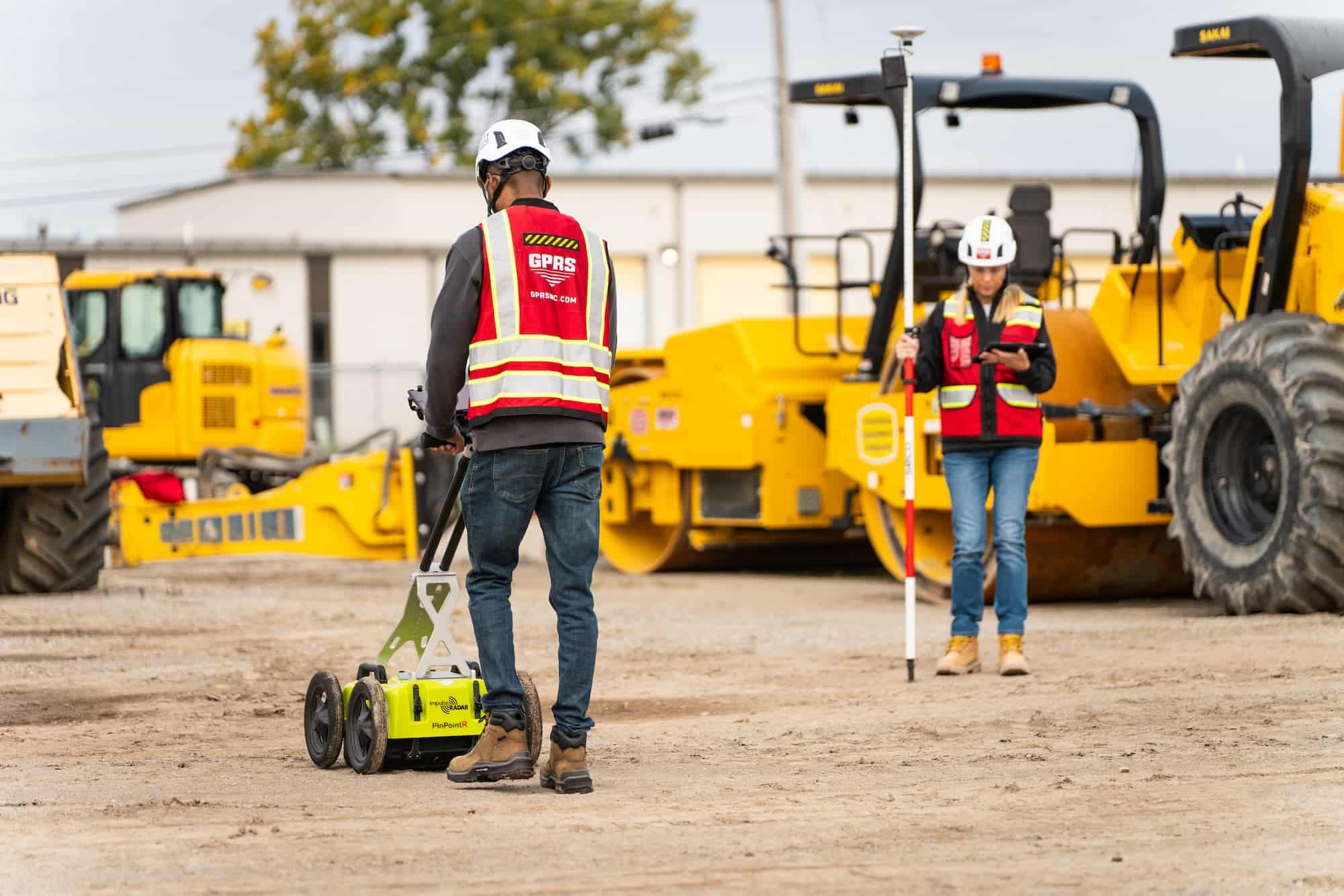
While citizen involvement is crucial, advanced technologies like ground-penetrating radar (GPR) and subsurface utility mapping are key to addressing the issue of lead pipes. These technologies enhance the accuracy and efficiency of locating and identifying lead pipes, even in challenging environments.
Ground Penetrating Radar (GPR)
GPR is a non-invasive technology that uses electromagnetic waves to detect and map subsurface structures. It is particularly useful for identifying buried pipes, including lead service lines, without the need for extensive excavation. Here’s how GPR aids in the fight against lead contamination:
Accurate Detection: GPR can precisely locate lead pipes beneath the ground, even in densely populated urban areas with complex underground infrastructure. GPRS boasts a 99.8% accuracy rating across more than 500,000 utility locating and concrete scanning jobs nationwide, demonstrating that our equipment, training, and methodology consistently deliver high-quality results. All 500+ GPRS Project Managers utilize the industry-leading Subsurface Investigation Methodology (SIM) for utility mapping, concrete scanning, sewer camera inspection, or 3D laser scanning.
Minimal Disruption: As a non-invasive technology, GPR causes minimal disruption to the environment and daily activities, making it a cost-effective and efficient tool for large-scale surveys.
Comprehensive Data: GPRS provides detailed data on the depth and condition of pipes, as well as other utilities, helping utility companies prioritize replacements based on the severity of risk.
See the Subsurface: SiteMap® is GPRS’s project and facility infrastructure management application that provides accurate documentation of existing conditions to protect your assets and people. Every GPRS customer receives a complimentary SiteMap® Personal subscription, allowing access to layered, geolocated, and annotated construction and facility infrastructure data from anywhere, at any time, via the SiteMap® Mobile App.
Subsurface Utility Mapping
Subsurface utility mapping involves creating detailed maps of underground utilities, including water, gas, and electrical lines. This mapping is essential for planning and executing pipe replacement projects safely and efficiently. Here’s how subsurface utility mapping contributes to solving the lead pipe problem:
Enhanced Planning: Accurate maps of underground utilities allow for better planning and coordination of pipe replacement projects, reducing the risk of damaging other infrastructure. SiteMap® allows you to protect your jobsite, your team, your budget, and your reputation with GPRS’ 99.8% accurate subsurface data to prevent utility strikes and damages that could derail your timeline.
Improved Safety: By knowing the exact location of all subsurface utilities, workers can avoid accidents and ensure that replacements are conducted safely. Every 60 seconds there’s a utility strike in the US, GPRS can help prevent this.
Cost Savings: Efficient mapping reduces the need for exploratory digging and minimizes the chances of costly mistakes, making the replacement process more economical.
The Collaborative Approach: A Path to Success
Combining the efforts of citizens with advanced technologies like GPR and subsurface utility mapping creates a powerful strategy for addressing lead contamination. This collaborative approach offers several benefits:
Comprehensive Identification: By leveraging citizen participation and advanced technology, utility companies can create a completer and more accurate inventory of lead service lines.
Prioritization: Detailed data allows utilities to prioritize replacements based on risk factors, such as the concentration of lead, the age of the pipes, and the vulnerability of the population served.
Community Engagement: Involving citizens fosters a sense of community and shared responsibility, leading to greater public awareness and support for water safety initiatives.
Resource Optimization: Combining grassroots efforts with technological tools optimizes the use of financial and human resources, making the replacement process more efficient and effective.
The Future of Lead Pipe Replacement
The collaborative approach of engaging citizens and utilizing advanced technologies offers a promising path forward. However, several key steps are necessary to ensure the success of these initiatives:
Public Education and Outreach
Educating the public about the dangers of lead pipes and the importance of testing and reporting is crucial for municipalities to receive reliable data. Utility companies can invest in comprehensive outreach programs that provide clear information on how citizens can help identify lead pipes. This includes distributing testing kits, creating instructional videos, and setting up dedicated hotlines for reporting and inquiries. Additionally, companies might consider subsidizing costs for those who contract professional services like GPRS.
Government Support and Funding
Addressing the widespread issue of lead contamination requires substantial financial investment. Federal, state, and local governments must provide adequate funding to support pipe replacement projects and the deployment of advanced technologies like GPR. Policy frameworks should encourage collaboration between utility companies and citizens. While the Biden administration has taken initial steps, more needs to be done.
Continued Technological Advancements
Ongoing research and development in subsurface utility mapping and GPR technology will further enhance the ability to detect and replace lead pipes efficiently. Investing in these advancements will ensure that utility companies have access to the most effective tools available.
Building Strong Partnerships
Collaboration between utility companies, government agencies, academic institutions, and community organizations is essential for the success of lead pipe replacement initiatives. By building strong partnerships, stakeholders can share knowledge, resources, and best practices, creating a unified front against lead contamination.
The presence of lead pipes in the U.S. water supply is a significant public health issue requiring immediate and sustained action. By combining the efforts of water utility companies, citizens, and advanced technologies like ground-penetrating radar and subsurface utility mapping, we can effectively identify and replace lead service lines, ensuring safer drinking water for all. Water is essential for everyone and everything, with lead threatening the very fabric of life. GPRS and SiteMap® are committed to 100% subsurface damage prevention, including addressing lead piping and associated issues. By leveraging advanced technology, communities can ensure that water flows freely and lead-free.
GPRS can help municipal water managers map and inventory their lead service lines for reporting and replacement needs. Click below to request a quote or schedule service today.