As technology advances, so does the demand for safe and efficient excavation practices. Hitting an underground utility line can cause significant damage, injuries, and even fatalities. Repairing underground utilities can be costly and delay construction projects. This affects both timelines and budgets. So, it is a must to use advanced techniques and tools for locating underground utilities with great precision. The implementation of safe excavation practices and accurate locating techniques can ensure that construction projects are safe, on time, and on budget.
This is where SiteMap® comes in. SiteMap®, powered by GPRS, offers a user-friendly solution for underground utility mapping. This makes it easier than ever to locate subsurface utilities and read utility markings. SiteMap’s utility mapping services locate and map out subsurface utilities. These include gas and water lines, communication and electrical cables, and more. This helps avoid any potential damages during excavation work.
What is Underground Utility Mapping?
Underground utility mapping is the process of creating a map of the subsurface utilities. The goal of underground utility mapping is to locate and identify utilities with a high level of accuracy. Accuracy is key to a job well done while avoiding any potential issues.
Underground utility mapping is a critical aspect of any excavation work. Failing to locate and map out subsurface utilities can result in costly damages and even pose a risk to public safety.
One of the benefits of using SiteMap’s layered utility mapping data is its accuracy. SiteMap® can provide detailed and precise information every time on every project. And it provides this information on an easy-to-use platform. SiteMap® can provide not only the location of utilities, but also their depth and size. This is essential information for any project.
How to Locate Underground Utilities
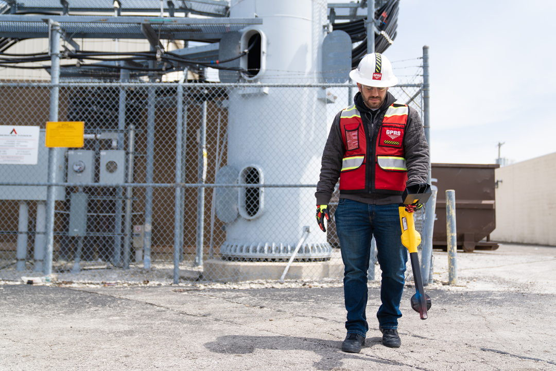
One of the benefits of SiteMap® is its ability to locate hard-to-find subsurface features. This information helps contractors and engineers see potential accidents before they occur. By using GPRS and SiteMap® you are gaining access to state-of-the-art technology. This technology can locate underground utilities with ease and precision.
SiteMap® offers specialized equipment and trained personnel. This combination provides accurate and reliable data time and again. This data is then used to create detailed maps and diagrams of the utilities in a specific area. SiteMap gives you the ability to provide everyone working on the project exactly the maps/layers they need to see in real time. This ensures safe excavation and construction work.
SiteMap® compiles all the data collected with the use of advanced equipment such as ground penetrating radar (GPR) and electromagnetic locators. This technology, paired with the industry-leading SIM (Subsurface Investigation Methodology) is how GPRS locates subsurface utilities with 99.8%. SiteMap provides detailed data with precise mapping and identification of potential hazards. This all adds up to reducing the risk of costly damages and ensuring the safety of their workers and the public.
SiteMap® is an efficient interface for your entire project from start to finish. SiteMap® allows users to view maps and diagrams on their mobile devices. This makes it easy to access critical information on the go. The user interface intuitive and easy to use, making it the go-to resource for all your project needs.
How to Read Utility Markings
When it comes to excavation and construction work, understanding how to read utility markings is crucial for a job well done. Inaccurate or incomplete information about subsurface utilities can lead to delays, change orders, and damage. Inaccuracies can also lead to safety hazards and costly repairs. SiteMap® provides an innovative app that will get everyone on the same page with subsurface utilities for a site.
With SiteMap® provides up-to-date information on your job site and all the necessary markings, allowing users to identify and interpret the location of underground utilities. This information is essential for safe excavation and construction work. It helps prevent accidental damage to critical infrastructure such as gas, water, and electrical lines. SiteMap is straightforward, ensuring that all team members you designate can access and understand the information provided.
Also, SiteMap provides detailed information on the meaning of different symbols and markings. This makes it a valuable resource even for those who have no prior knowledge or training. The platform offers information on the name of the utility company, the type of utility, and any extra markings, like previous locates and depths. . This ensures that all team members are in the know and empowered to make informed decisions about excavation and construction work.
Subsurface Utility Location
Subsurface utility location is the process of locating and mapping out subsurface utilities. The process of subsurface utility location involves using GPR and electromagnetic locators. GPR is a non-invasive technique that uses radar waves to detect changes in the ground. Electromagnetic locators use radio waves to locate the presence and depth. These methods are effective for locating subsurface utilities. Their resulting data allows SiteMap® to create detailed maps and diagrams in a specific area.
Subsurface utility location is an important aspect of construction and excavation work. By locating and mapping out subsurface utilities, contractors and engineers can avoid costly damages and ensure the safety of their workers and the public. The use of this specialized equipment and technology will completely reimagine your construction and excavation work.
SiteMap’s User-Friendly Solution
SiteMap® offers a user-friendly solution for underground utility mapping. With their unique features, they can locate and map out subsurface utilities to create a map of underground utilities. This map can identify the location and depth of subsurface utilities to avoid any potential damages during excavation work.
SiteMap® also offers an underground utility mapping app. This app allows users easy access to maps of underground utilities from their mobile devices. This makes it easy to reference when on the job site. Locating and mapping out underground utilities is essential for safe and efficient excavation work. SiteMap® offers a streamlined solution for underground utility mapping. They are making it easier than ever to locate subsurface utilities and read utility markings. With its utility mapping services and underground utility mapping app, SiteMap® is leading the way in safe and efficient excavation practices.
Contact your GPRS Business Development Manager to learn how you can receive a complimentary SiteMap® Personal subscription, or click here to schedule your service.