Supply chain disruptions coupled with a labor shortage have challenged the construction industry in recent years. While the lack of skilled construction labor will take time to remedy, the delays, cost overruns, and inefficiencies caused by supply chain interruptions may be mitigated by adopting a Design-Build strategy. Adding comprehensive existing conditions data management and GIS platforms like SiteMap® can help GCs and developers maintain project timelines and ensure accurate, up-to-date information is available to all stakeholders.
The Role of Accurate Existing Conditions Documentation
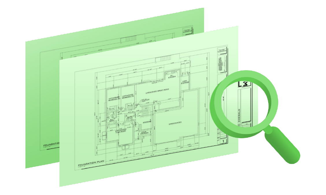
In the construction industry, precise documentation of existing conditions (aka, as-builts) is the cornerstone of project success. Because planning, designing, and excavating before you know what you’re building on causes billions in underground utility strikes, clashes, reworks, and other damages that set workflows back and budgets soaring. Capturing and maintaining accurate site documentation includes detailed information like the location of utilities, other subsurface facility infrastructure, and any other relevant site conditions.
Traditional methods of documentation often fall short in providing the level of accuracy and accessibility needed in today’s fast-paced and lean-running construction environment. Data management platforms like SiteMap® offer a robust solution that gives you comprehensive drawings, maps, and models of your jobsite, and the secure storage, and the easy access and analysis of site data. This capability is particularly important in design-build projects, where the integration of design and construction phases demands precise and reliable information shared among all parties.
Utility Mapping: A Crucial Aspect of Site Preparation
Utility mapping is a critical aspect of pre-construction, especially in a sped-up design-build strategy where one general contractor is responsible for both design and construction. Capturing and documenting the exact location of underground utilities can prevent accidents, avoid project delays, and reduce the risk of costly damage to existing infrastructure. Traditional methods of utility mapping often involve a combination of outdated public records, manual surveys, and the federally mandated location of public utilities, all of which can lead to inaccuracies.
Modern technology provides more accurate and efficient methods of utility mapping. Ground Penetrating Radar (GPR), for example, is a non-invasive technique that can accurately locate subsurface utilities without the need for excavation. When this data is integrated into a platform like SiteMap®, it becomes accessible to all project stakeholders, ensuring that everyone is working from the same accurate information, whether they’re on site, or across the country.
The Importance of Data Storage and Accessibility
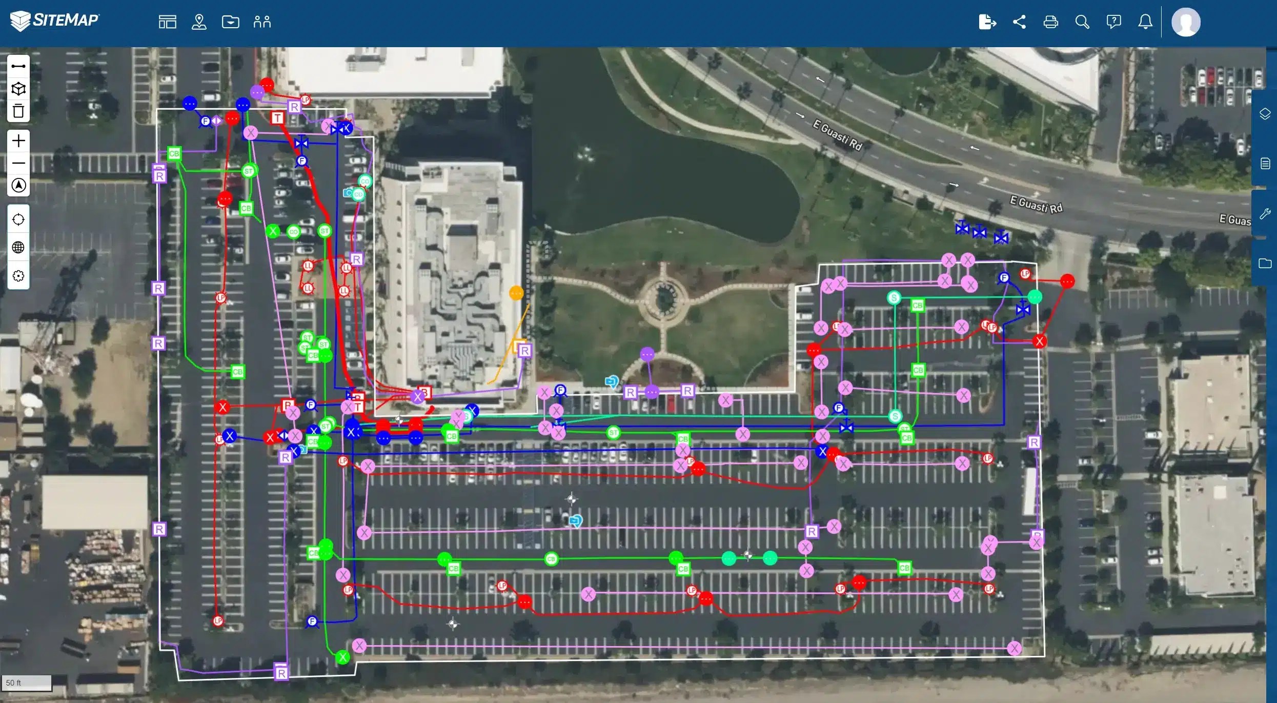
One of the most significant advantages of using a platform like SiteMap® is the ability to store and access large volumes of data efficiently. The ability to quickly retrieve and analyze data can be the difference between a large construction project staying on track or falling behind schedule. SiteMap’s map viewer and digital plan room centralize all your GPRS-collected site data in one place, making it easy for project managers, construction supervisors, architects, engineers, and other stakeholders to access the information they need when they need it.
Data stored in SiteMap® is both easily accessible and highly reliable because it is provided by GPRS. The company maintains a 99.8% accuracy rate in utility locating and concrete scanning, and provides 2-6mm accurate drawings, maps, and models of structural project components. The cloud-based software platform and mobile SiteMap® application allow for regular updates and modifications, ensuring that the information is always current. Accurate as-builts and construction progress documentation are particularly important in design-build projects, where changes in design or materials need to be quickly communicated and implemented across all phases of the project.
Enhancing Collaboration and Decision-Making
The integration of accurate existing conditions, construction progress documentation, and utility mapping into a centralized GIS platform also enhances collaboration among project teams. In the design-build model, where one GC or developer is responsible for both design and construction, effective communication and coordination are crucial to maintain your schedule, budget, and reputation. SiteMap® helps you build better by providing a shared platform where all project data is stored and updated in real time.
Real-time access to accurate project data allows for more informed decision-making. If an issue arises during construction, project teams can quickly refer to the most current site data and make necessary adjustments. The ability to respond to challenges in real-time can significantly reduce the risk of delays and keep the project on schedule.
Mitigating Risk with Advanced Technology
Risk management is a critical component of any construction project, and accurate documentation and utility mapping are key to mitigating potential risks. By providing a comprehensive and accurate picture of the jobsite, digital documentation tools help project teams identify and address potential issues before they become problems.
Advanced technologies like GPR and 3D laser scanning, combined with the powerful data management capabilities of SiteMap®, offer a level of precision and reliability that traditional methods cannot match. These technologies allow for the accurate mapping of subsurface conditions, the documentation of existing site conditions, and the integration of this data into a centralized platform that is accessible to all project stakeholders.
The challenges posed by supply chain disruptions, the ongoing labor shortage, and other unforeseen issues require innovative solutions. Accurate existing conditions documentation and utility mapping, when integrated into a robust GIS platform like SiteMap®, provide powerful tools for keeping projects on time, on budget, and safe. By ensuring that all project stakeholders have access to accurate and up-to-date information, SiteMap® enhances collaboration, improves decision-making, and mitigates risks, ultimately leading to more successful project outcomes.
As the construction industry continues to evolve, the importance of accurate data and efficient data management will only grow. GIS and data management platforms like SiteMap®, which offer comprehensive solutions for data storage, accessibility, and analysis, are essential tools for any construction project, helping to ensure that projects are completed on time, within budget, and to the highest standards of quality.
SiteMap® is the proprietary cloud-based GIS and existing conditions software application created by GPRS to provide its customers the ability to Intelligently Visualize The Built World so they avoid subsurface damages, create accurate as-built records, and collaborate & build better.