GPRS helped a longtime client avoid unexpected issues while remodeling a distribution warehouse.

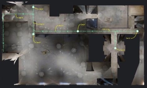
GPRS conducted 3D laser scans of the warehouse with a Matterport Pro 3D scanner, to create a detailed CAD drawing, 3D model, and virtual tour of the building for planning and design purposes.
GPRS Project Manager David Castro used the Video Pipe Inspection service to examine and map the interior sewer system of the 100,000-square-foot facility in Northern California. To support planning and design, GPRS also conducted 3D laser scans of the warehouse using a Matterport Pro 3 scanner, creating a detailed CAD drawing, 3D model, and virtual tour of the building.

GPRS Project Manager David Castro utilized our Video Pipe Inspection service to inspect and map the interior sewer system for the 100,000-square-foot facility in Northern California.
Castro noted that this client frequently buys and renovates similar facilities and relies on GPRS’ full range of infrastructure visualization services to uncover hidden details. By doing so, they can eliminate surprises, keep projects on schedule and within budget, and maintain safety throughout the remodeling process.

David Castro Project Manager
“[With VPI,] we’ll get the condition of the pipes, we’ll map out the layout for them just so they have all that information for their design purposes,” Castro said. “They just want to know what they’re walking into, so they don’t walk into any unexpected expenses or problems.”
How Does VPI Work?
Video Pipe Inspections are at the core of GPRS’ industry-leading sewer locating services, which also include smoke testing and dye tracing.
During a VPI, our NASSCO-certified Project Managers inspect your sewer or stormwater system using remote-controlled crawlers and push-fed sewer scopes that are equipped with CCTV cameras and sondes: instrument probes that allow us to track their location from the surface using electromagnetic (EM) locators.
With this technology, our Project Managers can inspect and map your sewer systems at the same time, and provide you with a detailed, NASSCO-compliant WinCan report that lists all identified defects – geolocated and ranked by severity – and provides photo and video evidence of our findings.
VPIs allow GPRS clients to identify problems within their sewer systems such as cross bores, clogs, and inflow/infiltration, and then expedites repairs to these issues by providing accurate data on where the defect is located and its severity.

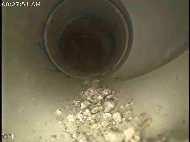
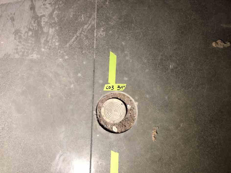
Castro’s inspection of the distribution warehouse’s sewer system revealed that some debris had seemed to have been intentionally shoved into some of the building’s cleanouts, but otherwise found no other issues.
What is Matterport?
The Matterport Pro 3 scanner allows our Project Managers to scan indoor and outdoor static environments and produces a full-color digital twin at a 10m range within 20mm accuracy.
With this 3D laser scanner, GPRS’ in-house Mapping & Modeling Team can create point clouds, 3D models, virtual tours, and 4K HDR photos. GPRS uses this tool to provide accurate as-built visualizations of a project site, incorporating utility locating, concrete scanning, VPI, and leak detection services for a complete solution.
What We Found at the Distribution Warehouse
Castro’s inspection of the distribution warehouse’s sewer system revealed that some debris had seemed to have been intentionally shoved into some of the building’s cleanouts, but otherwise found no other issues.
“For the most part, the sewer system was actually fairly new, and it looked to be in good condition,” he said.
But this was an exception to the rule.
“Most of the time when we do these jobs for new building owners, they always have a story of ‘Hey man, we just bought this other property on the other side of town, and maybe a month after we bought it, we had all these backup issues with the sewer,’” Castro said. “So, that’s exactly why we do this. It’s just so that they have an idea of what the existing condition looks like and if they need to be concerned about anything, if they need to plan for replacements or repairs or anything like that.”
Both the sewer inspection data, and the CAD drawing, 3D model, and created with the Matterport data will help our client with their planned renovations to the warehouse, including the addition of new bathrooms.
“Obviously with that project, they kind of need to know where the existing mainline is running through the building and then the depth,” Castro said. “So that way, they know what elevations they need to hit and all of that. Without us being there, they would have no idea where the sewer system is, or where to tie in. Their engineers would have no idea how to draw that plan up to get it to spec.”
Whether we’re visualizing a warehouse or inspecting a sewer system, all the accurate, field-verified data collected on your site by GPRS’ nationwide team of Project Managers is at your fingertips 24/7 thanks to SiteMap® (patent pending).
This proprietary project & facility management application provides accurate existing conditions documentation to protect your assets and people. Securely accessible anytime, anywhere via computer, tablet, or smartphone, SiteMap® helps you and your team eliminate mistakes caused by miscommunications, allowing you to plan, design, manage, dig, and ultimately build better.
