A power generation plant in Sandwich, Massachusetts, suspected a utility line on their property was leaking.
But they didn’t know where the leak was—or even what was leaking.
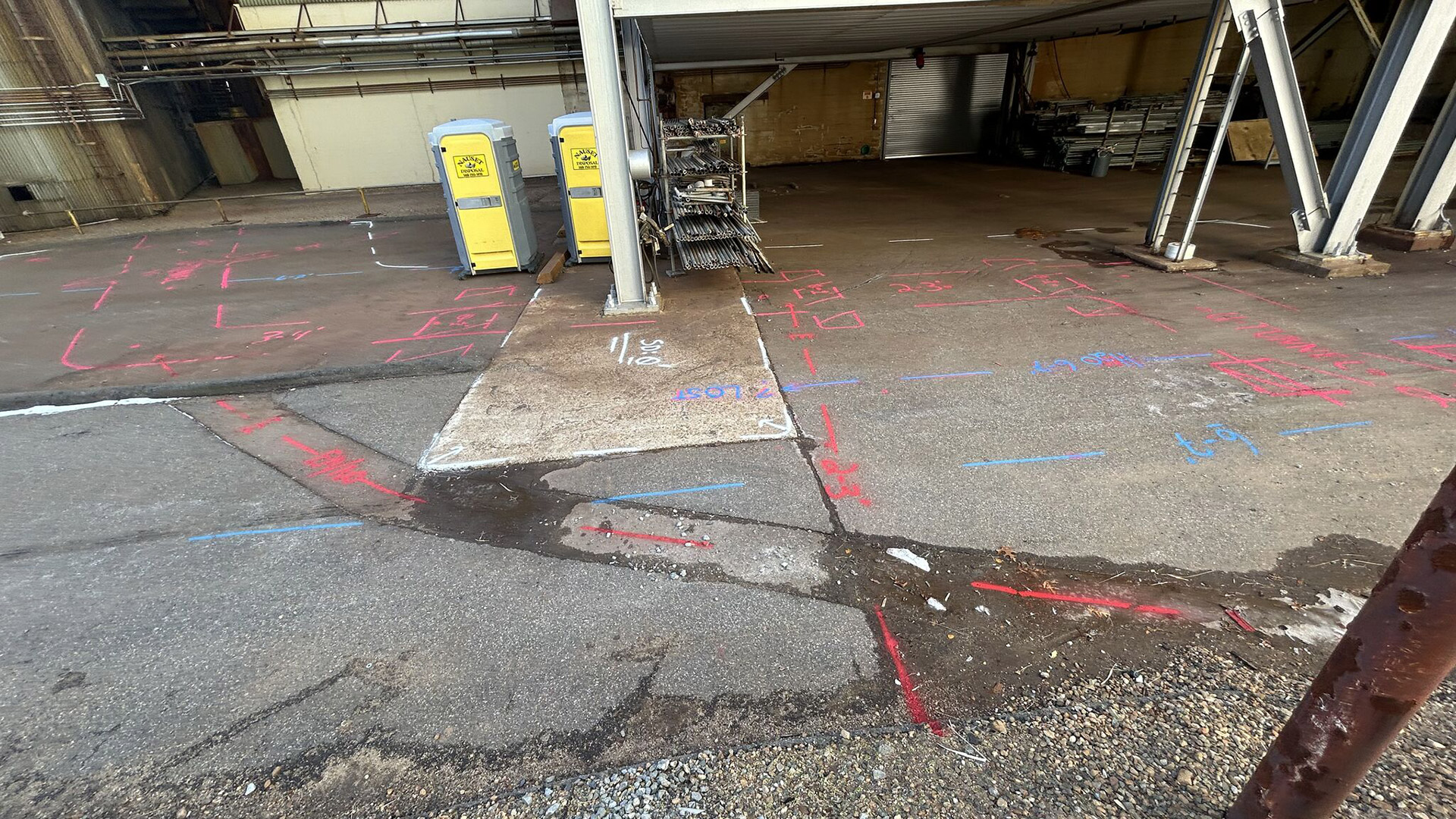
Plant officials first identified signs of the leak using a thermal imaging camera, but the data wasn’t enough to determine its exact source. The challenge was that the suspected leaking line was encased in what appeared to be a concrete or asbestos-lined pipe, buried alongside an unknown number of other utilities. These utilities had been underground for more than 40 years, resting two to three feet below the surface. To complicate matters further, at some point over the years, two steel support pillars had been built directly above the buried utilities.
The only way to locate and identify the leak was through utility potholing — an exploratory excavation method used to uncover underground utilities. However, given the types of utilities involved, this approach posed significant safety risks.
GPRS Project Manager Stephen Layon helped locate a leaking utility under a power generation plant in Sandwich, Massachusetts.
“[This utility tunnel] has liquid gas, fuel oil, cooled water, a little bit of everything,” explained GPRS Project Manager Stephen Layon. “They have a suspected leak because they took a thermal gun and saw the radiant heat coming out of the tunnel, and they also wanted to know, when they’re digging down, if there are any utilities popping out of this tunnel because they’ve used it to kind of hitchhike through the site without having to dig a really huge trench.”
Layon utilized a ground penetrating radar (GPR) scanner and electromagnetic (EM) locator to investigate the site of the suspected leak.
GPR scanners emit radio signals into the ground or a surface such as concrete, then detect the interactions between these signals and any buried or embedded objects like sewer pipes, electrical conduit, rebar, or post tension cable.
These interactions are displayed in a GPR readout as a series of hyperbolas that vary in size and shape depending on the type of material detected. GPRS Project Managers are specially trained to interpret this data to tell you what was located and provide you with an estimated depth for the object.

EM locators detect electromagnetic signals radiating from metallic pipes and cables. These signals can be created by the EM locator’s transmitter applying current to the pipe, from current flow in a live electrical cable, or from a conductive pipe acting as an antenna and re-radiating signals from stray electrical fields and communications transmissions.
Utilizing both his GPR unit and EM locator, Layon was able to locate the buried pipe full of utilities and pinpoint the location of the leak that the on-site personnel had detected with the thermal imaging gun.
“I located the tunnel, located the utilities around it,” he said. “Fortunately, the data was great. I could see down six-to-seven feet. I did see something that looked like a void… the data quality decreased from six-to-seven feet down to about one-to-two feet [in] the same area where the thermal camera indicated there was a leak…”
While utility potholing is a reliable way to locate utility lines during construction or repairs, it can be time-consuming, costly, and risky—especially when dealing with gas lines or electrical conduits. Thanks to the data Layon provided, the power generation plant was able to avoid unnecessary potholing, ensuring they only needed to dig once to locate and repair the leaking utility line.

Using ground penetrating radar (GPR) scanners (left) in concert with electromagnetic (EM) locators (right) allows GPRS Project Managers to provide you with a accurate, actionable about your buried infrastructure.
Layon went beyond the original scope of work by also identifying and mapping the expansion joints along the buried utility pipe.
In addition to marking these findings on the ground with spray paint, he logged all collected data into SiteMap® (patent pending), GPRS’ project and facility management application. This gives the facility’s staff 24/7 secure access to their accurate, actionable site data, enabling them to not only plan the necessary repairs but also streamline future operations and maintenance around the buried utilities.
Click below to schedule your live, personal SiteMap® demo today!