In the realm of geospatial solutions, the choices are abundant, each promising unique features and advantages. One standout player in this field is SiteMap®, a comprehensive platform that boasts powerful geospatial capabilities and subsurface infrastructure management. As with any company or service, comparing assets and strengths is crucial to understanding the company and their goals. Comparing SiteMap® with competing technologies to understand the distinctive features that set it apart helps to better inform your decision making while also helping identify any places for improvement in future projects or current project changes.
The Essence of Geospatial Solutions
Geospatial solutions play a pivotal role in today’s interconnected world, offering a dynamic approach to data analysis and visualization based on geographical information. Using GIS mapping software helps to enhance this information. For SiteMap®, this geographical information is carefully collected by the elite team of Project Managers employed by GPRS. GPRS utilizes state-of-the-art technology, and combines it with an innovative company environment, as well as an elite trained team. These tools are instrumental in a variety of industries, from urban planning and environmental monitoring to logistics and asset management.
Types of Geospatial Data
While geospatial data is information that describes objects, events, and other features with a location on or within the surface of the earth. This data typically combines location information and attribution information with temporal information. The location provided may be static or dynamic. There are many types of geospatial data that may be used to better understand the world around and below us:
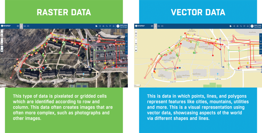
Raster Data:
This type of data is pixelated or gridded cells which are identified according to row and column. This data often creates images that are often more complex, such as photographs and other images.
Vector Data:
This is data in which points, lines, and polygons represent features like cities, mountains, utilities and more. This is a visual representation using vector data, showcasing aspects of the world via different shapes and lines.
SiteMap®: Unveiling a Geospatial Experience Integration of Multifaceted Data
SiteMap® takes geospatial solutions to the next level by seamlessly integrating a myriad of data types. From aggregated subsurface utility infrastructure data, to as builts, 3D models, and more,
A SiteMap® Personal subscription is complimentary with every GPRS utility locate, and the software platform excels in creating a comprehensive, layered view of subsurface spatial information. Use your Digital Plan Room to break down the data at hand, viewing it in a way that makes sense for you. SiteMap® Project and other subscription tiers put you in control by securing your layered and mapped subsurface as built data in one single source of truth for the life of your project. This data is powered by GPRS, which offers multiple subsurface information solutions and a 99.8% accuracy rating for over 500,000 utility locating and concrete scanning jobs.
Cross-Referencing Capabilities
SiteMap’s unique advantage lies in its ability to cross-reference geospatial data. Depending on your tier, you may be able to cross-reference historical geospatial data with the data provided by GPRS, as well as any other data that you may have added to the platform yourself. This allows you to carefully examine and study your data, creating a visual map of facilities and subsurface data so you can better understand the infrastructure at hand.
Real-Time Monitoring and Analytics
In an era where real-time insights are paramount, SiteMap® shines with its speed and accuracy. Once GPRS finishes the job in the field, your raw locate data is usually available within five minutes. This means that you can quickly access data that is 99.8% accurate, serving your needs quickly and efficiently. This data is up-to-date and is collected in real-time. SiteMap® allows for an up-to-date look at the world below your feet.
User-Friendly Interface
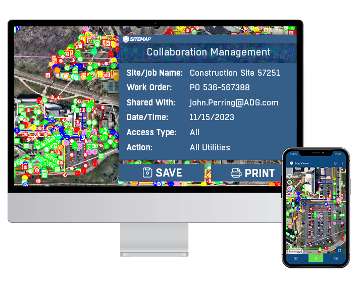
SiteMap® understands that the power of geospatial solutions should be accessible to all users, regardless of their technical expertise. With an intuitive interface, users can easily navigate through maps, overlay different data sets, and extract valuable insights with no extra knowledge. SiteMap® prides itself on its easy-to-use interface, and easily yet securely shared data, allowing you to break down communication barriers with anyone you choose. Share your data seamlessly with anyone on your team, no matter where they are.
Great Accuracy
SiteMap® is powered by the great accuracy of GPRS, which means 99.8% accurate utility maps and concrete scans, and millimeter-accurate 3D laser data engineered into the drawings, maps, and models you need. Furthermore, users can secure their subsurface files, maps, and drawings in one centralized Digital Plan Room, which is accessible only to those you designate. You’re able to safeguard the real-time accuracy of your subsurface data against unauthorized uploads or edits, and give access to only those who need it.
Comparing with Competing Technologies
While SiteMap® offers a robust geospatial solution, it’s essential to consider how it stacks up against other technologies in the market.
SiteMap® vs. Digital Data Platforms
Unlike SiteMap®, platforms that offer results based on satellite imagery, outdated public records, and online files may say they’ll provide data within 24 hours, their data collection cannot ensure the high level of accuracy that GPRS can. Digitally collected data may provide platform to visualize geospatial mapping, but it lacks real-time field data collection, where SIteMap® shines.
SiteMap® vs. Broad GIS Platforms
While some of the more established GIS software is excellent for mapping and analysis, it may fall short when it comes to keeping your data accessible to all who need it. While they offer some great technology solutions, they require a steeper learning curve. Yet, the data provided is not more detailed or in-depth than what is offered by SiteMap®, and in many cases is outdated or incomplete because it relies on the customer’s uploads. SiteMap® takes complex, detailed data and makes it easy to understand and navigate.
SiteMap® vs. Facility Infrastructure Software
Some facility-specific software takes geospatial data and makes it more complicated than it needs to be, especially when compared to SiteMap®. Many of the features of these kinds of platforms are better used for indoor systems than comprehensive subsurface and aboveground solutions. SiteMap®’s many capabilities, and its integration of diverse data sets set it apart, ensuring a more comprehensive understanding of spatial information.
In the evolving landscape of geospatial solutions, SiteMap® emerges as a powerful leader, offering a unique blend of comprehensive mapping, ease-of-use, and stunning accuracy. While there are other technologies in the market, SiteMap®’s comprehensive approach positions it as a versatile, accessible, and accurate solution, particularly beneficial for utility management, urban planning, and industries where the integration of spatial and facility-specific data is crucial.
As technology continues to advance, and our infrastructure continues to require upgrades and retooling, the choice of geospatial solutions becomes increasingly pivotal. SiteMap® stands at the forefront, not just as a mapping solution but as a dynamic platform that transforms spatial data into actionable insights, setting new standards in the realm of geospatial technologies. With SiteMap®, the worlds below and around you are Intelligently Visualized® and easily accessible.