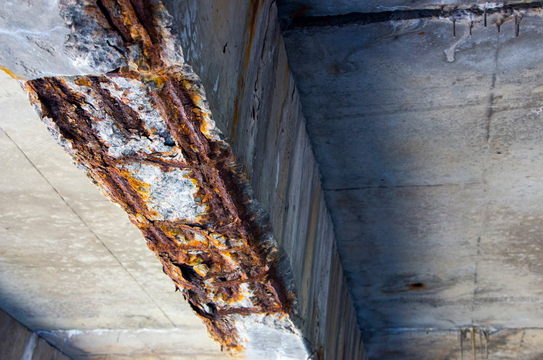
A construction worker was killed and three others were injured in a sudden bridge collapse in Clay County, Missouri. “The two lane bridge…about 27 miles northeast of Kansas City,” while workers were in the process of pouring concrete according to the Clay County Sheriff’s office.
Unfortunately, tragic stories of this kind are all too familiar to the construction industry, be it a concrete bridge or building collapse, accidental utility strikes, water main breaks, etc. Every bridge, road, and utility failure underscore the urgent need to repair US infrastructure. According to a recent American Road & Transportation Builders Association (ARTBA) analysis released by the U.S. Department of Transportation’s National Bridge Inventory (NBI) database, “nearly 231,000 U.S. bridges need major repair work or should be replaced… represent[ing] 37 percent, or more than a third, of all U.S. bridges.” To put this in perspective, if placed end-to-end, the length of these bridges “would stretch over 6,300 miles—long enough to make a round trip across the country from New York City to Los Angeles and back again to Chicago.” Worse yet, while more than 46,000 of these bridges are deemed “structurally deficient” and in poor condition, they are crossed 178 million times a day.

Though reconstruction of our current infrastructure is crucial to maintaining the future of our country’s bridges and roadways, improper assessments and preparations prior to working on these structures can result in horrible, life-threatening accidents such as the recent bridge collapse in Clay County, Missouri.
As communities and municipalities across the nation prepare to spend their portion of the Bipartisan Infrastructure Law funds, it is vital to have complete, accurate, and up-to-date assessments of the current infrastructure conditions prior to starting work, to avoid the horrible, life-threatening accidents. This newly passed law, also known as the Infrastructure Investment & Jobs Act, was “adopted by the U.S. Congress in November 2021, provid[ing] $550 billion for new initiatives to rebuild roads and bridges, improve public transit, replace lead pipes and address drinking water contamination, expand access to high-speed internet, and more.”
Here at SiteMap®, powered by GPRS, we provide modern and highly accurate inspection & utility locating services and digital planning tools our customers can trust. SiteMap® can aid large municipalities and projects by revolutionizing their data filing, organization, and collaboration through our Digital Plan Room. Plus, SiteMap offers comprehensive site visualization of everything from simple utility locates and GPR concrete scans to 3D maps and BIM models through our layered and cross-referenced Map Viewer feature.
SiteMap® completely redefines collaboration for projects with large amounts of data and multiple facilities spread across the US. This modern infrastructure management platform paired with the highly accurate structural analysis imaging and concrete imaging performed by our GPRS certified professionals provide you and your team with the high level of confidence you need to properly execute your project.
In addition, with the TruePoint 3D Laser Scanning Services provided by GPRS, complete as-builts can be captured with a reliable 2-4 mm level of accuracy, eliminating the inevitable redesign costs associated with traditional hand measurement techniques. Using 3D laser scanning technology, it typically takes only 1-2 days in most cases for our Project Managers to completely scan a job site. Afterwards, our professional design team can interpret the collected data to accurately generate the comprehensive maps, models, and drawings your project needs to move forward. This modernized process can assess any location with high precision, which is especially helpful for those preparing to execute a large infrastructure repair project safely, on time, and on budget.
Because of our dedication to the safety and welfare of all workers across the construction industry, GPRS has sponsored Concrete Sawing & Drilling Safety Week since 2018. This annual event educates workers on the best practices to mitigate the potential risks associated with cutting and coring concrete. Each year, this event serves to properly support and train over 5,500 construction workers. To date, GPRS has trained well over 12,000 workers in the best practices for working with post-tension concrete.
Regardless of the project at hand, we always prioritize our commitment to construction safety and data accuracy. You can learn more about how SiteMap®, powered by GPRS, supports those looking to Visualize The Built World™ using an easy, streamlined, reliable approach to infrastructure management by downloading our brochure, and contacting us for a quote today!
