The Common Ground Alliance’s latest recommendations for the damage prevention industry focus on enhancing data quality and reporting, addressing key damage drivers, and improving locating practices.
These insights come from the CGA’s 2023 DIRT Report, the organization’s annual analysis of data submitted to 811 call centers. The report introduces a new tool to measure the industry’s progress in excavation safety and showcases successful subsurface damage prevention initiatives from the past year.
It also outlines recommended actions for facility owners, locators, excavators, and 811 centers to support the CGA’s 50-in-5 industry challenge, refine data quality and reporting, mitigate top damage drivers, and strengthen locating practices.
“As we confront the challenge of significantly reducing damages to underground utilities, addressing the persistent top root causes demands a transformative mindset across the industry,” the report reads. “While the 2022 DIRT Report provides detailed, root cause-specific recommendations that remain relevant, the 2023 Report calls for even more decisive steps towards industry-wide improvement.”
Enhancing data quality and reporting, targeting top damage drivers, and improving locating practices were among the topics that the Common Ground Alliance covered in their most recent recommendations to guide the damage prevention industry.
Enhancing Data Quality and Reporting
To enhance data quality and reporting, the CGA recommends the following actions:
Facility Owners, Locators, Excavators
- Participate in the Damage Prevention Institute and submit damage data and metrics monthly to accelerate industry insights and improvements.
811 Centers
- Implement a standardized metric for measuring locate timeliness or “excavation readiness.”
- Establish a consistent process for mapping 811 center ticket data to standard DIRT field options such as work type.
All Stakeholders
- Regularly assess organizational data collection policies and DIRT DQI score, and develop strategies to reduce the percentage of “unknown” entries in critical data fields like root cause and work type.
- Utilize the DIRT root cause flow chart to guide more actionable root cause selection and the Common Work Types tool to map free text to DIRT work types – both are tools developed by CGA Committees.
- Become familiar with your state’s damage reporting requirements by reviewing regulations and 811 center guidelines, ensure all relevant staff are trained on reporting procedures and implement internal processes to meet or exceed state reporting standards.
- Bookmark the DIRT Interactive Dashboard and explore it regularly to guide your damage prevention outreach and programs.
Targeting Top Damage Drivers
To address the top damage drivers, the CGA recommends the following actions:
Facility Owners, Excavators, 811 Centers
- Implement tailored education and outreach programs for water/sewer, telecom and construction/development excavators, which are the leading types of work involved in damages.
- Develop scalable damage prevention strategies to accommodate the expected surge in excavation activities and arrival of out-of-state excavators who may be unfamiliar with local damage prevention regulations.
All Stakeholders
- Develop tiered education approaches based on the urban-rural continuum, recognizing that each geography poses unique challenges.
- Strengthen media and outreach materials for use following extreme weather to reduce damages in the wake of increased precipitation, natural disasters and other extreme events.
- Establish coordination mechanisms between government agencies/regulators, facility owners, excavators, locators and other industry stakeholders to manage the impact of increased infrastructure investments and reduce the incidence of utility-on-utility damage.
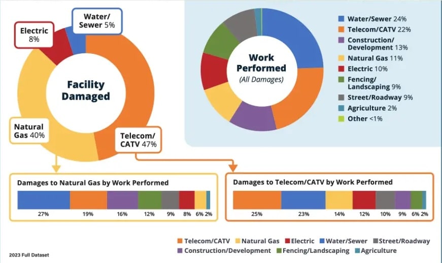
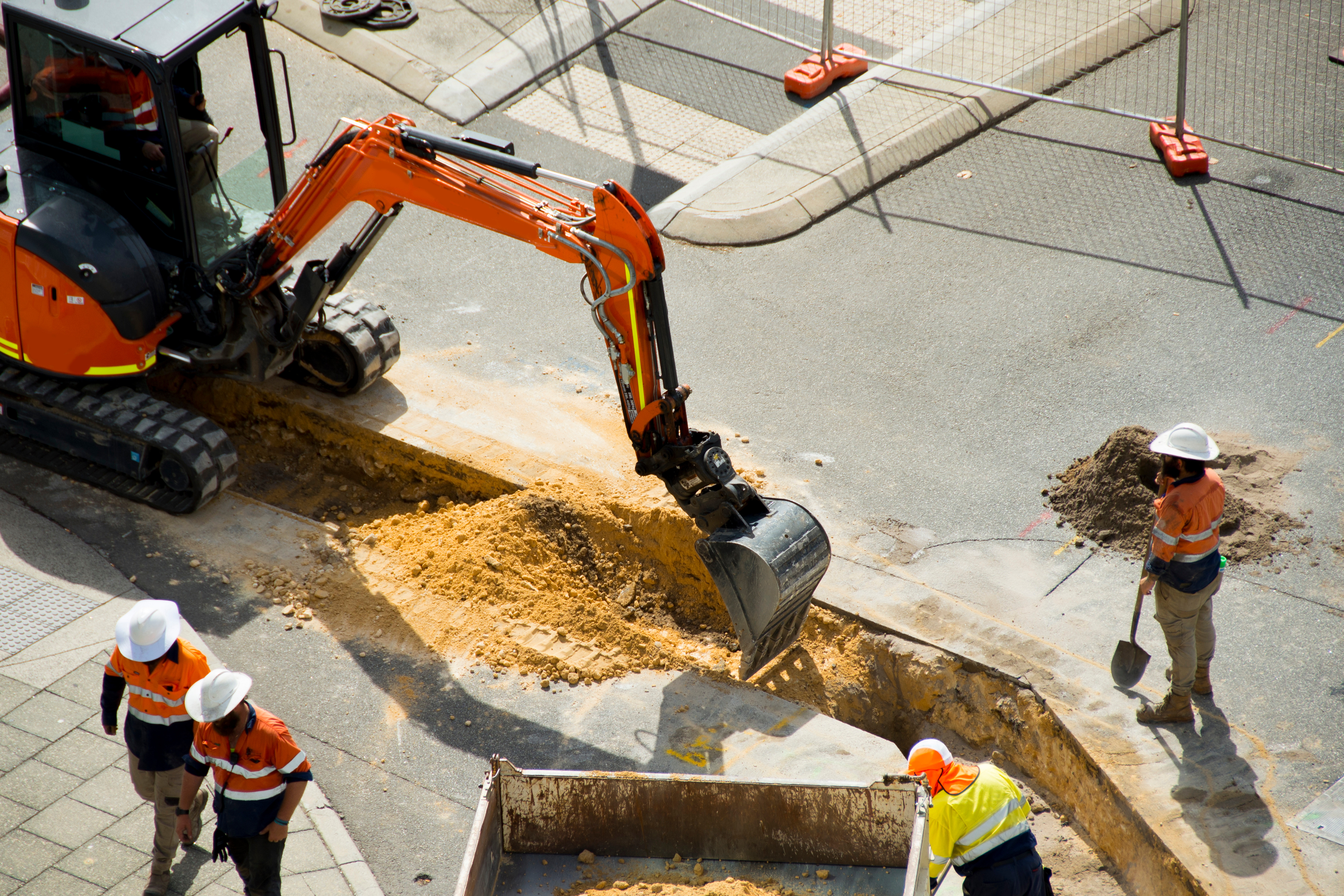
Photo courtesy of the Common Ground Alliance
Improving Locating Practices
To improve locating practices, the CGA recommends the following actions:
All Stakeholders
- Develop enforcement mechanisms for timely locating, considering both monetary (e.g., New Mexico) and collaborative (e.g., Massachusetts) approaches.
Facility Owners
- Improve contracts with third-party locators to ensure there are not financial, temporal or other barriers to on-time and accurate delivery of locates. Consider implementing best value contracts, which prioritize quality and overall value over the lowest price, as one potential approach to achieve this goal. Regularly meet with third-party locators to facilitate collaboration and information-sharing, regardless of the contract type in place.
- Invest in GPS-enabled locating devices and develop a protocol for locators to update facility maps in the field, ensuring that new or revised asset information is more immediately available to excavators and locators who need it. Implement a quality control process to verify and approve map updates before they are finalized.
Facility Owners, Locators, 811 Centers
- Conduct thorough analysis of 811 ticket screening effects on damage rates and Locating Practice root causes.
GPRS supports CGA’s mission of subsurface damage reduction through our comprehensive suite of subsurface damage prevention and utility mapping services.
How SiteMap® Helps You Mitigate the Risk of Subsurface Damage
GPRS aligns with CGA’s mission to reduce subsurface damage by providing a comprehensive suite of utility mapping and damage prevention services.
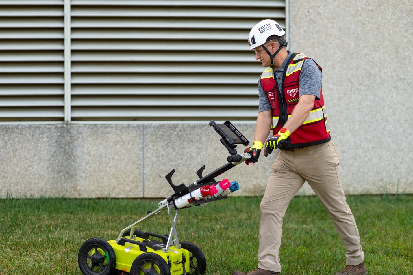
Our 99.8% accurate utility locating services leverage ground penetrating radar (GPR) and electromagnetic (EM) locating to deliver an accurate & complete picture of the infrastructure beneath your feet.
When it comes to sharing and collaborating with this precise, field-verified data, SiteMap® (patent pending)—GPRS’ project and facility management application—empowers you to plan, design, manage, excavate, and build with confidence. Accessible 24/7 from any computer, tablet, or smartphone, SiteMap® eliminates mistakes and miscommunications by ensuring you and your entire project team are working from a single source of truth.
Click below to schedule your live, personal SiteMap® demo today!
Frequently Asked Questions
What are the benefits of underground utility mapping?
Maintaining an up-to-date and accurate map of your subsurface infrastructure helps prevent accidents, minimize budget overruns, reduce change orders, and avoid project delays caused by costly and hazardous subsurface damage.
How does SiteMap® assist with utility mapping?
SiteMap®, powered by GPRS, is the industry’s leading infrastructure management platform, serving as a single source of truth for your project data. It securely houses the 99.8%+ accurate utility locating, concrete scanning, video pipe inspection, leak detection, and 3D laser scanning data collected by GPRS team of SIM and NASSCO-certified Project Managers. Best of all, when GPRS performs a utility locate for you, you receive a complimentary SiteMap® Personal account.
Does SiteMap® work with my existing GIS platform?
SiteMap® enables users to export data in SHP, GeoJSON, GeoPackage, and DXF formats directly from their accounts, whether they own the data or have a shared job. These file formats can then be manually imported and utilized within other GIS platforms for seamless integration.