The massive boom in manufacturing and infrastructure projects in the U.S. means that now, more than ever, pinpointing the location of subsurface utilities can be a matter of life or death. Precision matters, and there’s no room for guesswork.
American infrastructure stands at a critical crossroads, with the pressing need for maintenance and upgrades playing out against a backdrop of budgetary constraints. The staggering statistics — over 800,000 miles of public sewers, 500,000 miles of private lateral sewers, and approximately 2.2 million miles of potable water piping — highlight the expanse of the challenge. Yet, with an innovative approach and the right tools, the daunting scale of these numbers becomes an opportunity for growth and development.
SiteMap® (patent pending), powered by GPRS, is a digital platform driven by geospatial data that brings immense value to the processes of planning and executing digs. But before we dive into how SiteMap® strengthens a dig policy, let’s address the elephant in the room – the growing trend of AI-driven location tools and why they might not be the champions of accuracy professionals need.
The Misleading Precision of AI in Subsurface Data

AI can revolutionize the built world by optimizing energy usage, streamlining construction processes, enhancing occupant comfort, and improving safety and security measures
AI has taken the world by storm, from AI-created art to AI writing, and beyond. Most industries are just beginning to learn exactly what AI can do, and just how fast it can do it. However, scale and speed cannot make up for actual information; any AI-aided task is only as good as the prompt or material it receives.
There’s a lot of buzz around the idea that AI can streamline and improve the way we survey and locate underground utilities. But the reality is that AI is not yet the silver bullet we need in this domain. The precision it offers is often overstated, and when AI-based tools are misused without supplementary verification, the potential consequences are dire. At best, using AI for determining excavation sites can lead to time-consuming false positives, and at worst, it poses significant risks to construction teams, the public, and the integrity of critical infrastructure.
No, AI Can’t Accurately Locate Utilities, Yet
Artificial intelligence might seem sophisticated, but it largely relies on algorithms trained on data that, more often than not, is incomplete and outdated. Its ability to locate subsurface infrastructure accurately is marred by vast limitations. Unlike GPRS & SiteMap®, AI lacks the critical human oversight and validation that ensures every detected utility is precisely located. This real-time human involvement, expertly provided by professionals, makes all the difference in preventing disaster on the ground.
Understanding SiteMap®: The Human Touch in Infrastructure Insight
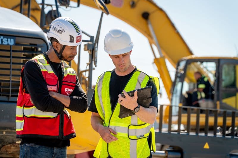
GPRS demonstrating how SiteMap® can Intelligently Visualize the Built World®
SiteMap® is not just another AI-driven technology; it’s a geospatial powerhouse that leverages the best of AI alongside the indispensable human touch. It’s the collaborative intelligence that sets SiteMap® apart, ensuring a level of accuracy that AI alone simply cannot provide.
The Power of People
At the core of SiteMap® is the expertise of GPRS, who employ boots on the ground, carefully collecting infrastructure data, ensuring an incredible 99.8% accuracy in subsurface utility detection. It’s this partnership between advanced technology and human validation that revolutionizes excavation site analysis. By retaining the advanced yet trusted methods of Ground Penetrating Radar, 3D Laser Scanning, CCTV Pipe Inspection, and more, SiteMap® offers a layer of assurance that is indispensable in critical construction and civil engineering.
GPRS was one of the first companies in the country to focus on concrete scanning and utility locating, primarily using ground penetrating radar (GPR). Since we started in September, 2001, we have built a nationwide network of offices with staff strategically placed in every major metropolitan area in the United States. Since our founding, we have worked on some of the largest and most significant construction projects in the country. We stay busy: On average, each of our 500 nationwide Project Managers perform 300 jobs per year.
Just one utility strike or damaged concrete structural element can be the difference between a simple renovation and a prolonged project that incurs costly damages, delays, and even injuries. GPRS utilizes multiple technologies to get a clear picture of what’s underneath the ground or inside the concrete. It’s not just about the tools…It’s about the person operating them. When these technologies are in the hands of GPRS Project Managers – the industry’s most experienced infrastructure visualization specialists – you get an immediate and accurate report of subsurface elements, allowing you to safely and successfully complete your projects. Our Project Managers are held to the highest standards — ours, which include being certified in Subsurface Investigation Methodology (SIM), the industry-leading non-destructive testing assessment protocol with three levels of certification.
GPRS offers something that AI can’t, and that’s real people who are dedicated to the work they do: who go above and beyond to ensure the highest level of accuracy possible.
Risks of AI Infrastructure Insights
The dependence on the infallibility of AI can result in incomplete data analysis and misguided planning. Projects that sway into the realm of AI-only decision-making expose themselves to time and cost overruns due to unnecessary redigging and resurveying. Beyond the immediate financial burden, the missteps associated with inaccurate AI data can lead to legal liabilities, and, more importantly, safety hazards.
Challenges and Considerations in AI’s Role in Infrastructure Data

As we recognize the popularity of AI-assisted analysis in infrastructure planning, we must not sidestep the discussion on its limitations.
The Myth of Infallibility
Some state that the Titanic was heralded as an “unsinkable ship” but the vastness of the ocean’s subsurface had different plans. AI can be a powerful support system — but only after it has been thoroughly vetted and augmented by the expertise of professionals who can interpret, verify, and correct the results. The concept of an AI system that works perfectly straight out of the box is fanciful at best, dangerous at worst. It’s the flawed assumption of AI’s superiority that can lead to avoidable catastrophes, and that’s just the tip of the iceberg.
There’s always a risk of error, especially when giving blind faith to relatively new technology that just doesn’t have the same checks and balances as real people using verifiable methods. Especially when this new technology goes unregulated, offering incomplete processes and verification, much like the Titanic’s emergency plan and preparations.
Integration and Workflow
One size does not fit all in the realm of construction and civil engineering. Adapting AI tools to an existing workflow is often a cumbersome and time-consuming process. In contrast, SiteMap® was designed to be seamlessly integrated into the existing project management toolkit, minimizing disruption and maximizing efficiency.
Data Privacy and Security
Trust in AI-driven analytics also comes with considerations regarding the security of the data used and the privacy of the individuals or entities the data pertains to. This is especially prevalent in the medical field, where we see more of the security lapses that AI systems can cause. As with any digital platform, the role of SiteMap® in the protection of sensitive information is paramount. However, the proliferation of AI-powered utilities in the digital space has yet to demonstrate a collective commitment to data integrity that SiteMap® exudes
Future Trends: AI in Construction and Civil Engineering

Despite the inherent risks, the future of AI in the construction and civil engineering sectors is promising. However, a prudent approach, one that supplements AI with human acumen, will likely be the trajectory. As AI tools evolve, the value of a human-driven approach should not decline but rather remain the constant that ensures the measured progress and potential of these technologies.
The Evolving Role of AI
AI will undoubtedly play an increasing role in the future of infrastructure insights. Nevertheless, its capabilities should always be tempered by the expertise of professionals who understand the limitations and potential misuse of automated systems. The forward-thinking approach that integrates AI use within a suite of validation protocols is likely to define the next wave of precision in civil engineering.
Steering Clear of AI Exclusivity
As professionals delve into the sphere of AI-driven infrastructure insights, it’s clear that its tools should not be wielded in isolation. The risks are simply too high. Instead, complementing AI with proven platforms like SiteMap® offers a more robust and secure approach. It’s the balance of advanced technology and professional insight that will undoubtedly shape the future of infrastructure projects for years to come.
In the complicated arena of infrastructure development and construction, the allure of AI-driven insights is understandable. However, the dangers of relying solely on automated systems for decision-making cannot be overstated. By choosing platforms like SiteMap®, construction professionals and civil engineers can maintain a level of control and verification that is indispensable in the field. The risks of trusting AI to determine where to dig are high and still largely unmitigated, but with the guidance of tested and human-integrated solutions like SiteMap®, the evolution of infrastructure planning is poised to be both cutting-edge and safe.
How Will SiteMap® Improve Your Facility Management?
![]()
By offering a centralized repository of stunning mapping, accurate data, and up-to-date as-built drawings, SiteMap® simplifies the complex puzzle of facility management. Its cloud-based approach ensures your digital plan room is accessible and intuitive, enabling seamless collaboration and enhanced visibility into every facet of your infrastructure. With SiteMap®, you get more than just data — you gain a comprehensive understanding that drives informed decision-making and, ultimately, success in your facility management endeavors.
Better Tools
The tools of infrastructure detection have seen remarkable advancements. From ground-penetrating radar (GPR) to electromagnetic induction (EMI), the arsenal of technologies at our disposal is more sophisticated than ever. These instruments are not mere gadgets but critical components in the quest for accurate infrastructure insights. They represent the physical manifestations of our commitment to progress in an industry where precision is non-negotiable.
GPRS Services: The Future of Utility Detection
GPRS is more than a service provider — it’s the future of utility detection and infrastructure visualization providers, a trailblazer setting new benchmarks in safety and efficacy. The robotic CCTV crawlers that chart new territories under streets and buildings, the acoustic leak detectors that home in on sounds in the immensity of underground, and the magnetometers that make the invisible world visible — each tool, when wielded by the expertise and training of GPRS’s Project Managers, becomes a harbinger of a safer, more efficient construction landscape. This is something that even the best AI program could never deliver, at least not anytime soon.
As the construction and civil engineering spheres continue their march toward full digital integration, the stakes have never been higher. The promise of AI is tempered by the need for caution. It’s in this balance that the true potential of technology is revealed — not in the tools themselves, but in the hands of those who understand their value and their limitations. SiteMap® stands as a testament to the fact that while the allure of AI might draw the eye, it is the guarantee of human-driven accuracy that keeps us safe and keeps us moving.
Are you looking for a better infrastructure solution? Contact SiteMap® today.