A $66-million roadway upgrade near Reno, Nevada encountered a significant obstacle when crews uncovered a high-pressure water line cutting directly through the construction zone.
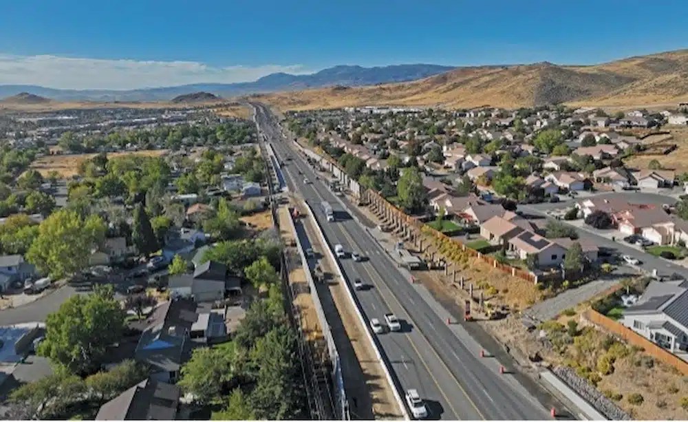
Granite Construction, headquartered in Watsonville, California, is leading the initial phase of the six-phase Pyramid Highway Project. This stage focuses on reconstructing and widening approximately 2.5 miles of the heavily traveled corridor, which supports around 50,000 vehicles each day.
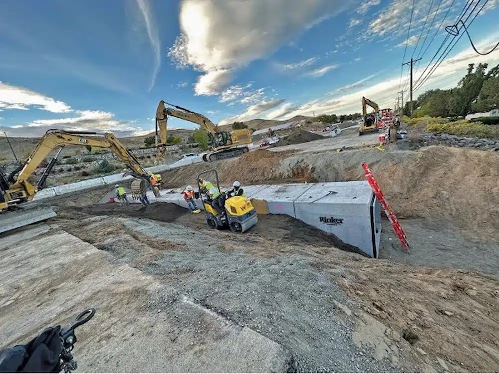
(Photo courtesy of the Nevada Dept. of Transportation via Engineering News-Record) Watsonville, California-based Granite Construction is the general contractor on the first phase of the six-phase Pyramid Highway Project, which is rebuilding and widening about 2.5 miles of the arterial road that serves 50,000 vehicles daily.
Slated for completion this summer, the project will expand much of the roadway from four to six lanes and introduce a range of infrastructure improvements, including new bike lanes, sidewalks, curbs, gutters, a 10-foot shared-use path, upgraded traffic signals, sound barriers, enhanced lighting, landscaping, and overhauled drainage systems.
“These upgrades are designed to improve traffic flow, safety and accessibility for all users,” Nanette Maxwell, senior project manager for NDOT, the lead agency on the project, told Engineering News-Record. “This project will not only reduce traffic congestion and travel times, but it will also generate significant crash-cost savings for vehicles, bicyclists and pedestrians” because the improvements are expected to reduce accidents.
ENR reports that the local water utility alerted the construction team to a previously unmarked high-pressure water line running through the project site. The line supplies water to the nearby Spanish Springs community and, per utility requirements, must be buried at a minimum depth of two feet.
A follow-up review of the subsurface utility exploration data revealed that a portion of the pipeline would fall short of this depth requirement, with less than two feet of soil cover in one area.
(Photo courtesy of the Nevada Dept. of Transportation via Engineering News-Record) Expected to be completed this summer, Phase 1 of the Pyramid Highway Project will see much of the road expand from four to six lanes, along with the addition of bike lanes, sidewalks curbs, gutters, a 10-ft shared-use path on one side of the road, smart traffic signals, sound walls, enhanced lighting, landscaping, and improved drainage infrastructure.
Exposing too much of the high-pressure line posed a risk to its structural integrity, and shutting off the water supply wasn’t an option. To address the issue, crews proceeded in 50-foot segments, removing surface layers down to the subgrade. Each section was then graded and compacted. A temporary gravel layer was installed to shield the pipe, with plans to replace it with an aggregate base as part of the final paving process.
“Meetings were held between NDOT, Granite and the local water authority to develop a work plan allowing the contractor to continue working,” Aaron Lobato, roadway design project coordinator at NDOT, told ENR.
Amanda Callegari, commission engineering manager, told the publication that the collaborative elements of the project – including the real-time multiagency cooperation necessary to overcome the water line problem – show how important Pyramid Highway is to Reno’s present and future. The highway – designated State Route 445 – is an important commuter route for the area’s growing population, with more than 90% of the 40,000 people who live within two miles of the project working outside the area.
“This project holds regional significance and will provide meaningful benefits to the growing community,” Callegari said. “To ensure its successful delivery, the [commission] and NDOT have joined forces to implement these vital improvements.”
How Accurate Utility Mapping Protects Your Infrastructure Projects
Whether it’s a high-pressure water line, an electrical conduit, or a gas main, striking a buried utility while excavating can have costly consequences.
Subsurface damage endangers the lives of your workers and residents of the surrounding community. And the downtime and cost of repairing the damage can decimate your schedule and budget.
Calling your local 811 center should be your first step whenever you’re planning an excavation. Federal law requires you contact 811 to receive the approximate location of all registered utilities within your project area prior to breaking ground. Registered utilities can consist of both private and public lines, but it’s important to remember that not all utilities are registered with 811.
GPRS’ professional utility locating services compliment your 811 locate by providing you with accurate and complete data about the buried infrastructure on your job site. Utilizing ground penetrating radar (GPR), electromagnetic (EM) locating, and other non-destructive subsurface investigation technologies, we identify where you can and can’t safely dig.
All this data is at your fingertips 24/7 thanks to SiteMap® (patent pending), GPRS’ interactive utility mapping software application that provides accurate existing conditions documentation to protect your assets and people.
Securely accessible from any computer, tablet or smartphone, SiteMap enables seamless communication between you and your project team. You’ll be able to plan, design, manage, dig, and ultimately build better.
Click below to schedule your live, personal SiteMap demo today!