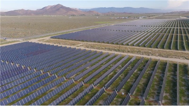
A solar farm in Texas faced the challenge of replacing damaged collector lines that connected thousands of solar panels across the site.
Before any work could begin, they first had to locate those lines.
GPRS Project Managers Scott Moore and Miguel Campos, along with Area Manager Keith Knoblock, were brought in to conduct utility locating and mapping services across the sprawling 1,200-acre property in East Bernard, Texas. Local wildlife had been burrowing into the ground and chewing through the lines responsible for gathering and transmitting electricity from the solar cells.
“Whoever did the installation work wasn’t the company that we were contracted with,” Moore explained. “When they buried the lines, they did a great job keeping everything in order, everything in line, but they didn’t put anything in conduit. These lines are about the size of like a cable TV line, and so what happened is the wildlife in that environment would like to have dinner via those lines, so they were shorting out and burning up a lot of these combiner boxes and fun stuff like that.”
The GPRS team used electromagnetic (EM) locators to find the damaged collector lines.
Unlike ground penetrating radar (GPR), which utilizes radio waves to detect buried utilities and other subsurface obstructions, EM locators detect the electromagnetic signals radiating from metallic pipes and cables.
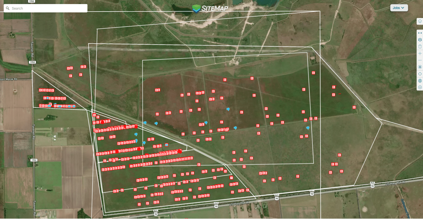
GPRS conducted utility locating services to find damaged connector lines on a large solar farm in Texas. The data was uploaded into SiteMap® for future planning purposes.
EM locators can operate in both active and passive mode.
Active Location Mode is used to trace, identify, and pinpoint a buried line. It also can be used to measure the depth estimation of the buried line, or the signal current on that line.
Passive sweeps are used to mark the location of unidentified, buried lines prior to breaking ground. Passive signals can originate from a variety of sources:
Power
- Current flowing through a live electrical wire
- Cathodic protection for pipelines
- Stray currents from power transmission systems can use any conductive pipe as a return path
Note: Finding a power reading does not necessarily mean that an electrical line has been located. The line should be identified by tracing it to its source or an electrical structure.
Radio
- Any conductive pipe or utility can act as an antenna for radio wave transmissions in the atmosphere and enter the ground
- Some active phone lines
- Stray currents from power transmission systems can use any conductive pipe as a return path
Note: Radio Mode cannot calculate depth readings. Once a radio reading has been found, induction could be used to assist with tracing and depths.
Rebar
- Reinforcing such as rebar and mesh will often re-radiate these signals and can provide false positive readings
- Raising the receiver and adjusting the gain to eliminate the weaker readings from the rebar may allow the stronger reading from the utility to be traced
- After adjusting the height, a GPRS Project Manager will continue sweeping and tracing at that height
A solar farm in Texas need to replace damaged collector lines running from hundreds of their solar panels. But first, they needed to find those lines.
Due to the damage to the collector lines, Moore and his GPRS team needed to pinpoint their locations using passive sweeps.
“Since a lot of these lines were melted, chewed through, things like that, really you couldn’t actively locate them,” he explained. “So, we were basically locating these lines with our passive methods, which turned out to be just the quickest way to handle this job.”
The solar farm operator was eager to quickly repair the damaged lines and restore the site to full capacity. Throughout the project, their repair crews followed closely behind GPRS—almost as soon as we identified the lines, they would begin excavation and install new ones encased in protective conduit.
However, thanks to the efficiency of GPRS’ SIM-certified utility locating process, our team ultimately stayed ahead of the repair crew’s pace.
“We got to where we were weeks ahead of their rate of pace, which they were happy with,” Moore said.
In addition to marking the location of the collector lines with spray paint and flags, Moore and his team members uploaded all the data they collected into SiteMap® (patent pending), GPRS’ project & facility management application that provides accurate existing conditions documentation to protect assets and people.
SiteMap® is a single source of truth for the critical infrastructure data needed to eliminate the costly and potentially dangerous mistakes caused by miscommunications. Securely accessible 24/7 from any computer, tablet, or smartphone, SiteMap® allows you and your project team to plan, design, manage, dig, and ultimately build better.
With SiteMap®, the solar farm operators will have accurate data on the connector lines pulling electricity from the hundreds of solar panels on their property, which will help ensure the safety of any future maintenance projects.