At GPRS, we understand the critical importance of knowing what’s beneath the surface. Hidden underground obstacles can pose significant risks to your project once excavation begins, making it essential to gather precise, comprehensive utility location and mapping data before any digging starts.
But don’t just take our word for it.
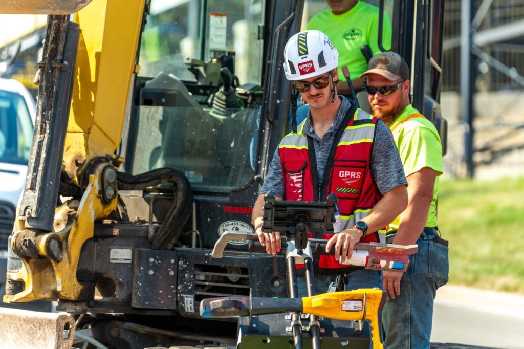
GPRS provides 99.8%+ accurate utility locating and mapping services designed to mitigate the risk of subsurface damage when you need to break ground
In Topeka, Kansas, during a water line project tied to the replacement of a downtown viaduct, workers unearthed a remarkable piece of history—a Topeka Fire Department cistern from 1878.
According to a report in The Topeka Capital-Journal, the crew discovered the cistern while using heavy machinery to dig near an intersection. Contractor Tony Emerson, a former Topeka City Council member, told the newspaper that water surged out when their equipment broke into the cistern.
That water had been sitting there, “just waiting for that fire that never came,” Emerson noted.
Fire Marshal Alan Stahl explained that he found an old article from the Topeka Daily Commonwealth dated June 28, 1878, which described the construction of the cistern with a capacity of “1,000 barrels,” situated near a reliable spring.
Stahl also uncovered a 1907 city report confirming the cistern’s continued use for emergencies and noted that it was one of eight built by Topeka’s government for the fire department, holding between 40,000 and 60,000 gallons of water. The cisterns were used until the 1930s, according to Keith Krause’s Impact of Water on the Development of Topeka (1993).
A Topeka State Journal article from December 1909 revealed that three of these cisterns exploded due to natural gas buildup, with one blast shaking the city but causing no injuries. Tragically, a city employee died earlier that month from burns while investigating gas fumes in the same cistern.
Emerson’s crew only removed the necessary portion of the cistern to complete the water line work, but the discovery served as a reminder of the risks lurking underground.
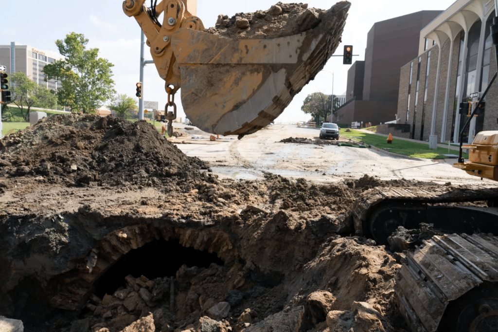
(Photo courtesy of Evert Nelson/The Topeka Capital-Journal) Workers in Topeka, Kansas, excavating for an underground water line project linked to the replacement of a viaduct in the city’s downtown district recently uncovered a Topeka Fire Department cistern built in 1878.
GPRS Protects You from Subsurface Hazards
What happened in Topeka will go down as an interesting footnote in an otherwise routine utility project. But it could have been a much more dangerous situation.
According to a 2021 GPRS study conducted by Finch, the average cost of a single utility strike is around $56,000. Beyond financial loss, cutting into active electrical lines or gas mains could result in serious injury or even death. The cisterns in Topeka exploded three times in one month when in use, highlighting the real danger to workers who encounter such underground threats.
At GPRS, we provide utility locating and mapping services with 99.8%+ accuracy to minimize subsurface damage risks. Using ground penetrating radar (GPR) and electromagnetic (EM) locators, our SIM-certified Project Managers map buried utilities so you can dig safely, avoiding potential catastrophes.
Our NASSCO-certified Video Pipe Inspection Project Managers also use remote-controlled sewer inspection technology to locate and assess sewer and stormwater lines.
With all this data available through SiteMap® (patent pending), our project and facility data management tool, you gain access to accurate infrastructure information. This cloud-based platform allows you and your team to plan, design, and build more effectively, accessible from any computer, tablet, or smartphone.
Schedule a live, personalized SiteMap® demo today to see how GPRS can help protect your assets and team with precise underground data.
Frequently Asked Questions
What are the Benefits of Underground Utility Mapping?
Having an updated and accurate map of your subsurface infrastructure reduces accidents, budget overruns, change orders, and project downtime caused by dangerous and costly subsurface damage.
How does SiteMap® assist with Utility Mapping?
SiteMap®, powered by GPRS, is the industry-leading infrastructure management program. It is a single source of truth, housing the 99.8%+ accurate utility locating, concrete scanning, video pipe inspection, leak detection, and 3D laser scanning data our Project Managers collect on your job site. And the best part is you get a complimentary SiteMap® Personal Subscription when GPRS performs a utility locate for you.
Does SiteMap® Work with my Existing GIS Platform?
SiteMap® allows for exporting of data to SHP, GeoJSON, GeoPackage, and DXF directly from any user’s account that either owns or has a job shared to their account. All these file formats can be imported and utilized by other GIS packages if manually imported by the user. More information can be found at SiteMap.com.